Shire of Boyup Brook
| Shire of Boyup Brook Western Australia | |||||||||||||||
|---|---|---|---|---|---|---|---|---|---|---|---|---|---|---|---|
 Location in Western Australia | |||||||||||||||
| Population | 1,701 (2016 census)[1] | ||||||||||||||
| • Density | 0.60123/km2 (1.5572/sq mi) | ||||||||||||||
| Established | 1896 | ||||||||||||||
| Area | 2,829.2 km2 (1,092.4 sq mi) | ||||||||||||||
| Mayor | Richard Walker | ||||||||||||||
| Council seat | Boyup Brook | ||||||||||||||
| Region | South West | ||||||||||||||
| State electorate(s) | Blackwood-Stirling | ||||||||||||||
| Federal Division(s) | O'Connor | ||||||||||||||
| Website | Shire of Boyup Brook | ||||||||||||||
| |||||||||||||||
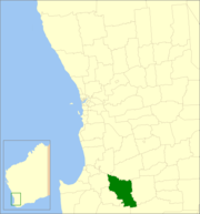
The Shire of Boyup Brook is a local government area located in the South West region of Western Australia, about 270 kilometres (168 mi) southeast of Perth, the state capital. The Shire covers an area of 2,829 square kilometres (1,092 sq mi) and its seat of government is the town of Boyup Brook.
History[]
The Upper Blackwood Road District was gazetted on 17 July 1896. On 1 July 1961, it became the Shire of Upper Blackwood under the Local Government Act 1960 and on 30 May 1969 changed its name to the Shire of Boyup Brook.[2]
Wards[]
The shire has been divided into 4 wards.
- Boyup Brook Ward (3 councillors)
- Benjinup Ward (2 councillors)
- Dinninup Ward (2 councillors)
- Scotts Brook Ward (2 councillors)
Towns and localities[]
- Boyup Brook
- Benjinup
- Dinninup
- Mayanup
- Wilga
Heritage-listed places[]
As of 2021, 43 places are heritage-listed in the Shire of Boyup Brook,[3] of which one is on the State Register of Heritage Places,[4] the Norlup Homestead. The homestead, dating back to 1872, was added to the register on 24 March 1998.[5]
References[]
- ^ Australian Bureau of Statistics (27 June 2017). "Boyup Brook (S)". 2016 Census QuickStats. Retrieved 28 October 2019.

- ^ "Municipality Boundary Amendments Register" (PDF). Western Australian Electoral Distribution Commission. Retrieved 11 January 2020.
- ^ "Shire of Boyup Brook Heritage Places". inherit.stateheritage.wa.gov.au. Heritage Council of Western Australia. Retrieved 13 March 2021.
- ^ "Shire of Boyup Brook State Register of Heritage Places". inherit.stateheritage.wa.gov.au. Heritage Council of Western Australia. Retrieved 13 March 2021.
- ^ "Norlup Homestead". inherit.stateheritage.wa.gov.au. Heritage Council of Western Australia. Retrieved 13 March 2021.
External links[]
| Authority control |
|
|---|

- Populated places established in 1896
- 1896 establishments in Australia
- Local government areas of the South West region of Western Australia