Shire of Brookton
| Shire of Brookton Western Australia | |||||||||||||||
|---|---|---|---|---|---|---|---|---|---|---|---|---|---|---|---|
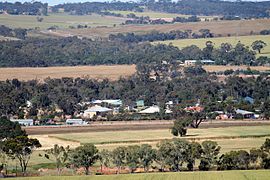 Brookton from the west | |||||||||||||||
 Location in Western Australia | |||||||||||||||
| Population | 975 (2016 census)[1] | ||||||||||||||
| • Density | 0.6088/km2 (1.5767/sq mi) | ||||||||||||||
| Established | 1906 | ||||||||||||||
| Area | 1,601.6 km2 (618.4 sq mi) | ||||||||||||||
| President | Katrina Crute | ||||||||||||||
| Council seat | Brookton | ||||||||||||||
| Region | Wheatbelt | ||||||||||||||
| State electorate(s) | Wagin | ||||||||||||||
| Federal Division(s) | O'Connor | ||||||||||||||
| Website | Shire of Brookton | ||||||||||||||
| |||||||||||||||
The Shire of Brookton is a local government area in the Wheatbelt region of Western Australia, about 140 kilometres (87 mi) southeast of Perth, the state capital. The Shire covers an area of 1,602 square kilometres (619 sq mi) and its seat of government is the town of Brookton.
The local economy, worth approximately $25 million per year to the state economy, is based on agriculture - predominantly cereal grains and sheep.[2]
History[]
The Brookton Road District was established on 27 April 1906 after Mr Samuel Williams led a move by local landowners to break away from the Beverley Road District, and met for the first time on 10 September that year. On 1 July 1961, it became the Shire of Brookton under the Local Government Act 1960, which reformed all remaining road districts into shires.[3]
Wards[]
The shire presently is undivided and has 7 councillors. Prior to the 2009 local government election, it was divided into three wards as follows:
- Central Ward (5 councillors)
- West Ward (2 councillors)
- East Ward (2 councillors)
Towns[]
Population[]
| Year | Population |
|---|---|
| 1911 | 1,268 |
| 1921 | 1,149 |
| 1933 | 1,188 |
| 1947 | 934 |
| 1954 | 1,376 |
| 1961 | 1,319 |
| 1966 | 1,341 |
| 1971 | 1,272 |
| 1976 | 1,181 |
| 1981 | 1,214 |
| 1986 | 1,093 |
| 1991 | 1,018 |
| 1996 | 908 |
| 2001 | 957 |
| 2006 | 978 |
| 2011 | 934 |
Heritage-listed places[]
As of 2021, 74 places are heritage-listed in the Shire of Brookton,[4] of which none are on the State Register of Heritage Places.[5]
References[]
- ^ Australian Bureau of Statistics (27 June 2017). "Brookton (S)". 2016 Census QuickStats. Retrieved 28 October 2019.

- ^ Agriculture WA (July 2000). "Agriculture Statistical Overview 96/97 - Shire of Brookton" (PDF). Archived from the original (PDF) on 17 September 2006. Retrieved 15 November 2006.
- ^ "Municipality Boundary Amendments Register" (PDF). Western Australian Electoral Distribution Commission. Retrieved 11 January 2020.
- ^ "Shire of Brookton Heritage Places". inherit.stateheritage.wa.gov.au. Heritage Council of Western Australia. Retrieved 13 March 2021.
- ^ "Shire of Brookton State Register of Heritage Places". inherit.stateheritage.wa.gov.au. Heritage Council of Western Australia. Retrieved 13 March 2021.
External links[]
![]() Media related to Shire of Brookton at Wikimedia Commons
Media related to Shire of Brookton at Wikimedia Commons
| Authority control |
|
|---|

- Populated places established in 1906
- 1906 establishments in Australia
- Local government areas of the Wheatbelt region of Western Australia