Shire of Narrogin
| Shire of Narrogin Western Australia | |||||||||||||||
|---|---|---|---|---|---|---|---|---|---|---|---|---|---|---|---|
 The state heritage listed Narrogin Town Hall, 2018 | |||||||||||||||
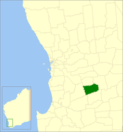 Location in Western Australia | |||||||||||||||
 | |||||||||||||||
| Population | 5,162 (2016 census)[1] | ||||||||||||||
| • Density | 3.1888/km2 (8.2589/sq mi) | ||||||||||||||
| Established | 1892 | ||||||||||||||
| Area | 1,618.8 km2 (625.0 sq mi) | ||||||||||||||
| Shire president | Leigh Ballard | ||||||||||||||
| Council seat | Narrogin | ||||||||||||||
| Region | Wheatbelt | ||||||||||||||
| State electorate(s) | Roe | ||||||||||||||
| Federal division(s) | O'Connor | ||||||||||||||
| Website | Shire of Narrogin | ||||||||||||||
| |||||||||||||||

The Shire of Narrogin is a local government area in the Wheatbelt region of Western Australia, about 190 kilometres (118 mi) south-east of the state capital, Perth. The seat of government is in the town of Narrogin. Until 2016, when the two entities merged, the Narrogin townsite was governed by a separate local government area, the Town of Narrogin.
History[]
On 19 May 1892, the Narrogin Road District came into being. On 1 July 1961, it became a Shire under the Local Government Act 1960.[2] In 1999 and 2004, proposals to merge the Shire with the Town of Narrogin were defeated at referendum.[3] In 2016, on July 1, the Shire of Narrogin amalgamated with the Town of Narrogin. The new entity retained the designation of Shire.
Wards[]
This section needs to be updated. (September 2016) |
Both the Shire and the Town of Narrogin had wards, but they have since been abolished. Nine elected members now sit at large.
Towns and localities[]
- Boundain
- Highbury
- Narrogin
- Nomans Lake
- Yilliminning
Population[]
| Year | Population |
|---|---|
| 1911 | 889 |
| 1921 | 1,117 |
| 1933 | 1,217 |
| 1947 | 844 |
| 1954 | 966 |
| 1961 | 972 |
| 1966 | 1,010 |
| 1971 | 905 |
| 1976 | 843 |
| 1981 | 813 |
| 1986 | 680 |
| 1991 | 862 |
| 1996 | 867 |
| 2001 | 843 |
| 2006 | 830 |
| 2011 | 875 |
| 2016 | 5,162 |
Heritage-listed places[]
As of 2021, 169 places are heritage-listed in the Shire of Narrogin,[4] of which 23 are on the State Register of Heritage Places.[5]
References[]
- ^ Australian Bureau of Statistics (27 June 2017). "Narrogin (S)". 2016 Census QuickStats. Retrieved 28 October 2019.

- ^ WA Electoral Commission, Municipality Boundary Amendments Register (release 3.0), 31 July 2007.
- ^ ABC Online (27 February 2004). "Narrogin Shire residents make merger feelings clear". Retrieved 2 November 2006.
- ^ "Shire of Narrogin Heritage Places". inherit.stateheritage.wa.gov.au. Heritage Council of Western Australia. Retrieved 27 March 2021.
- ^ "Shire of Narrogin State Register of Heritage Places". inherit.stateheritage.wa.gov.au. Heritage Council of Western Australia. Retrieved 27 March 2021.
External links[]

- Populated places established in 1892
- 1892 establishments in Australia
- Shire of Narrogin
- Local government areas of the Wheatbelt region of Western Australia