City of Karratha
| City of Karratha Western Australia | |||||||||||||||
|---|---|---|---|---|---|---|---|---|---|---|---|---|---|---|---|
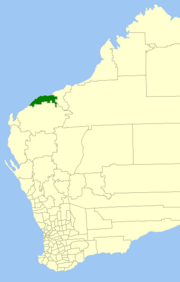 Location in Western Australia | |||||||||||||||
 | |||||||||||||||
| Population | 21,473 (2016 census)[1] | ||||||||||||||
| • Density | 1.40938/km2 (3.65027/sq mi) | ||||||||||||||
| Established | 1910 | ||||||||||||||
| Area | 15,235.8 km2 (5,882.6 sq mi) | ||||||||||||||
| Mayor | Peter Long | ||||||||||||||
| Council seat | Karratha | ||||||||||||||
| Region | Pilbara | ||||||||||||||
| State electorate(s) | North West | ||||||||||||||
| Federal division(s) | Durack | ||||||||||||||
| Website | City of Karratha | ||||||||||||||
| |||||||||||||||
The City of Karratha is one of the four local government areas in the Pilbara region of Western Australia. It covers an area of 15,882 square kilometres (6,132 sq mi) and had a population of about 21,500 as at the 2016 Census, most of which is located in its seat of government, the city of Karratha, and the major towns. It was formerly known as the Shire of Roebourne but was renamed and granted city status on 1 July 2014.[2][3]
History[]
The City of Karratha originated as the Roebourne Road District, which was established on 6 January 1887. The towns of Roebourne and Cossack were both excised as their own municipalities on 1 December 1887, forming the and Municipality of Cossack. As the region's population declined, both the Roebourne and Cossack municipalities merged back into the road district in 1910, Roebourne on 11 March and then Cossack on 13 August.[4]
On 1 July 1961, it became the Shire of Roebourne under the Local Government Act 1960.[4] On 1 July 2014 it was granted city status and renamed the City of Karratha.[2][3]
Wards[]
The city is divided into wards:
- Karratha (six councillors)
- Dampier (two councillors)
- Roebourne/Pastoral (one councillor)
Towns[]
Heritage-listed places[]
As of 2021, 122 places are heritage-listed in the City of Karratha,[5] of which 29 are on the State Register of Heritage Places. Of those, 18 are located in Cossack and ten are in Roebourne; with the only one outside those two locations being the Cooya Pooya Station.[6]
References[]
- ^ Australian Bureau of Statistics (27 June 2017). "Karratha (C)". 2016 Census QuickStats. Retrieved 26 November 2017.

- ^ a b "City of Karratha born as Shire of Roebourne in WA's Pilbara officially changes status". Australian Broadcasting Corporation. 1 July 2014. Retrieved 1 July 2014.
- ^ a b "Local Government (Roebourne - Change of Designation and Name of District) Order 2014". Government Gazette of Western Australia. State Law Publisher. 3 June 2014. Retrieved 1 July 2014.
- ^ a b "Municipality Boundary Amendments Register" (PDF). Western Australian Electoral Distribution Commission. Retrieved 11 January 2020.
- ^ "City of Karratha Heritage Places". inherit.stateheritage.wa.gov.au. Heritage Council of Western Australia. Retrieved 12 March 2021.
- ^ "City of Karratha State Register of Heritage Places". inherit.stateheritage.wa.gov.au. Heritage Council of Western Australia. Retrieved 12 March 2021.
External links[]
| Wikimedia Commons has media related to City of Karratha. |

- Populated places established in 1910
- 1910 establishments in Australia
- City of Karratha
- Local government areas of the Pilbara region of Western Australia
- Cities in Western Australia