Town of Cottesloe
| Town of Cottesloe Western Australia | |||||||||||||||
|---|---|---|---|---|---|---|---|---|---|---|---|---|---|---|---|
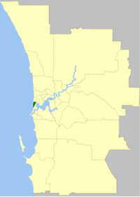 Location of Cottesloe, Western Australia | |||||||||||||||
| Population | 7,597 (2016 census)[1] | ||||||||||||||
| • Density | 1,948/km2 (5,050/sq mi) | ||||||||||||||
| Established | 1895 | ||||||||||||||
| Area | 3.9 km2 (1.5 sq mi) | ||||||||||||||
| Mayor | Phil Angers | ||||||||||||||
| Council seat | Cottesloe | ||||||||||||||
| Region | West Metropolitan Perth | ||||||||||||||
| State electorate(s) | Cottesloe | ||||||||||||||
| Federal Division(s) | Curtin | ||||||||||||||
| Website | Town of Cottesloe | ||||||||||||||
| |||||||||||||||
The Town of Cottesloe is a local government area in the western suburbs of Perth, the capital of Western Australia. It covers the suburb of the same name as well as a tiny portion of the suburb of Claremont. Cottesloe is located 11 kilometres (7 mi) west of Perth's central business district, covers an area of 3.9 square kilometres (1.5 sq mi), maintains 45.7 km of roads and had a population of approximately 7,500 as at the 2016 Census. Cottesloe is served by Swanbourne, Victoria Street, Grant Street and Cottesloe train stations, all operated through the Fremantle Railway Line. Various bus routes operate along Stirling Highway, enabling transport through the suburb's western and eastern precincts with Perth and Fremantle. All services are operated by the Public Transport Authority. The Town of Cottesloe's inclusion of walk and cycle paths enable it to be a walkable precinct.
History[]
The Cottesloe Road District was created on 4 October 1895 and was granted municipal status as the Municipality of Cottesloe on 20 September 1907. In 1950 it bought Overton Lodge from Claude de Bernales and renamed it to the Cottesloe Memorial Town Hall and Civic Centre.[2] On 1 July 1961, it became a Town following the enactment of the Local Government Act 1960.[3]
Wards[]
The town has been divided into 4 wards. The mayor is directly elected.
- Central Ward (2 councillors)
- East Ward (2 councillors)
- South Ward (2 councillors)
- North Ward (2 councillors)
Suburbs[]
The suburb of Cottesloe is the only suburb within this local government area, but four short streets with the suburb of Claremont fall under its jurisdiction.
Population[]
|
|
Heritage listed places[]
As of 2021, 430 places are heritage-listed in the Town of Cottesloe,[4] of which 28 are on the State Register of Heritage Places, among them the Cottesloe Civic Centre and the Residence of John Curtin.[5]
See also[]
References[]
- ^ Australian Bureau of Statistics (27 June 2017). "Cottesloe (T)". 2016 Census QuickStats. Retrieved 26 November 2017.

- ^ "History". Town of Cottesloe. Retrieved 9 April 2007.
- ^ "Municipality Boundary Amendments Register" (PDF). Western Australian Electoral Distribution Commission. Retrieved 11 January 2020.
- ^ "Town of Cottesloe Heritage Places". inherit.stateheritage.wa.gov.au. Heritage Council of Western Australia. Retrieved 6 March 2021.
- ^ "Town of Cottesloe State Register of Heritage Places". inherit.stateheritage.wa.gov.au. Heritage Council of Western Australia. Retrieved 6 March 2021.
External links[]
| Authority control |
|
|---|

- Populated places established in 1895
- 1895 establishments in Australia
- Town of Cottesloe
- Local government areas of the Perth region of Western Australia