Shire of Woodanilling
| Shire of Woodanilling Western Australia | |||||||||||||||
|---|---|---|---|---|---|---|---|---|---|---|---|---|---|---|---|
 Location in Western Australia | |||||||||||||||
| Population | 409 (2016 census)[1] | ||||||||||||||
| • Density | 0.3623/km2 (0.9383/sq mi) | ||||||||||||||
| Area | 1,129.0 km2 (435.9 sq mi) | ||||||||||||||
| Mayor | H R (Russel) Thomson JP | ||||||||||||||
| Council seat | Woodanilling | ||||||||||||||
| Region | Great Southern | ||||||||||||||
| State electorate(s) | Roe | ||||||||||||||
| Federal Division(s) | O'Connor | ||||||||||||||
 | |||||||||||||||
| Website | Shire of Woodanilling | ||||||||||||||
| |||||||||||||||
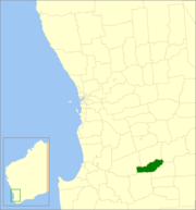
The Shire of Woodanilling is a local government area in the Great Southern region of Western Australia, about 30 kilometres (19 mi) south of Wagin and about 260 kilometres (162 mi) south-southeast of the state capital, Perth. The Shire covers an area of 1,129 square kilometres (436 sq mi), and its seat of government is the town of Woodanilling.
History[]
The Woodanilling Road District was established on 2 February 1906. On 1 July 1961, it became a Shire under the Local Government Act 1960, which reformed all road districts into shires.[2]
Wards[]
The shire is divided into 3 wards:
- Central Ward (2 councillors)
- West Ward (3 councillors)
- East Ward (2 councillors)
Towns and localities[]
- Woodanilling
- Beaufort River
- Cartmeticup
Population[]
| Year | Population[3] |
|---|---|
| 1911 | 614 |
| 1921 | 639 |
| 1933 | 671 |
| 1947 | 697 |
| 1954 | 718 |
| 1961 | 639 |
| 1966 | 580 |
| 1971 | 529 |
| 1976 | 447 |
| 1981 | 461 |
| 1986 | 435 |
| 1991 | 391 |
| 1996 | 354 |
| 2001 | 394 |
| 2006 | 418 |
| 2011 | 419 |
Heritage-listed places[]
As of 2021, 224 places are heritage-listed in the Shire of Woodanilling,[4] of which one is on the State Register of Heritage Places,[5] the Carrolup Aboriginal Cemetery in Marribank.[6] The cemetery is part of the also state heritage listed Carrolup Native Settlement, which was state heritage listed on 22 May 2007 but is predominantly located in the neighbouring Shire of Kojonup.[7]
References[]
- ^ Australian Bureau of Statistics (27 June 2017). "Woodanilling (S)". 2016 Census QuickStats. Retrieved 28 October 2019.

- ^ "Municipality Boundary Amendments Register" (PDF). Western Australian Electoral Distribution Commission. Retrieved 11 January 2020.
- ^ Australian Bureau of Statistics (30 March 2010). "Regional Population Growth, Australia, 2008–09". Archived from the original on 5 June 2010. Retrieved 4 June 2010.
- ^ "Shire of Woodanilling Heritage Places". inherit.stateheritage.wa.gov.au. Heritage Council of Western Australia. Retrieved 13 March 2021.
- ^ "Shire of Woodanilling State Register of Heritage Places". inherit.stateheritage.wa.gov.au. Heritage Council of Western Australia. Retrieved 13 March 2021.
- ^ "Carrolup Aboriginal Cemetery". inherit.stateheritage.wa.gov.au. Heritage Council of Western Australia. Retrieved 13 March 2021.
- ^ "Carrolup Native Settlement". inherit.stateheritage.wa.gov.au. Heritage Council of Western Australia. Retrieved 13 March 2021.
External links[]
| Authority control |
|
|---|
Coordinates: 33°33′50���S 117°25′55″E / 33.564°S 117.432°E

- Local government areas of the Great Southern region of Western Australia