City of Mandurah
| City of Mandurah Western Australia | |||||||||||||||
|---|---|---|---|---|---|---|---|---|---|---|---|---|---|---|---|
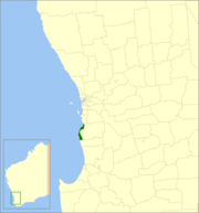 Location in Western Australia | |||||||||||||||
| Population | |||||||||||||||
| • Density | 259/km2 (670/sq mi) | ||||||||||||||
| Established | 1950 | ||||||||||||||
| Area | 174 km2 (67.2 sq mi) | ||||||||||||||
| Mayor | Rhys Williams | ||||||||||||||
| Council seat | Mandurah | ||||||||||||||
| Region | Peel region, Outer southern Perth | ||||||||||||||
| State electorate(s) | Mandurah, Dawesville | ||||||||||||||
| Federal Division(s) | Canning | ||||||||||||||
| Website | City of Mandurah | ||||||||||||||
| |||||||||||||||
The City of Mandurah is a local government area of Western Australia, covering both Mandurah proper and an additional area reaching down as far south as Lake Clifton. The city has a total area of approximately 174 square kilometres (67 sq mi).
The city is located in the Peel region, just beyond the southern boundary of metropolitan Perth, and lies about 75 kilometres (47 mi) south of the Perth central business district. It is bordered by the City of Rockingham to the north, the Shire of Murray to the east (the border being for the most part the Harvey Estuary and Serpentine River), and Shire of Waroona to the south.
History[]
The area that is now Mandurah was part of the Murray Road District until 1949.
The City of Mandurah originated as the Mandurah Road District, established on 10 June 1949.[3] The road board held its first meeting on 1 September 1949. The board was suspended on 12 July 1956 by an Order in Council and the district was placed under the administration of Commissioner Richard Rushton, who ultimately served in the role for almost four years.[4]
It became the Shire of Mandurah on 1 July 1961 following the passage of the Local Government Act 1960, which reformed all remaining road districts into shires. It became the Town of Mandurah when it gained town status on 1 July 1987 and assumed its current name when it gained city status on 14 April 1990.[5]
Wards[]
The City is divided into four wards, each electing three councillors:
- East Ward
- North Ward
- Coastal Ward
- Town Ward
Suburbs and localities[]
- Bouvard
- Clifton
- Coodanup
- Dawesville
- Dudley Park
- Erskine
- Falcon
- Greenfields
- Halls Head
- Herron
- Lakelands
- Madora Bay
- Mandurah
- Meadow Springs
- Parklands
- San Remo
- Silver Sands
- Wannanup
Officials[]
The elected members on the Mandurah City Council are:[6]
- Mayor
- Rhys Williams
- East Ward
- Darren Lee
- Lynn Rodgers
- Don Pember
- Coastal Ward
- Merv Darcy
- Jenny Green
- Candice Di Prinzio
- North Ward
- Caroline Knight, Deputy Mayor
- Peter Jackson
- Ahmed Zilani
- Town Ward
- Peter Rogers
- Dave Schumacher
- Matt Rogers
Population[]
|
|
[citation needed]
Heritage-listed places[]
As of 2021, 86 places are heritage-listed in the City of Mandurah,[7] of which six are on the State Register of Heritage Places.[8]
References[]
- ^ Australian Bureau of Statistics (27 June 2017). "Mandurah (C)". 2016 Census QuickStats. Retrieved 26 November 2017.

- ^ "3218.0 – Regional Population Growth, Australia, 2017-18". Australian Bureau of Statistics. 27 March 2019. Retrieved 31 December 2019. Estimated resident population (ERP) at 30 June 2018.
- ^ "Municipality Boundary Amendments Register" (PDF). Western Australian Electoral Distribution Commission. Retrieved 11 January 2020.
- ^ "Road Districts Act 1919-1954 - Mandurah Road District - Appointment of Commissioner - Order in Council (per L.G.D. 259/56)". Western Australia Government Gazette. 13 July 1956. p. 1956:1724.
- ^ City of Mandurah (31 January 2004). "City of Mandurah Information Statement". Archived from the original on 27 August 2006. Retrieved 1 November 2006.
- ^ City of Mandurah. "City Councillors". Retrieved 16 January 2017.
- ^ "City of Mandurah Heritage Places". inherit.stateheritage.wa.gov.au. Heritage Council of Western Australia. Retrieved 12 March 2021.
- ^ "City of Mandurah State Register of Heritage Places". inherit.stateheritage.wa.gov.au. Heritage Council of Western Australia. Retrieved 12 March 2021.
External links[]
| Authority control |
|
|---|

- Populated places established in 1950
- 1950 establishments in Australia
- Local government areas of the Peel region of Western Australia
- Mandurah