Shire of Lake Grace
| Shire of Lake Grace Western Australia | |||||||||||||||
|---|---|---|---|---|---|---|---|---|---|---|---|---|---|---|---|
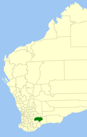 Location in Western Australia | |||||||||||||||
 | |||||||||||||||
| Population | 1,268 (2016 census)[1] | ||||||||||||||
| • Density | 0.12217/km2 (0.31641/sq mi) | ||||||||||||||
| Established | 1922 | ||||||||||||||
| Area | 10,379.2 km2 (4,007.4 sq mi) | ||||||||||||||
| Shire President | Leonard William Armstrong | ||||||||||||||
| Council seat | Lake Grace | ||||||||||||||
| Region | Wheatbelt | ||||||||||||||
| State electorate(s) | Roe | ||||||||||||||
| Federal division(s) | O'Connor | ||||||||||||||
| Website | Shire of Lake Grace | ||||||||||||||
| |||||||||||||||
The Shire of Lake Grace is a local government area in the eastern Wheatbelt region of Western Australia, about 350 kilometres (217 mi) ESE of the state capital, Perth. The Shire has a land area of 10,379 square kilometres (4,007 sq mi) and its seat of government is the town of Lake Grace.
History[]
The Lake Grace Road District was gazetted on 22 December 1922. On 1 July 1961, it became a Shire under the Local Government Act 1960, which reformed all remaining road districts into shires.[2]
Towns and localities[]
Heritage-listed places[]
As of 2021, 231 places are heritage-listed in the Shire of Lake Grace,[3] of which three are on the State Register of Heritage Places.[4]
References[]
- ^ Australian Bureau of Statistics (27 June 2017). "Lake Grace (S)". 2016 Census QuickStats. Retrieved 28 October 2019.

- ^ "Municipality Boundary Amendments Register" (PDF). Western Australian Electoral Distribution Commission. Retrieved 11 January 2020.
- ^ "Shire of Lake Grace Heritage Places". inherit.stateheritage.wa.gov.au. Heritage Council of Western Australia. Retrieved 27 March 2021.
- ^ "Shire of Lake Grace State Register of Heritage Places". inherit.stateheritage.wa.gov.au. Heritage Council of Western Australia. Retrieved 27 March 2021.
External links[]

Categories:
- Populated places established in 1922
- 1922 establishments in Australia
- Shire of Lake Grace
- Local government areas of the Wheatbelt region of Western Australia