Shire of Westonia
| Shire of Westonia Western Australia | |||||||||||||||
|---|---|---|---|---|---|---|---|---|---|---|---|---|---|---|---|
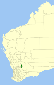 Location in Western Australia | |||||||||||||||
| Population | 304 (2016 Census)[1] | ||||||||||||||
| • Density | 0.09200/km2 (0.2383/sq mi) | ||||||||||||||
| Area | 3,304.4 km2 (1,275.8 sq mi) | ||||||||||||||
| Mayor | Karin Day | ||||||||||||||
| Council seat | Westonia | ||||||||||||||
| Region | Wheatbelt | ||||||||||||||
| State electorate(s) | Central Wheatbelt | ||||||||||||||
| Federal Division(s) | Durack | ||||||||||||||
 | |||||||||||||||
| Website | Shire of Westonia | ||||||||||||||
| |||||||||||||||
The Shire of Westonia is a local government area in the eastern Wheatbelt region of Western Australia, about 310 kilometres (193 mi) east of Perth, the state capital. Its seat of government is the small town of Westonia.
Although the Shire of Westonia is located in the Wheatbelt region, it is at the eastern limit of land suitable for wheat growing. The most important industries of Westonia today are wheat and sheep, but historically it was a gold mining area.
History[]
The Westonia Road District was established on 30 June 1916. On 1 July 1961, it became the Shire of Westonia under the Local Government Act 1960, which reformed all remaining road districts into shires.[2]
Wards[]
The Shire initially had a ward system with two elected members representing the north, south, west and town wards (for a total of eight members). However, following the 2009 local government elections the Shire of Westonia's ward system was abolished and the number of elected members was dropped to six.
Towns[]
Population[]
| Year | Population |
|---|---|
| 1921 | 842 |
| 1933 | 1,032 |
| 1947 | 547 |
| 1954 | 487 |
| 1961 | 435 |
| 1966 | 612 |
| 1971 | 473 |
| 1976 | 510 |
| 1981 | 453 |
| 1986 | 484 |
| 1991 | 282 |
| 1996 | 292 |
| 2001 | 237 |
| 2006 | 213 |
| 2011 | 277 |
| 2016 | 304 |
Heritage-listed places[]
As of 2021, 69 places are heritage-listed in the Shire of Westonia,[3] of which one is on the State Register of Heritage Places, the Edna May Tavern in Westonia.[4]
| Place name | Place # | Street name | Suburb or town | Co-ordinates | Built | Stateregistered | Notes & former names | Photo |
|---|---|---|---|---|---|---|---|---|
| Edna May Tavern | 2707 | Wolfram Street | Westonia | 31°18′10″S 118°41′48″E / 31.302758°S 118.696696°E | 1915 | 26 August 2008 | Edna May Hotel, Westonia Hotel |

References[]
- ^ Australian Bureau of Statistics (27 June 2017). "Westonia (S)". 2016 Census QuickStats. Retrieved 6 June 2020.

- ^ "Municipality Boundary Amendments Register" (PDF). Western Australian Electoral Distribution Commission. Retrieved 11 January 2020.
- ^ "Shire of Westonia Heritage Places". inherit.stateheritage.wa.gov.au. Heritage Council of Western Australia. Retrieved 27 March 2021.
- ^ "Shire of Westonia State Register of Heritage Places". inherit.stateheritage.wa.gov.au. Heritage Council of Western Australia. Retrieved 27 March 2021.
External links[]
| Authority control |
|
|---|
- Shire of Westonia