Shire of Wickepin
| Shire of Wickepin Western Australia | |||||||||||||||
|---|---|---|---|---|---|---|---|---|---|---|---|---|---|---|---|
 Wickepin Town Hall, 2014 | |||||||||||||||
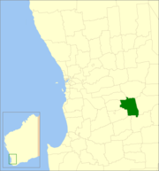 Location in Western Australia | |||||||||||||||
| Population | 718 (2016 census)[1] | ||||||||||||||
| • Density | 0.35168/km2 (0.9109/sq mi) | ||||||||||||||
| Established | 1909 | ||||||||||||||
| Area | 2,041.6 km2 (788.3 sq mi) | ||||||||||||||
| President | Julie Russell | ||||||||||||||
| Council seat | Wickepin | ||||||||||||||
| Region | Wheatbelt | ||||||||||||||
| State electorate(s) | Central Wheatbelt | ||||||||||||||
| Federal Division(s) | O'Connor | ||||||||||||||
| Website | Shire of Wickepin | ||||||||||||||
| |||||||||||||||
The Shire of Wickepin is a local government area in the Wheatbelt region of Western Australia, east of Narrogin and about 220 kilometres (137 mi) southeast of the state capital, Perth. The Shire covers an area of 2,042 square kilometres (788 sq mi), and its seat of government is the town of Wickepin.
History[]
The Wickepin Road District was established on 19 February 1909. The Road Board consisted of a chairman, secretary and seven members. On 1 July 1961, it became a shire under the Local Government Act 1960, which reformed all remaining road districts into shires.[2]
Wards[]
The Shire is at present undivided with its nine councillors representing the entire shire.
Until 20 October 2007 the shire was divided into 5 wards:
- Townsite Ward (2 councillors)
- North Ward (2 councillors)
- Central Ward (2 councillors)
- South Ward (2 councillors)
- East Ward (1 councillor)
Towns and localities[]
- Wickepin
- Gillimanning
- Harrismith
- Malyalling
- Tincurrin
- Wogolin
- Yealering
Population[]
| Year | Population |
|---|---|
| 1911 | 1,146 |
| 1921 | 1,454 |
| 1933 | 1,598 |
| 1947 | 1,153 |
| 1954 | 1,334 |
| 1961 | 1,276 |
| 1966 | 1,380 |
| 1971 | 1,144 |
| 1976 | 1,076 |
| 1981 | 1,018 |
| 1986 | 951 |
| 1991 | 915 |
| 1996 | 833 |
| 2001 | 713 |
| 2006 | 716 |
| 2011 | 750 |
| 2016 | 718 |
Heritage-listed places[]
As of 2021, 213 places are heritage-listed in the Shire of Wickepin,[3] of which one is on the State Register of Heritage Places, the Wickepin Nursing Post.[4]
| Place name | Place # | Street name | Suburb or town | Co-ordinates | Built | Stateregistered | Notes & former names | Photo |
|---|---|---|---|---|---|---|---|---|
| Wickepin Nursing Post | 2722 | Wogolin Road | Wickepin | 32°46′56″S 117°30′27″E / 32.782128°S 117.507366°E | 1926 | 24 November 2000 | Wickepin District War Memorial Hospital |

References[]
- ^ Australian Bureau of Statistics (27 June 2017). "Wickepin (S)". 2016 Census QuickStats. Retrieved 28 October 2019.

- ^ "Municipality Boundary Amendments Register" (PDF). Western Australian Electoral Distribution Commission. Retrieved 11 January 2020.
- ^ "Shire of Wickepin Heritage Places". inherit.stateheritage.wa.gov.au. Heritage Council of Western Australia. Retrieved 27 March 2021.
- ^ "Shire of Wickepin State Register of Heritage Places". inherit.stateheritage.wa.gov.au. Heritage Council of Western Australia. Retrieved 27 March 2021.
External links[]
![]() Media related to Shire of Wickepin at Wikimedia Commons
Media related to Shire of Wickepin at Wikimedia Commons
| Authority control |
|
|---|
- Populated places established in 1909
- 1909 establishments in Australia
- Local government areas of the Wheatbelt region of Western Australia