Dlouhá Loučka (Svitavy District)
Dlouhá Loučka | |
|---|---|
Municipality | |
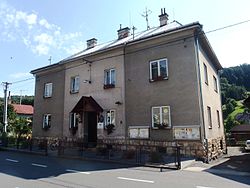 Municipal office | |
 Flag  Coat of arms | |
 Dlouhá Loučka | |
| Coordinates: 49°42′16″N 16°37′29″E / 49.70444°N 16.62472°ECoordinates: 49°42′16″N 16°37′29″E / 49.70444°N 16.62472°E | |
| Country | |
| Region | Pardubice |
| District | Svitavy |
| Area | |
| • Total | 17.58 km2 (6.79 sq mi) |
| Elevation | 398 m (1,306 ft) |
| Population (2006) | |
| • Total | 554 |
| • Density | 32/km2 (82/sq mi) |
| Postal code | 569 43 |
| Website | https://www.obecdlouhaloucka.cz/ |

Dlouhá Loučka (German: Langenlutsch) is a village and municipality (obec) in Svitavy District in the Pardubice Region of the Czech Republic.
The municipality covers an area of 17.58 square kilometres (6.79 sq mi), and has a population of 554 (as at 28 August 2006).
Dlouhá Loučka lies approximately 13 kilometres (8 mi) south-east of Svitavy, 72 km (45 mi) south-east of Pardubice, and 164 km (102 mi) east of Prague.
References[]
| Authority control: National libraries |
|---|
This Pardubice Region location article is a stub. You can help Wikipedia by . |
Categories:
- Villages in Svitavy District
- Pardubice Region geography stubs