Svitavy District
Svitavy District
Okres Svitavy | |
|---|---|
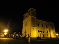
 Saint George's church in Pomezí | |
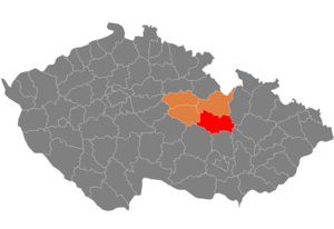 District location in the Pardubice Region within the Czech Republic | |
| Country | |
| Region | Pardubice |
| Capital | Svitavy |
| Area | |
| • Total | 1,378.56 km2 (532.26 sq mi) |
| Population (2019-01-01[1]) | |
| • Total | 104,401 |
| • Density | 76/km2 (200/sq mi) |
| Time zone | UTC+1 (CET) |
| • Summer (DST) | UTC+2 (CEST) |
| Municipalities | 116 |
| * Towns | 7 |
| * Market towns | 1 |
| * Villages | 108 |
Svitavy District (Czech: okres Svitavy) is a district (okres) within Pardubice Region of the Czech Republic. Its capital is the town of Svitavy. As a part of Pardubice Region the district has borders with Ústí nad Orlicí District to the north and Chrudim District to the west. The district was administratively formed in 1960, when the former districts of Litomyšl, Moravská Třebová, Polička and Svitavy were merged.
Svitavy District incorporates parts of historical regions of Bohemia and Moravia. From a total of 116 municipalities, 44 municipalities (including the district's capital) are situated in Moravia. As of 1 January 2007, 48,864 inhabitants live in the Moravian part of the district. The Bohemian part counted 67 municipalities with 50,885 inhabitants. Five municipalities (Brněnec, Březová nad Svitavou, Kamenná Horka, Karle and Radiměř altogether having 4,769 inhabitants) lie in Bohemia as well as Moravia.
Geography[]
With a total area of 1,379 km² it is the largest district of the Pardubice Region. From the total area of the district, agricultural land occupies 835.1 km² (arable land 628,8 km², permanent pastures 171.3 km² and water bodies 10.8 km²). Forests cover 31.3% of the district's area.
The district is divided into drainage basins of the Elbe and the Danube. The main rivers in the district are Svitava (central part of the district), Svratka (south-eastern part), Třebůvka (eastern part), Třebovka and Loučná (both in the north-western part). The former three rivers comprise part of the Danube basin, while the latter two comprise part of the Elbe basin. The largest water body in Svitavy District is the pond Hvězda, with an area of 82 ha.[2]
Demography[]
As of 31 December 2012, the district had 104,971 inhabitants from which 53,120 were women and 51,851 were men. The average age was 40.9 years; 15.3% of the inhabitants were 14 years or younger, while 16.5% were 65 years or older. The district's workforce counted 53,955 people.[3]
Climate[]
The district has a continental climate which is characterised by significant variations in temperature in the course of the year. There are slight variations between the climate in various parts of the district. The northwestern and southeastern part of the district have an average temperature of 7 °C and precipitation up to 600 mm in one year. The central part of the district is slightly cooler and more humid, with an average temperature of 6 °C and precipitation of 700 mm. The southeastern part of the district is even cooler and even more humid.[4]
Economy[]
The district has been suffering from the highest unemployment rate in the Pardubice region, reaching 8.6% at the end of 2012.
The economy of the district is oriented towards agriculture and manufacturing. The share of the district's employment accounted for by agriculture has been steadily decreasing, yet it is still higher than in other districts of the Pardubice Region. The agricultural sector mainly produces cereals and rapeseed.
There is a relatively varied structure of manufacturing in the Svitavy district. Food and textile production comprise the main volume of manufacturing. However, the long-term importance of textile manufacturing is decreasing. Glass fibre production, metalworking and mechanical engineering are other important branches of manufacturing in the district.
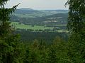
Places of interest[]
- Hřebeč mining paths and museums
- Litomyšl with its château complex which is listed as a UNESCO World Heritage Site
- Renaissance historical core of Moravská Třebová
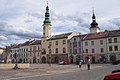
- Polička with its town walls
- , nature reserve with a labyrinth of sandstone rocks
- Protected Landscape Area Žďárské vrchy
Complete list of municipalities[]
- Banín
- Bělá nad Svitavou
- Bělá u Jevíčka
- Benátky
- Bezděčí u Trnávky
- Biskupice
- Bohuňov
- Bohuňovice
- Borová
- Borušov
- Březina
- Březinky
- Březiny
- Březová nad Svitavou
- Brněnec
- Budislav
- Bystré
- Cerekvice nad Loučnou
- Chmelík
- Chornice
- Chotovice
- Chotěnov
- Chrastavec
- Čistá
- Desná
- Dlouhá Loučka
- Dolní Újezd
- Dětřichov
- Dětřichov u Moravské Třebové
- Gruna
- Hartinkov
- Hartmanice
- Horky
- Horní Újezd
- Hradec nad Svitavou
- Janov
- Janůvky
- Jaroměřice
- Jarošov
- Javorník
- Jedlová
- Jevíčko
- Kamenec u Poličky
- Kamenná Horka
- Karle
- Koclířov
- Korouhev
- Koruna
- Křenov
- Kukle
- Kunčina
- Květná
- Lavičné
- Linhartice
- Litomyšl
- Lubná
- Makov
- Malíkov
- Mikuleč
- Mladějov na Moravě
- Moravská Třebová
- Morašice
- Městečko Trnávka
- Nedvězí
- Němčice
- Nová Sídla
- Nová Ves u Jarošova
- Oldřiš
- Opatov
- Opatovec
- Osík
- Pohledy
- Polička
- Pomezí
- Poříčí u Litomyšle
- Pustá Kamenice
- Pustá Rybná
- Příluka
- Radiměř
- Radkov
- Řídký
- Rohozná
- Rozhraní
- Rozstání
- Rudná
- Rychnov na Moravě
- Sádek
- Sebranice
- Sedliště
- Široký Důl
- Sklené
- Slatina
- Sloupnice
- Staré Město
- Stašov
- Strakov
- Študlov
- Suchá Lhota
- Svitavy
- Svojanov
- Telecí
- Trpín
- Trstěnice
- Tržek
- Třebařov
- Újezdec
- Útěchov
- Vendolí
- Vidlatá Seč
- Víska u Jevíčka
- Vítějeves
- Vlčkov
- Vranová Lhota
- Vrážné
- Vysoká
- Želivsko
Gallery[]

Svojanov Castle

Toulovcovy maštale
Žďárské vrchy


References[]
- ^ "Population of municipalities of the Czech republic". Czech Statistical Office. Retrieved 2019-04-30.
- ^ Časová řada vybraných ukazatelů za okres Svitavy (2000–2012), available online at http://www.czso.cz/xe/redakce.nsf/i/okres_svitavy
- ^ Časová řada vybraných ukazatelů za okres Svitavy (2000–2012), available online at http://www.czso.cz/xe/redakce.nsf/i/okres_svitavy
- ^ Časová řada vybraných ukazatelů za okres Svitavy (2000–2012), available online at http://www.czso.cz/xe/redakce.nsf/i/okres_svitavy
External links[]
Coordinates: 49°45′21″N 16°28′10″E / 49.75583°N 16.46944°E

| show Authority control |
|---|
- Svitavy District
- Districts of the Czech Republic