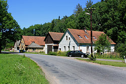
Trstěnice (Svitavy District)
Trstěnice
Trstenice | |
|---|---|
Village | |
 | |
 Flag  Coat of arms | |
 Trstěnice Location in the Czech Republic | |
| Coordinates: 49°47′33″N 16°20′42″E / 49.79250°N 16.34500°ECoordinates: 49°47′33″N 16°20′42″E / 49.79250°N 16.34500°E | |
| Country | Czech Republic |
| Region | Pardubice |
| District | Svitavy |
| Government | |
| • Mayor | Jan Sigl |
| Area | |
| • Total | 21.47 km2 (8.29 sq mi) |
| Population (2007-12-31) | |
| • Total | 517 |
| • Density | 24/km2 (62/sq mi) |
| Time zone | UTC+1 (CET) |
| • Summer (DST) | UTC+2 (CEST) |
| Postal code | 569 57 |
| Website | www.trstenice.cz |
Trstěnice is a village and municipality in the Svitavy District, in the Pardubice Region of the Czech Republic located about 8 km southeast of Litomyšl. The population as at the end of 2007 was 517.[1]
History[]
First written records of the village date back to 993.
Geography[]
This section is empty. You can help by . (July 2010) |
Sights[]
- Church of the Finding of the Holy Cross - gothic church, extended during the baroque period
- Late gothic Bell Tower
- Great number of old log houses
External links[]
| Wikimedia Commons has media related to Trstěnice (Svitavy District). |
- www.trstenice.cz Official webpage in Czech;
- www.litomyslsko.cz Microregion Litomyšlsko webpage in Czech;
Categories:
- Villages in Svitavy District
- Pardubice Region geography stubs

