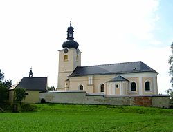
Koclířov
Koclířov | |
|---|---|
Municipality | |
 | |
 Flag  Coat of arms | |
 Koclířov | |
| Coordinates: 49°46′0″N 16°32′28″E / 49.76667°N 16.54111°ECoordinates: 49°46′0″N 16°32′28″E / 49.76667°N 16.54111°E | |
| Country | |
| Region | Pardubice |
| District | Svitavy |
| Area | |
| • Total | 17.3 km2 (6.7 sq mi) |
| Elevation | 502 m (1,647 ft) |
| Population (1.1.2014) | |
| • Total | 693 |
| • Density | 40/km2 (100/sq mi) |
| Postal code | 569 11 |
| Website | http://www.svitavskoweb.cz/place.asp?place=8 |

Koclířov is a village and municipality (obec) in Svitavy District in the Pardubice Region of the Czech Republic.
The municipality covers an area of 17.3 square kilometres (6.7 sq mi), and has a population of 700 (as at 2 July 2007).
Koclířov lies approximately 6 kilometres (4 mi) east of Svitavy, 63 km (39 mi) south-east of Pardubice, and 157 km (98 mi) east of Prague.
References[]
| Wikimedia Commons has media related to Koclířov. |
| show Authority control |
|---|
This Pardubice Region location article is a stub. You can help Wikipedia by . |
Categories:
- Villages in Svitavy District
- Pardubice Region geography stubs