Dlouhoňovice
Dlouhoňovice | |
|---|---|
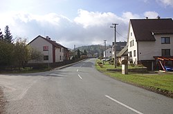 Main road | |
 Flag  Coat of arms | |
 Dlouhoňovice Location in the Czech Republic | |
| Coordinates: 50°4′13″N 16°26′30″E / 50.07028°N 16.44167°ECoordinates: 50°4′13″N 16°26′30″E / 50.07028°N 16.44167°E | |
| Country | |
| Region | Pardubice |
| District | Ústí nad Orlicí |
| First mentioned | 1543 |
| Area | |
| • Total | 3.90 km2 (1.51 sq mi) |
| Elevation | 416 m (1,365 ft) |
| Population (2021-01-01)[1] | |
| • Total | 836 |
| • Density | 210/km2 (560/sq mi) |
| Time zone | UTC+1 (CET) |
| • Summer (DST) | UTC+2 (CEST) |
| Postal code | 564 01 |
| Website | www |

Dlouhoňovice is a municipality and village in Ústí nad Orlicí District in the Pardubice Region of the Czech Republic. It has about 800 inhabitants.
Etymology[]
The name is probably derived from dlouhé hony, which meant long narrow fields.[2]
References[]
- ^ "Population of Municipalities – 1 January 2021". Czech Statistical Office. 2021-04-30.
- ^ "Historie obce" (in Czech). Obec Dlouhoňovice. Retrieved 2021-10-08.
External links[]
| Wikimedia Commons has media related to Dlouhoňovice. |
- Official website (in Czech)
This Pardubice Region location article is a stub. You can help Wikipedia by . |
Categories:
- Villages in Ústí nad Orlicí District
- Pardubice Region geography stubs