Orlické Podhůří
Orlické Podhůří | |
|---|---|
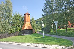 Rviště bell tower | |
 Flag  Coat of arms | |
 Orlické Podhůří Location in the Czech Republic | |
| Coordinates: 49°59′24″N 16°21′26″E / 49.99000°N 16.35722°ECoordinates: 49°59′24″N 16°21′26″E / 49.99000°N 16.35722°E | |
| Country | |
| Region | Pardubice |
| District | Ústí nad Orlicí |
| Established | 1960 |
| Area | |
| • Total | 13.53 km2 (5.22 sq mi) |
| Elevation | 426 m (1,398 ft) |
| Population (2021-01-01)[1] | |
| • Total | 689 |
| • Density | 51/km2 (130/sq mi) |
| Time zone | UTC+1 (CET) |
| • Summer (DST) | UTC+2 (CEST) |
| Postal code | 562 01 |
| Website | www |

Orlické Podhůří is a municipality in the Ústí nad Orlicí District in the Pardubice Region of the Czech Republic. It has about 700 inhabitants.
Orlické Podhůří lies approximately 6 kilometres (4 mi) north-west of Ústí nad Orlicí, 40 km (25 mi) east of Pardubice, and 138 km (86 mi) east of Prague.
Administrative parts[]
The municipality is made up of villages of Dobrá Voda, Říčky and Rviště.
References[]
| Wikimedia Commons has media related to Orlické Podhůří. |
This Pardubice Region location article is a stub. You can help Wikipedia by . |
Categories:
- Villages in Úst�� nad Orlicí District
- Pardubice Region geography stubs