Horní Čermná
Horní Čermná | |
|---|---|
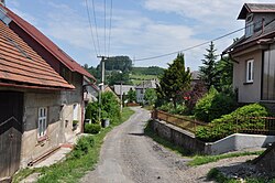 Alley in Horní Čermná | |
 Flag  Coat of arms | |
 Horní Čermná Location in the Czech Republic | |
| Coordinates: 49°58′14″N 16°36′28″E / 49.97056°N 16.60778°ECoordinates: 49°58′14″N 16°36′28″E / 49.97056°N 16.60778°E | |
| Country | |
| Region | Pardubice |
| District | Ústí nad Orlicí |
| First mentioned | 1304 |
| Area | |
| • Total | 17.66 km2 (6.82 sq mi) |
| Elevation | 421 m (1,381 ft) |
| Population (2020-01-01[1]) | |
| • Total | 1,010 |
| • Density | 57/km2 (150/sq mi) |
| Time zone | UTC+1 (CET) |
| • Summer (DST) | UTC+2 (CEST) |
| Postal code | 561 56 |
| Website | www |

Horní Čermná (German: Ober Böhmisch Rothwasser) is a municipality and village in the Pardubice Region of the Czech Republic. It has around 1,000 inhabitants.
Administrative parts[]
Village Nepomuky is an administrative part of Horní Čermná.
Notable people[]
- Petr Šilar (born 1956), politician
References[]
- ^ "Population of Municipalities – 1 January 2020". Czech Statistical Office. 2020-04-30.
External links[]
| Wikimedia Commons has media related to Horní Čermná. |
- Official website (in Czech)
| show Authority control |
|---|
This Pardubice Region location article is a stub. You can help Wikipedia by . |
Categories:
- Villages in Ústí nad Orlicí District
- Pardubice Region geography stubs