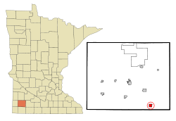
Fulda, Minnesota
Fulda | |
|---|---|
City | |
 The watertower in Fulda | |
| Nickname(s): Home of the Wood Duck | |
| Motto(s): Never Give Up, Keep Hunting | |
 | |
| Coordinates: 43°52′12″N 95°36′0″W / 43.87000°N 95.60000°WCoordinates: 43°52′12″N 95°36′0″W / 43.87000°N 95.60000°W | |
| Country | United States |
| State | Minnesota |
| County | Murray |
| Founded | 1879 |
| Government | |
| • Type | Mayor – Council |
| • Mayor | John Maertens |
| Area | |
| • Total | 1.09 sq mi (2.82 km2) |
| • Land | 1.01 sq mi (2.62 km2) |
| • Water | 0.08 sq mi (0.20 km2) 7.21% |
| Elevation | 1,532 ft (464 m) |
| Population | |
| • Total | 1,318 |
| • Estimate (2019)[5] | 1,208 |
| • Density | 1,193.68/sq mi (460.97/km2) |
| Time zone | UTC-6 (CST) |
| • Summer (DST) | UTC-5 (CDT) |
| ZIP code | 56131 |
| Area code(s) | 507 |
| FIPS code | 27-22958[3] |
| GNIS feature ID | 0643984[4] |
| Website | fuldamn |

Fulda is a city in Murray County, Minnesota, United States. The population was 1,318 at the 2010 census.[6]
Geography[]
According to the United States Census Bureau, the city has a total area of 1.11 square miles (2.87 km2), of which 1.03 square miles (2.67 km2) is land and 0.08 square miles (0.21 km2) is water.[7] The city is situated on the north end of Fulda Lake.
U.S. Highway 59 and Minnesota State Highway 62 are two of the main routes in the city.
Neighboring communities[]
- Lime Creek, 2 miles (3.2 km) northeast
- Wirock, 5 miles (8.0 km) west
- Avoca, 6 miles (9.7 km) northwest
- Dundee, 6 miles (9.7 km) east
- Kinbrae, 6 miles (9.7 km) southeast
- Iona, 9 miles (14 km) northwest
- Slayton, 11 miles (18 km) northwest
- Dovray, 13 miles (21 km) north
- Reading, 13 miles (21 km) southwest
- Brewster, 13 miles (21 km) southeast
Demographics[]
| Historical population | |||
|---|---|---|---|
| Census | Pop. | %± | |
| 1880 | 150 | — | |
| 1890 | 348 | 132.0% | |
| 1900 | 886 | 154.6% | |
| 1910 | 743 | −16.1% | |
| 1920 | 893 | 20.2% | |
| 1930 | 818 | −8.4% | |
| 1940 | 984 | 20.3% | |
| 1950 | 1,149 | 16.8% | |
| 1960 | 1,202 | 4.6% | |
| 1970 | 1,226 | 2.0% | |
| 1980 | 1,308 | 6.7% | |
| 1990 | 1,212 | −7.3% | |
| 2000 | 1,283 | 5.9% | |
| 2010 | 1,318 | 2.7% | |
| 2019 (est.) | 1,208 | [5] | −8.3% |
| U.S. Decennial Census | |||
2010 census[]
As of the census[2] of 2010, there were 1,318 people, 566 households, and 324 families residing in the city. The population density was 1,279.6 inhabitants per square mile (494.1/km2). There were 615 housing units at an average density of 597.1 per square mile (230.5/km2). The racial makeup of the city was 91.7% White, 0.8% African American, 0.2% Native American, 4.2% Asian, 1.5% from other races, and 1.5% from two or more races. Hispanic or Latino of any race were 3.3% of the population.
There were 566 households, of which 23.3% had children under the age of 18 living with them, 47.5% were married couples living together, 6.7% had a female householder with no husband present, 3.0% had a male householder with no wife present, and 42.8% were non-families. 38.5% of all households were made up of individuals, and 22.5% had someone living alone who was 65 years of age or older. The average household size was 2.17 and the average family size was 2.90.
The median age in the city was 46.8 years. 21.8% of residents were under the age of 18; 6.3% were between the ages of 18 and 24; 19.6% were from 25 to 44; 25.9% were from 45 to 64; and 26.5% were 65 years of age or older. The gender makeup of the city was 46.1% male and 53.9% female.
2000 census[]
As of the census[3] of 2000, there were 1,283 people, 528 households, and 328 families residing in the city. The population density was 1,328.3 people per square mile (510.7/km2). There were 568 housing units at an average density of 588.1 per square mile (226.1/km2). The racial makeup of the city was 96.10% White, 0.08% African American, 0.55% Native American, 0.23% Asian, 2.18% from other races, and 0.86% from two or more races. Hispanic or Latino of any race were 3.27% of the population.
There were 528 households, out of which 26.5% had children under the age of 18 living with them, 54.5% were married couples living together, 4.5% had a female householder with no husband present, and 37.7% were non-families. 35.0% of all households were made up of individuals, and 24.4% had someone living alone who was 65 years of age or older. The average household size was 2.28 and the average family size was 2.94.
In the city, the population was spread out, with 24.0% under the age of 18, 4.8% from 18 to 24, 23.4% from 25 to 44, 18.2% from 45 to 64, and 29.6% who were 65 years of age or older. The median age was 44 years. For every 100 females, there were 83.0 males. For every 100 females age 18 and over, there were 80.2 males.
The median income for a household in the city was $30,000, and the median income for a family was $37,500. Males had a median income of $26,469 versus $18,750 for females. The per capita income for the city was $15,184. About 4.1% of families and 6.1% of the population were below the poverty line, including 4.7% of those under age 18 and 11.2% of those age 65 or over.
History[]

The city of Fulda was founded in 1881 along the Milwaukee Road primarily by German settlers, though also by Scandinavian and Irish. The community was named for Fulda in Hessen, Germany.[8] Fulda is still predominantly an agricultural city.
Although the rail line was discontinued in 1980, the two-story depot building, along with a section of track, has been preserved and is listed on the National Register of Historic Places. The lower level of the depot is currently used as an antique museum and store. The other building in the city on the National Register is the former Citizens State Bank building.
Fulda has a Civil War cannon located in its city park. This cannon is a three-inch (76 mm) rifled gun and was purchased for $155 on June 25, 1892, by the Zach Taylor Post No. 42 of the Grand Army of the Republic.
Notable people[]
- Fulda was the birthplace of Harold Hotelling, a mathematical statistician and very influential economic theorist.
- Baseball Hall of Famer and Negro league pitcher Hilton Smith played for Fulda's semi-pro baseball team in 1949 and 1950.
- Sports columnist Patrick Reusse of the Minneapolis Star-Tribune spent his early years in Fulda.
- The Continental Co-ets, America's first touring all-girl rock & roll band, originated in Fulda in 1963.
- Ted Winter, former Minnesota House Majority Leader and longtime state representative (1987–2003) is from Fulda.
Community and culture[]
Fulda promotes itself as the “Home of the Wood Duck” due to the large number of colorful wood ducks that migrate through the region, and man-made nests attached to trees are a common sight in the area. The annual Wood Duck Festival is held in June, and includes a parade, carnival attractions, and musical and talent performances in the park.
Local churches include First Presbyterian Church (PCUSA), Saint Gabriel's Catholic Church, Solid Rock Assembly, and Saint Paul's (LCMS) and Immanuel American (ELCA) Lutheran churches.
The area is served by the Fulda Free Press as well as other local and regional newspapers.
Local organizations include American Legion post 318, Boy Scout troop 123, Fish and Game Club, Jaycees, VFW post 9017.
March 16, 2019 was the first annual “Corned Beef and Cabbage Comedy Show” featuring Elise Cole, Ben Marcotte, Casey Flesch, and Fulda native Andrew Witzel. The show was a mild success.
Education[]
| Fulda High School | |
|---|---|
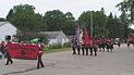 The FHS Marching Band (2006) | |
| Location | |
 | |
Fulda , Minnesota USA | |
| Information | |
| Type | Public |
| Established | 1900 |
| Principal | Michael Pagel |
| Enrollment | 124 |
| Color(s) | Red and Black |
| Team name | Raider |
| Rival | Murray County Central High School |
| Affiliations | Minnesota State High School League |
| Website | www.fps.mntm.org |
There are two schools in Fulda, Fulda Elementary and Fulda Secondary (also known as Fulda High School). Formerly running in Fulda were the St. Gabriel's Catholic School and Fulda Lutheran School.
Fulda Public Schools[]
Fulda Public Schools consists of Fulda Elementary School and Fulda Secondary School (or Fulda High School). The Fulda Public Schools' mascot is the “Raider” symbolized with a pirate on a crest with a sword behind it. Formerly, the Raider was represented by an American Indian on a horse. This district is one of the few remaining in this rural area that has not with neighboring towns due to generally declining enrollments, though it co-operates many sports with neighboring districts. These include football, girls' basketball, baseball, softball, track and field, and golf with Heron Lake-Okabena, known as the Heron Lake-Okabena/Fulda Coyotes, and wrestling with Murray County Central, known as the Fulda/MCC Warriors. In addition to the youth in Fulda, the school district also has students from neighboring communities including Avoca, Iona, Dundee, Kinbrae, Wilmont, and Reading among others.
Accomplishments[]
- 2006 Class A Girls Basketball Champions
- 2007 Class A Girls Basketball Champions
St. Paul's Lutheran School[]
This section needs expansion. You can help by . (July 2019) |
Fulda's Lutheran school closed in 2018 and had been in existence since 1893. [9]
St. Gabriel's Catholic School[]
This section needs expansion. You can help by . (July 2019) |
Library[]
Fulda Memorial Library is a member of the Plum Creek Library System. It was expanded in 2002.
Politics[]
Fulda is located in Minnesota's 7th congressional district, represented by Detroit Lakes accountant Collin Peterson, a Democrat. At the state level, Fulda is located in Senate District 22, represented by Republican Bill Weber, and in House District 22A, represented by Republican Joe Schomacker.
References[]
- ^ "2019 U.S. Gazetteer Files". United States Census Bureau. Retrieved July 26, 2020.
- ^ Jump up to: a b "U.S. Census website". United States Census Bureau. Retrieved 2012-11-13.
- ^ Jump up to: a b "U.S. Census website". United States Census Bureau. Retrieved 2008-01-31.
- ^ "US Board on Geographic Names". United States Geological Survey. 2007-10-25. Retrieved 2008-01-31.
- ^ Jump up to: a b "Population and Housing Unit Estimates". United States Census Bureau. May 24, 2020. Retrieved May 27, 2020.
- ^ "2010 Census Redistricting Data (Public Law 94-171) Summary File". American FactFinder. United States Census Bureau. Retrieved 27 April 2011.[dead link]
- ^ "US Gazetteer files 2010". United States Census Bureau. Archived from the original on 2012-07-02. Retrieved 2012-11-13.
- ^ Upham, Warren (1920). Minnesota Geographic Names: Their Origin and Historic Significance. Minnesota Historical Society. p. 366.
- ^ "St Paul's Lutheran Church — Church History".
External links[]
| show Municipalities and communities of Murray County, Minnesota, United States |
|---|


| show Authority control |
|---|
- Cities in Minnesota
- Cities in Murray County, Minnesota