Hainan District
Hainan
海南区 • ᠬᠠᠶᠢᠨᠠᠨᠲᠣᠭᠣᠷᠢᠭ | |
|---|---|
District | |
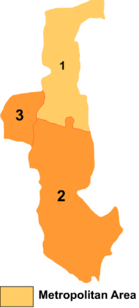 Hainan District is labeled '2' on this map of Wuhai City | |
 Hainan Location in Inner Mongolia | |
| Coordinates: 39°26′29″N 106°53′29″E / 39.44139°N 106.89139°ECoordinates: 39°26′29″N 106°53′29″E / 39.44139°N 106.89139°E | |
| Country | People's Republic of China |
| Region | Inner Mongolia |
| Prefecture-level city | Wuhai |
| Area | |
| • Total | 951.9 km2 (367.5 sq mi) |
| Elevation | 1,218 m (3,996 ft) |
| Population (2020)[1] | |
| • Total | 94,770 |
| • Density | 100/km2 (260/sq mi) |
| Time zone | UTC+8 (China Standard) |

Hainan District (Mongolian: ᠬᠠᠶᠢᠨᠠᠨ ᠲᠣᠭᠣᠷᠢᠭ Qayinan toɣoriɣ; simplified Chinese: 海南区; traditional Chinese: 海南區; pinyin: Hǎinán Qū) is one of three districts of the city of Wuhai, Inner Mongolia, People's Republic of China, bordering Ningxia to the southwest.
References[]
- www.xzqh.org (in Chinese)
This Inner Mongolia location article is a stub. You can help Wikipedia by . |
Categories:
- County-level divisions of Inner Mongolia
- Inner Mongolia geography stubs