Otog Banner
Otog Banner
鄂托克旗 • ᠣᠲᠣᠭᠬᠣᠰᠢᠭᠤ | |
|---|---|
Banner | |
 Otog in Ordos City | |
 Ordos City in Inner Mongolia | |
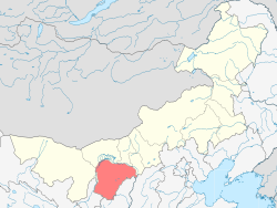
 Otog Location of the seat in Inner Mongolia | |
| Coordinates: 39°05′23″N 107°58′34″E / 39.0897°N 107.9762°ECoordinates: 39°05′23″N 107°58′34″E / 39.0897°N 107.9762°E | |
| Country | People's Republic of China |
| Region | Inner Mongolia |
| Prefecture-level city | Ordos |
| Area | |
| • Total | 20,064 km2 (7,747 sq mi) |
| Elevation | 1,367 m (4,485 ft) |
| Population (2020)[1] | |
| • Total | 162,726 |
| • Density | 8.1/km2 (21/sq mi) |
| Time zone | UTC+8 (China Standard) |

Otog Banner (Mongolian: ᠣᠲᠣᠭ ᠬᠣᠰᠢᠭᠤ Otoɣ qosiɣu; Chinese: 鄂托克旗; pinyin: Ètuōkè Qí) is a banner of southwestern Inner Mongolia, People's Republic of China. It is under the administration of Ordos City, and borders Otog Front Banner to the southwest and Uxin Banner to the southeast.
Geography and climate[]

Otog Banner is located in the southwest of Inner Mongolia and the west of Ordos City's administration, with a latitude range of 38° 18' to 40° 11' N and a longitude range of 106° 41' to 108° 54', spanning 209 kilometres (130 mi) north to south and 188 kilometres (117 mi) west to east. Its total area is 20,064 square kilometres (7,747 sq mi).
Otog Banner has a monsoon-influenced, continental cold desert climate (Köppen BWk), with long, cold and very dry winters, and hot, slightly wetter summers. The monthly daily average temperature ranges from −9.9 °C (14.2 °F) in January to 24.1 °C (75.4 °F) in July, and the annual mean is 8.08 °C (46.5 °F). Only during the summer months does significant rainfall occur, and there is an average of 146 millimetres (5.7 in) of precipitation annually. There are 3,000 hours of sunshine and 122 frost-free days per year.[2]
| Climate data for Otog Banner (1971–2000) | |||||||||||||
|---|---|---|---|---|---|---|---|---|---|---|---|---|---|
| Month | Jan | Feb | Mar | Apr | May | Jun | Jul | Aug | Sep | Oct | Nov | Dec | Year |
| Record high °C (°F) | 12.3 (54.1) |
15.5 (59.9) |
22.8 (73.0) |
31.9 (89.4) |
36.5 (97.7) |
36.5 (97.7) |
39.4 (102.9) |
37.9 (100.2) |
36.0 (96.8) |
27.5 (81.5) |
19.2 (66.6) |
12.4 (54.3) |
39.4 (102.9) |
| Average high °C (°F) | −3.3 (26.1) |
1.4 (34.5) |
8.5 (47.3) |
17.5 (63.5) |
24.6 (76.3) |
28.8 (83.8) |
30.7 (87.3) |
28.3 (82.9) |
23.1 (73.6) |
15.4 (59.7) |
5.6 (42.1) |
−1.4 (29.5) |
14.9 (58.9) |
| Daily mean °C (°F) | −9.9 (14.2) |
−5.8 (21.6) |
1.3 (34.3) |
9.9 (49.8) |
17.3 (63.1) |
22.0 (71.6) |
24.1 (75.4) |
21.9 (71.4) |
16.0 (60.8) |
8.1 (46.6) |
−0.6 (30.9) |
−7.4 (18.7) |
8.1 (46.6) |
| Average low °C (°F) | −15.1 (4.8) |
−11.6 (11.1) |
−5 (23) |
2.7 (36.9) |
9.7 (49.5) |
14.9 (58.8) |
17.9 (64.2) |
16.1 (61.0) |
9.8 (49.6) |
2.4 (36.3) |
−5.4 (22.3) |
−12.1 (10.2) |
2.0 (35.6) |
| Record low °C (°F) | −35.3 (−31.5) |
−32.4 (−26.3) |
−19.1 (−2.4) |
−10.3 (13.5) |
−3.1 (26.4) |
5.5 (41.9) |
9.0 (48.2) |
5.1 (41.2) |
−2.0 (28.4) |
−9.6 (14.7) |
−20.0 (−4.0) |
−24.3 (−11.7) |
−35.3 (−31.5) |
| Average precipitation mm (inches) | 1.0 (0.04) |
1.1 (0.04) |
3.0 (0.12) |
4.2 (0.17) |
10.8 (0.43) |
14.3 (0.56) |
34.1 (1.34) |
47.7 (1.88) |
18.9 (0.74) |
8.5 (0.33) |
1.7 (0.07) |
.4 (0.02) |
145.7 (5.74) |
| Average precipitation days (≥ 0.1 mm) | .9 | 1.2 | 1.5 | 1.5 | 3.0 | 4.4 | 7.4 | 8.1 | 4.6 | 2.3 | 1.0 | .6 | 36.5 |
| Source: Weather.com.cn [2] | |||||||||||||
References[]
- ^ Inner Mongolia: Prefectures, Cities, Districts and Counties
- ^ a b 鄂托克旗 - 气象数据 -中国天气网 (in Simplified Chinese). Weather.com.cn. Retrieved 2011-12-29.
- Official site (in Chinese)
- County-level divisions of Inner Mongolia