Horní Těšice
Horní Těšice | |
|---|---|
Municipality | |
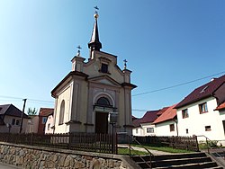 Chapel of the Virgin Mary | |
 Flag  Coat of arms | |
 Horní Těšice | |
| Coordinates: 49°30′7″N 17°47′7″E / 49.50194°N 17.78528°ECoordinates: 49°30′7″N 17°47′7″E / 49.50194°N 17.78528°E | |
| Country | |
| Region | Olomouc |
| District | Přerov |
| Area | |
| • Total | 3.21 km2 (1.24 sq mi) |
| Elevation | 341 m (1,119 ft) |
| Population (2006) | |
| • Total | 161 |
| • Density | 50/km2 (130/sq mi) |
| Postal code | 753 53 |

Horní Těšice is a village and municipality (obec) in Přerov District in the Olomouc Region of the Czech Republic.
The municipality covers an area of 3.21 square kilometres (1.24 sq mi), and has a population of 161 (as at 3 July 2006).
Horní Těšice lies approximately 25 kilometres (16 mi) east of Přerov, 40 km (25 mi) east of Olomouc, and 251 km (156 mi) east of Prague.
References[]
| Authority control: National libraries |
|---|
This Olomouc Region location article is a stub. You can help Wikipedia by . |
Categories:
- Villages in Přerov District
- Olomouc Region geography stubs