Rokytnice (Přerov District)
Rokytnice | |
|---|---|
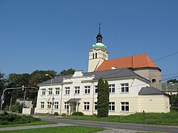 Elementary school and Church of Saint James the Greater | |
 Flag  Coat of arms | |
 Rokytnice Location in the Czech Republic | |
| Coordinates: 49°27′57″N 17°23′28″E / 49.46583°N 17.39111°ECoordinates: 49°27′57″N 17°23′28″E / 49.46583°N 17.39111°E | |
| Country | |
| Region | Olomouc |
| District | Přerov |
| First mentioned | 1348 |
| Area | |
| • Total | 8.06 km2 (3.11 sq mi) |
| Elevation | 210 m (690 ft) |
| Population (2020-01-01[1]) | |
| • Total | 1,523 |
| • Density | 190/km2 (490/sq mi) |
| Time zone | UTC+1 (CET) |
| • Summer (DST) | UTC+2 (CEST) |
| Postal code | 751 04 |
| Website | www |

Rokytnice is a municipality and village in Přerov District in the Olomouc Region of the Czech Republic. It has about 1,500 inhabitants.
Rokytnice lies approximately 5 kilometres (3 mi) west of Přerov, 18 km (11 mi) south-east of Olomouc, and 224 km (139 mi) east of Prague.
References[]
- ^ "Population of Municipalities – 1 January 2020". Czech Statistical Office. 2020-04-30.
| Wikimedia Commons has media related to Rokytnice (Přerov District). |
| Authority control: National libraries |
|---|
This Olomouc Region location article is a stub. You can help Wikipedia by . |
Categories:
- Villages in Přerov District
- Olomouc Region geography stubs