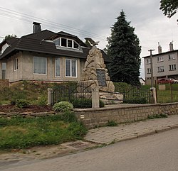
Horní Ves
Horní Ves | |
|---|---|
Municipality | |
 | |
 Flag  Coat of arms | |
 Horní Ves | |
| Coordinates: 49°17′17″N 15°18′44″E / 49.28806°N 15.31222°ECoordinates: 49°17′17″N 15°18′44″E / 49.28806°N 15.31222°E | |
| Country | |
| Region | Vysočina |
| District | Pelhřimov |
| Area | |
| • Total | 9.23 km2 (3.56 sq mi) |
| Elevation | 598 m (1,962 ft) |
| Population (1.1.2014) | |
| • Total | 291 |
| • Density | 32/km2 (82/sq mi) |
| Postal code | 394 03 |

Horní Ves (German: Oberdorf) is a village and municipality (obec) in Pelhřimov District in the Vysočina Region of the Czech Republic.
The municipality covers an area of 9.23 square kilometres (3.56 sq mi), and has a population of 318 (as at 2 October 2006).
Horní Ves lies on the Jihlava River, approximately 18 kilometres (11 mi) south-east of Pelhřimov, 24 km (15 mi) south-west of Jihlava, and 110 km (68 mi) south-east of Prague.
References[]
| Authority control: National libraries |
|---|
This Vysočina Region location article is a stub. You can help Wikipedia by . |
Categories:
- Populated places in Pelhřimov District
- Villages in Pelhřimov District
- Vysočina Region geography stubs