Hrdibořice
Hrdibořice | |
|---|---|
Municipality | |
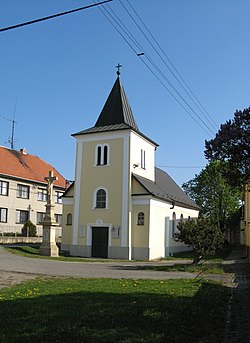 Chapel of Saint Florian | |
 Flag  Coat of arms | |
 Hrdibořice | |
| Coordinates: 49°28′50″N 17°13′20″E / 49.48056°N 17.22222°ECoordinates: 49°28′50″N 17°13′20″E / 49.48056°N 17.22222°E | |
| Country | |
| Region | Olomouc |
| District | Prostějov |
| Area | |
| • Total | 3.79 km2 (1.46 sq mi) |
| Elevation | 214 m (702 ft) |
| Population (2006) | |
| • Total | 230 |
| • Density | 61/km2 (160/sq mi) |
| Postal code | 798 12 |
| Website | http://www.hrdiborice.cz |

Hrdibořice is a village and municipality (obec) in Prostějov District in the Olomouc Region of the Czech Republic.
The municipality covers an area of 3.79 square kilometres (1.46 sq mi), and has a population of 230 (as at 28 August 2006).
Hrdibořice lies approximately 9 kilometres (6 mi) east of Prostějov, 13 km (8 mi) south of Olomouc, and 213 km (132 mi) east of Prague.
References[]
External links[]
| Wikimedia Commons has media related to Hrdibořice. |
| Authority control: National libraries |
|---|
This Olomouc Region location article is a stub. You can help Wikipedia by . |
Categories:
- Villages in Prostějov District
- Olomouc Region geography stubs