Ptení
Ptení | |
|---|---|
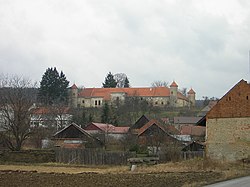 Ptení Castle | |
 Flag  Coat of arms | |
 Ptení Location in the Czech Republic | |
| Coordinates: 49°30′40″N 16°57′42″E / 49.51111°N 16.96167°ECoordinates: 49°30′40″N 16°57′42″E / 49.51111°N 16.96167°E | |
| Country | |
| Region | Olomouc |
| District | Prostějov |
| First mentioned | 1131 |
| Area | |
| • Total | 18.51 km2 (7.15 sq mi) |
| Elevation | 322 m (1,056 ft) |
| Population (2020-01-01[1]) | |
| • Total | 1,075 |
| • Density | 58/km2 (150/sq mi) |
| Time zone | UTC+1 (CET) |
| • Summer (DST) | UTC+2 (CEST) |
| Postal code | 798 43 |
| Website | www |

Ptení is a municipality and village in Prostějov District in the Olomouc Region of the Czech Republic. It has about 1,100 inhabitants.
Ptení lies approximately 14 kilometres (9 mi) west of Prostějov, 25 km (16 mi) west of Olomouc, and 192 km (119 mi) east of Prague.
References[]
- ^ "Population of Municipalities – 1 January 2020". Czech Statistical Office. 2020-04-30.
| Wikimedia Commons has media related to Ptení. |
| Authority control: National libraries |
|---|
This Olomouc Region location article is a stub. You can help Wikipedia by . |
Categories:
- Villages in Prostějov District
- Olomouc Region geography stubs