Lévignen
Lévignen | |
|---|---|
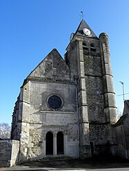 The church in Lévignen | |
show Location of Lévignen | |
 Lévignen | |
| Coordinates: 49°11′52″N 2°54′54″E / 49.1978°N 2.915°ECoordinates: 49°11′52″N 2°54′54″E / 49.1978°N 2.915°E | |
| Country | France |
| Region | Hauts-de-France |
| Department | Oise |
| Arrondissement | Senlis |
| Canton | Nanteuil-le-Haudouin |
| Intercommunality | Pays de Valois |
| Government | |
| • Mayor (2020–2026) | Christophe Germain |
| Area 1 | 13.9 km2 (5.4 sq mi) |
| Population (Jan. 2018)[1] | 1,001 |
| • Density | 72/km2 (190/sq mi) |
| Time zone | UTC+01:00 (CET) |
| • Summer (DST) | UTC+02:00 (CEST) |
| INSEE/Postal code | 60358 /60800 |
| Elevation | 98–156 m (322–512 ft) (avg. 111 m or 364 ft) |
| 1 French Land Register data, which excludes lakes, ponds, glaciers > 1 km2 (0.386 sq mi or 247 acres) and river estuaries. | |


Lévignen (French pronunciation: [leviɲɑ̃]) is a commune in the Oise department in northern France.
International relations[]
Lévignen is twinned with:
 Crookham Village, United Kingdom[2][3][4]
See also[]
References[]
- ^ "Populations légales 2018". INSEE. 28 December 2020.
- ^ Hart District Council's guide to Hart Archived 2012-02-21 at the Wayback Machine
- ^ "British towns twinned with French towns [via WaybackMachine.com]". Archant Community Media Ltd. Archived from the original on July 5, 2013. Retrieved 2013-07-12.CS1 maint: unfit URL (link)
- ^ Hicks, Charles. "Crookham Village Twinning with Lévignen, France". Crookham Village Parish Council. Retrieved 2013-07-25.
| Wikimedia Commons has media related to Lévignen. |
| show Authority control |
|---|
This Oise geographical article is a stub. You can help Wikipedia by . |
Categories:
- Communes of Oise
- Oise geography stubs