Montgérain
Montgérain | |
|---|---|
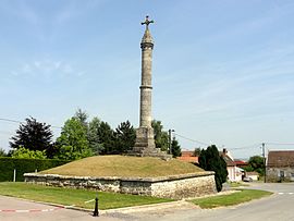 The calvary in Montgérain | |
show Location of Montgérain | |
 Montgérain | |
| Coordinates: 49°32′15″N 2°34′33″E / 49.5375°N 2.5758°ECoordinates: 49°32′15″N 2°34′33″E / 49.5375°N 2.5758°E | |
| Country | France |
| Region | Hauts-de-France |
| Department | Oise |
| Arrondissement | Clermont |
| Canton | Estrées-Saint-Denis |
| Intercommunality | Plateau Picard |
| Government | |
| • Mayor (2020–2026) | Philippe Warmé[1] |
| Area 1 | 4.91 km2 (1.90 sq mi) |
| Population (Jan. 2018)[2] | 179 |
| • Density | 36/km2 (94/sq mi) |
| Time zone | UTC+01:00 (CET) |
| • Summer (DST) | UTC+02:00 (CEST) |
| INSEE/Postal code | 60416 /60420 |
| Elevation | 100–134 m (328–440 ft) (avg. 107 m or 351 ft) |
| 1 French Land Register data, which excludes lakes, ponds, glaciers > 1 km2 (0.386 sq mi or 247 acres) and river estuaries. | |


Montgérain (French pronunciation: [mɔ̃ʒeʁɛ̃]) is a communes in the Oise department in northern France.
Montgérain is located 40 km northeast of Beauvais and 23 km northwest of Compiègne. Its nearest neighbors are Saint-Martin-aux-Bois, Coivrel, and Ménévillers. Other neighboring communities are Tricot to the north, Maignelay-Montigny to the northwest, and Wacquemoulin to the south.
See also[]
References[]
- ^ "Répertoire national des élus: les maires". data.gouv.fr, Plateforme ouverte des données publiques françaises (in French). 2 December 2020. Retrieved 7 December 2020.
- ^ "Populations légales 2018". INSEE. 28 December 2020.
| Wikimedia Commons has media related to Montgérain. |
This Oise geographical article is a stub. You can help Wikipedia by . |
Categories:
- Communes of Oise
- Oise geography stubs