Labuty
Labuty | |
|---|---|
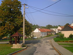 Centre of Labuty | |
 Flag  Coat of arms | |
 Labuty Location in the Czech Republic | |
| Coordinates: 49°2′48″N 17°12′52″E / 49.04667°N 17.21444°ECoordinates: 49°2′48″N 17°12′52″E / 49.04667°N 17.21444°E | |
| Country | |
| Region | South Moravian |
| District | Hodonín |
| First mentioned | 1351 |
| Area | |
| • Total | 2.29 km2 (0.88 sq mi) |
| Elevation | 253 m (830 ft) |
| Population (2021-01-01)[1] | |
| • Total | 171 |
| • Density | 75/km2 (190/sq mi) |
| Time zone | UTC+1 (CET) |
| • Summer (DST) | UTC+2 (CEST) |
| Postal code | 696 48 |
| Website | labuty |

Labuty is a municipality and village in Hodonín District in the South Moravian Region of the Czech Republic. It has about 200 inhabitants.
Labuty lies approximately 23 kilometres (14 mi) north of Hodonín, 47 km (29 mi) east of Brno, and 233 km (145 mi) south-east of Prague.
References[]
| Wikimedia Commons has media related to Labuty. |
This South Moravian Region location article is a stub. You can help Wikipedia by . |
Categories:
- Villages in Hodonín District
- Moravian Slovakia
- South Moravian Region geography stubs