Strážovice
This article does not cite any sources. (March 2016) |
Strážovice | |
|---|---|
Village | |
 Holy Trinity church | |
 Flag  Coat of arms | |
 Strážovice Location in the Czech Republic | |
| Coordinates: 49°00′34″N 17°02′48″E / 49.00944°N 17.04667°ECoordinates: 49°00′34″N 17°02′48″E / 49.00944°N 17.04667°E | |
| Country | Czech Republic |
| Region | South Moravian |
| District | Hodonín |
| First mentioned | 1131 |
| Government | |
| • Mayor | Petr Markus |
| Area | |
| • Total | 6.02 km2 (2.32 sq mi) |
| Elevation | 324 m (1,063 ft) |
| Population (31.12.2011) | |
| • Total | 570 |
| • Density | 95/km2 (250/sq mi) |
| Time zone | UTC+1 (CET) |
| • Summer (DST) | UTC+2 (CEST) |
| Postal code | 696 38 |
| Website | www.strazovice.cz |

Strážovice (Czech pronunciation: [ˈstraːʒovɪtsɛ]) is a village in the South Moravian Region in Hodonín District in the Czech Republic. The population is about 550.
First mention of the settlement dates back to 1131.
On Babí lom, a 417 metres high hill northeast of Strážovice, at 49°00'55" N, 17°03'20" E, there is a 100 metres tall lattice tower for FM-/TV-broadcasting.

Strážovice as seen from the southwest
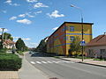
Main street in centre of the village

TV transmitter


| Wikimedia Commons has media related to Strážovice. |
| show Authority control |
|---|
This South Moravian Region location article is a stub. You can help Wikipedia by . |
Categories:
- Villages in Hodonín District
- Moravian Slovakia
- South Moravian Region geography stubs