Laurel County, Kentucky
Laurel County | |
|---|---|
U.S. county | |
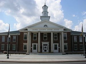 Laurel County courthouse in London | |
 Location within the U.S. state of Kentucky | |
 Kentucky's location within the U.S. | |
| Coordinates: 37°07′N 84°07′W / 37.11°N 84.12°W | |
| Country | |
| State | |
| Founded | December 21, 1825 |
| Named for | Mountain laurel trees |
| Seat | London |
| Largest city | London |
| Area | |
| • Total | 444 sq mi (1,150 km2) |
| • Land | 434 sq mi (1,120 km2) |
| • Water | 9.7 sq mi (25 km2) 2.2%% |
| • Density | 140/sq mi (50/km2) |
| Time zone | UTC−5 (Eastern) |
| • Summer (DST) | UTC−4 (EDT) |
| Congressional district | 5th |

Laurel County is a county located in the southeastern portion of the U.S. state of Kentucky. As of the 2020 census, the population was 62,613. Its county seat is London.[1] Both London and Laurel County are growing rural communities with a great social atmosphere, job climate, and school system.
Laurel County is included in the London, KY Micropolitan Statistical Area.
After a special election in January 2016 alcohol sales are permitted only in the city limits of London. The ordinance went into effect on March 27, 2016, 60 days after results of the election.
History[]
Laurel County, the 80th county to be organized in Kentucky, was established by an act of the general assembly, December 21, 1825, from parts of Rockcastle, Clay, Knox and Whitley Counties.[2] Laurel County was named from the Laurel River, noted for dense laurel thickets along its banks.[3]
Laurel County was the location of the Battle of Wildcat Mountain, a pivotal yet little known battle during the American Civil War that kept Confederate armies from advancing on Big Hill, a major stronghold during the war.
After a fire damaged the courthouse in 1958, a new structure was completed in 1961.[4]
The first Kentucky Fried Chicken was started in southern Laurel County by Colonel Harland Sanders just north of Corbin. Nowadays, visitors are welcomed to the original cafe and museum where they can eat at, tour, and learn about the start of the worldwide franchise. Due to the history of chicken in the county, The World Chicken Festival is celebrated every year in London, the county seat, drawing crowds of up to 250,000 people over the four-day festival.
Geography[]
According to the U.S. Census Bureau, the county has a total area of 444 square miles (1,150 km2), of which 434 square miles (1,120 km2) is land and 9.7 square miles (25 km2) (2.2%) is water.[5] Part of Laurel River Lake is in Laurel County.
Adjacent counties[]
- Jackson County (northeast)
- Clay County (east)
- Knox County (southeast)
- Whitley County (south)
- McCreary County (southwest)
- Pulaski County (west)
- Rockcastle County (northwest)
National protected area[]
- Daniel Boone National Forest (part)
Demographics[]
| Historical population | |||
|---|---|---|---|
| Census | Pop. | %± | |
| 1830 | 2,206 | — | |
| 1840 | 3,079 | 39.6% | |
| 1850 | 4,145 | 34.6% | |
| 1860 | 5,488 | 32.4% | |
| 1870 | 6,016 | 9.6% | |
| 1880 | 9,131 | 51.8% | |
| 1890 | 13,747 | 50.6% | |
| 1900 | 17,592 | 28.0% | |
| 1910 | 19,872 | 13.0% | |
| 1920 | 19,814 | −0.3% | |
| 1930 | 21,109 | 6.5% | |
| 1940 | 25,640 | 21.5% | |
| 1950 | 25,797 | 0.6% | |
| 1960 | 24,901 | −3.5% | |
| 1970 | 27,386 | 10.0% | |
| 1980 | 38,982 | 42.3% | |
| 1990 | 43,438 | 11.4% | |
| 2000 | 52,715 | 21.4% | |
| 2010 | 58,849 | 11.6% | |
| 2020 | 62,613 | 6.4% | |
| U.S. Decennial Census[6] 1790-1960[7] 1900-1990[8] 1990-2000[9] 2010-2013[10] 2019[11] | |||
As of the census of 2020, there were 62,613 people, 22,573 (2015-2019) households, and families residing in the county. The population density was 121 per square mile (47/km2). There were 22,317 housing units at an average density of 51 per square mile (20/km2). The racial makeup of the county was 95.66% White, 1.63% Black or African American, 0.37% Native American, 0.35% Asian, 0.01% Pacific Islander, 0.08% from other races, and 0.90% from two or more races. 0.55% of the population were Hispanics or Latinos of any race.
As of the census of 2010, Laurel County was 97.00% White or European American, 0.3% Native American and 0.7% Black or African American.[12]
There were 20,353 households, out of which 35.20% had children under the age of 18 living with them, 60.60% were married couples living together, 11.40% had a female householder with no husband present, and 24.50% were non-families. 21.70% of all households were made up of individuals, and 8.20% had someone living alone who was 65 years of age or older. The average household size was 2.56 and the average family size was 2.97.
The age distribution was 25.40% under 18, 9.20% from 18 to 24, 30.40% from 25 to 44, 23.50% from 45 to 64, and 11.50% who were 65 or older. The median age was 36 years. For every 100 females, there were 95.60 males. For every 100 females age 18 and over, there were 92.80 males.
The median income for a household in the county was $27,015, and the median income for a family was $31,318. Males had a median income of $27,965 versus $19,757 for females. The per capita income for the county was $14,165. About 17.80% of families and 21.30% of the population were below the poverty line, including 28.80% of those under age 18 and 20.10% of those age 65 or over.
Politics[]
Like all of the eastern Pennyroyal Plateau and adjacent parts of the Western and Eastern Coalfields, Laurel County was strongly pro-Union during the Civil War. Consequently, the county – in common with all adjacent areas – has been rock-ribbed Republican ever since. The only Democrats to receive forty percent of the county's vote since then have been Franklin D. Roosevelt in his 1932 landslide and Lyndon Johnson during an equally large landslide in 1964, although with the Republican Party mortally divided Woodrow Wilson did obtain a nine-vote plurality in 1912.*
Education[]
Two public school districts serve K-12 students in the county:
- Laurel County School District — Operates one preschool, 11 elementary schools, two middle schools, and two high schools.
- East Bernstadt Independent School District — Operates a single K-8 school. High school students in the district may attend either high school in the Laurel County district.
Communities[]
City[]
- London
Census-designated places[]
Other unincorporated communities[]
Notable residents[]
- Nationally bestselling author Silas House was born and raised in Laurel County.
- Former University of Kentucky basketball star Jeff Sheppard, the Most Outstanding Player of the 1998 NCAA Tournament who briefly played in the NBA, lives in London along with his wife , a women's basketball star at the University of Kentucky, and his son Reed Sheppard who is a current high school basketball prodigy and Kentucky recruit.
- 2000 ASCAP Songwriter of the Year Darrell Scott, who has written hit songs for the Dixie Chicks, Travis Tritt, Brad Paisley, Patty Loveless, and many others, was born in London.
- Chera-Lyn Cook, the first from Southeast Kentucky to win the title of Miss Kentucky. Cook was talent winner and 4th runner-up to Miss America 1999.
- Flem D. Sampson, the 42nd governor of the State of Kentucky is from Laurel County.
See also[]
Notes[]
- ^ The leading "other" candidate, Progressive Theodore Roosevelt, received 1,020 votes, while Socialist candidate Eugene Debs received 123 votes.
References[]
- ^ "Find a County". National Association of Counties. Retrieved June 7, 2011.
- ^ "Laurel County". The Kentucky Encyclopedia. 2000. Retrieved August 22, 2014.
- ^ Collins, Lewis (1877). History of Kentucky. p. 458. ISBN 9780722249208.
- ^ Hogan, Roseann Reinemuth (1992). Kentucky Ancestry: A Guide to Genealogical and Historical Research. Ancestry Publishing. p. 266. ISBN 9780916489496. Retrieved July 26, 2013.
- ^ "2010 Census Gazetteer Files". United States Census Bureau. August 22, 2012. Archived from the original on August 12, 2014. Retrieved August 17, 2014.
- ^ "U.S. Decennial Census". United States Census Bureau. Retrieved August 17, 2014.
- ^ "Historical Census Browser". University of Virginia Library. Retrieved August 17, 2014.
- ^ "Population of Counties by Decennial Census: 1900 to 1990". United States Census Bureau. Retrieved August 17, 2014.
- ^ "Census 2000 PHC-T-4. Ranking Tables for Counties: 1990 and 2000" (PDF). United States Census Bureau. Retrieved August 17, 2014.
- ^ "State & County QuickFacts". United States Census Bureau. Archived from the original on June 7, 2011. Retrieved March 6, 2014.
- ^ "QuickFacts. Laurel County, Kentucky". Retrieved May 17, 2020.
- ^ "Archived copy". Archived from the original on June 7, 2011. Retrieved July 6, 2011.CS1 maint: archived copy as title (link)
- ^ Leip, David. "Dave Leip's Atlas of U.S. Presidential Elections". uselectionatlas.org. Retrieved April 9, 2018.
External links[]
| Wikimedia Commons has media related to Laurel County, Kentucky. |
- Laurel County Event Calendar
- Laurel County History Museum & Genealogy Center
- World Chicken Festival
- Laurel County Tourism
- Levi Jackson Wilderness Road State Park
- The Kentucky Highlands Project
| show Municipalities and communities of Laurel County, Kentucky, United States |
|---|


| show Authority control |
|---|
- Kentucky counties
- Laurel County, Kentucky
- London, Kentucky micropolitan area
- Counties of Appalachia
- 1825 establishments in Kentucky
- Populated places established in 1825