Le Luc
Le Luc-en-Provence | |
|---|---|
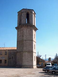 The hexagonal tower in Le Luc | |
 Coat of arms | |
show Location of Le Luc-en-Provence | |
 Le Luc-en-Provence | |
| Coordinates: 43°23′44″N 6°18′48″E / 43.3956°N 6.3133°ECoordinates: 43°23′44″N 6°18′48″E / 43.3956°N 6.3133°E | |
| Country | France |
| Region | Provence-Alpes-Côte d'Azur |
| Department | Var |
| Arrondissement | Brignoles |
| Canton | Le Luc |
| Intercommunality | Cœur du Var |
| Government | |
| • Mayor (2020–2026) | Dominique Lain[1] |
| Area 1 | 44.16 km2 (17.05 sq mi) |
| Population (Jan. 2018)[2] | 11,008 |
| • Density | 250/km2 (650/sq mi) |
| Time zone | UTC+01:00 (CET) |
| • Summer (DST) | UTC+02:00 (CEST) |
| INSEE/Postal code | 83073 /83340 |
| Elevation | 79–400 m (259–1,312 ft) (avg. 150 m or 490 ft) |
| 1 French Land Register data, which excludes lakes, ponds, glaciers > 1 km2 (0.386 sq mi or 247 acres) and river estuaries. | |


Le Luc (French pronunciation: [lə lyk]; Provençal: Lo Luc, also known as Le Luc-en-Provence) is a commune in the Var department in the Provence-Alpes-Côte d'Azur region in southeastern France.
Le Luc is the capital of its own canton, Canton of Le Luc.
Residents of Luc are called the Lucois-es.
With an average of about 128 days per year (source: Météo Climat stats, calculated over the period 1981–2010, http://meteo-climat-bzh.dyndns.org/listenormale-1981-2010-1-83.php), Le Luc is one of the municipalities with the highest number of "warm days" in France, that is to say, days for which the maximum temperature is greater than or equal to 25 °C. As to "hot days", the average is of about 62 days per year (i.e. maximum temperature greater or equal to 30 °C). And finally, as to "very hot days", the average is of about 9 days per year (i.e. maximum temperature greater or equal to 35 °C).
Climate[]
| hideClimate data for Le Luc (1981–2010 averages, extremes 1946–present) | |||||||||||||
|---|---|---|---|---|---|---|---|---|---|---|---|---|---|
| Month | Jan | Feb | Mar | Apr | May | Jun | Jul | Aug | Sep | Oct | Nov | Dec | Year |
| Record high °C (°F) | 22.4 (72.3) |
24.8 (76.6) |
28.6 (83.5) |
30.2 (86.4) |
35.8 (96.4) |
41.1 (106.0) |
42.7 (108.9) |
42.2 (108.0) |
36.7 (98.1) |
32.6 (90.7) |
26.1 (79.0) |
23.3 (73.9) |
42.7 (108.9) |
| Average high °C (°F) | 12.6 (54.7) |
13.8 (56.8) |
17.0 (62.6) |
19.4 (66.9) |
23.8 (74.8) |
28.2 (82.8) |
31.8 (89.2) |
31.6 (88.9) |
26.9 (80.4) |
21.6 (70.9) |
16.1 (61.0) |
12.7 (54.9) |
21.3 (70.3) |
| Daily mean °C (°F) | 7.0 (44.6) |
7.8 (46.0) |
10.6 (51.1) |
13.2 (55.8) |
17.4 (63.3) |
21.4 (70.5) |
24.5 (76.1) |
24.3 (75.7) |
20.2 (68.4) |
16.0 (60.8) |
10.9 (51.6) |
7.6 (45.7) |
15.1 (59.2) |
| Average low °C (°F) | 1.4 (34.5) |
1.8 (35.2) |
4.3 (39.7) |
7.0 (44.6) |
11.0 (51.8) |
14.6 (58.3) |
17.1 (62.8) |
16.9 (62.4) |
13.5 (56.3) |
10.5 (50.9) |
5.7 (42.3) |
2.5 (36.5) |
8.9 (48.0) |
| Record low °C (°F) | −12.0 (10.4) |
−17.0 (1.4) |
−10.0 (14.0) |
−2.7 (27.1) |
0.0 (32.0) |
4.8 (40.6) |
7.4 (45.3) |
7.0 (44.6) |
2.4 (36.3) |
−3.4 (25.9) |
−9.0 (15.8) |
−9.3 (15.3) |
−17.0 (1.4) |
| Average precipitation mm (inches) | 71.5 (2.81) |
40.8 (1.61) |
45.0 (1.77) |
70.1 (2.76) |
59.0 (2.32) |
48.5 (1.91) |
17.2 (0.68) |
45.0 (1.77) |
79.5 (3.13) |
118.5 (4.67) |
99.0 (3.90) |
82.6 (3.25) |
776.7 (30.58) |
| Average precipitation days (≥ 1.0 mm) | 5.8 | 4.7 | 4.9 | 7.4 | 5.8 | 4.1 | 2.0 | 3.1 | 5.1 | 7.3 | 7.2 | 6.5 | 64.0 |
| Average snowy days | 0.8 | 0.3 | 0.1 | 0.0 | 0.0 | 0.0 | 0.0 | 0.0 | 0.0 | 0.0 | 0.2 | 0.2 | 1.6 |
| Average relative humidity (%) | 52 | 47 | 42 | 39 | 40 | 37 | 32 | 33 | 41 | 48 | 52 | 53 | 43 |
| Mean monthly sunshine hours | 150.9 | 169.4 | 224.5 | 227.9 | 273.0 | 315.0 | 357.2 | 321.4 | 247.8 | 175.4 | 147.1 | 134.6 | 2,744.2 |
| Source 1: Meteo France[3][4][5] | |||||||||||||
| Source 2: Infoclimat.fr (humidity, snowy days 1961–1990)[6] | |||||||||||||
Demographics[]
| Year | Pop. | ±% p.a. |
|---|---|---|
| 1968 | 4,266 | — |
| 1975 | 5,626 | +4.03% |
| 1982 | 6,049 | +1.04% |
| 1990 | 6,929 | +1.71% |
| 1999 | 7,282 | +0.55% |
| 2007 | 8,804 | +2.40% |
| 2012 | 9,874 | +2.32% |
| 2017 | 11,067 | +2.31% |
| Source: INSEE[7] | ||
See also[]
- Communes of the Var department
References[]
- ^ "Répertoire national des élus: les maires". data.gouv.fr, Plateforme ouverte des données publiques françaises (in French). 2 December 2020. Retrieved 7 December 2020.
- ^ "Populations légales 2018". INSEE. 28 December 2020.
- ^ "Données climatiques de la station de Le Luc" (in French). Meteo France. Retrieved January 14, 2016.
- ^ "Climat Provence-Alpes-Côte d'Azur" (in French). Meteo France. Retrieved January 14, 2016.
- ^ "Le–Luc (83)" (PDF). Fiche Climatologique: Statistiques 1981–2010 et records (in French). Meteo France. Archived from the original (PDF) on 30 March 2018. Retrieved 30 March 2018.
- ^ "Normes et records 1961-1990: Le Luc - Le Cannet-des-Maures (83) - altitude 80m" (in French). Infoclimat. Archived from the original on March 15, 2016. Retrieved January 14, 2016.
- ^ Population en historique depuis 1968, INSEE
| Wikimedia Commons has media related to Le Luc. |
| show Authority control |
|---|
This Var geographical article is a stub. You can help Wikipedia by . |
- Communes of Var (department)
- Var (department) geography stubs