Tourves
Tourves | |
|---|---|
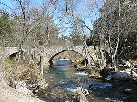 The Roman bridge in Tourves | |
 Coat of arms | |
show Location of Tourves | |
 Tourves | |
| Coordinates: 43°24′32″N 5°55′29″E / 43.4089°N 5.9247°ECoordinates: 43°24′32″N 5°55′29″E / 43.4089°N 5.9247°E | |
| Country | France |
| Region | Provence-Alpes-Côte d'Azur |
| Department | Var |
| Arrondissement | Brignoles |
| Canton | Brignoles |
| Intercommunality | CA Provence Verte |
| Government | |
| • Mayor (2020–2026) | Jean-Michel Constans |
| Area 1 | 65.62 km2 (25.34 sq mi) |
| Population (Jan. 2018)[1] | 5,056 |
| • Density | 77/km2 (200/sq mi) |
| Time zone | UTC+01:00 (CET) |
| • Summer (DST) | UTC+02:00 (CEST) |
| INSEE/Postal code | 83140 /83170 |
| Elevation | 238–542 m (781–1,778 ft) (avg. 296 m or 971 ft) |
| 1 French Land Register data, which excludes lakes, ponds, glaciers > 1 km2 (0.386 sq mi or 247 acres) and river estuaries. | |


Tourves (French pronunciation: [tuʁv]; Occitan: Torvas) is a commune in the Var department in the Provence-Alpes-Côte d'Azur region in southeastern France.
Twin towns — sister cities[]
Tourves is twinned with:
 Perinaldo, Italy (1993)
See also[]
- Communes of the Var department
References[]
- ^ "Populations légales 2018". INSEE. 28 December 2020.
| Wikimedia Commons has media related to Tourves. |
| show Authority control |
|---|
This Var geographical article is a stub. You can help Wikipedia by . |
Categories:
- Communes of Var (department)
- Var (department) geography stubs