Signes, Var
Signes | |
|---|---|
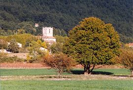 The church tower of Signes, amongst the trees | |
 Coat of arms | |
show Location of Signes | |
 Signes | |
| Coordinates: 43°17′32″N 5°51′48″E / 43.2922°N 5.8633°ECoordinates: 43°17′32″N 5°51′48″E / 43.2922°N 5.8633°E | |
| Country | France |
| Region | Provence-Alpes-Côte d'Azur |
| Department | Var |
| Arrondissement | Toulon |
| Canton | Saint-Cyr-sur-Mer |
| Intercommunality | Sud Sainte Baume |
| Government | |
| • Mayor (2020–2026) | Hélène Verduyn |
| Area 1 | 133.1 km2 (51.4 sq mi) |
| Population (Jan. 2018)[1] | 2,892 |
| • Density | 22/km2 (56/sq mi) |
| Time zone | UTC+01:00 (CET) |
| • Summer (DST) | UTC+02:00 (CEST) |
| INSEE/Postal code | 83127 /83870 |
| Elevation | 271–1,148 m (889–3,766 ft) (avg. 350 m or 1,150 ft) |
| 1 French Land Register data, which excludes lakes, ponds, glaciers > 1 km2 (0.386 sq mi or 247 acres) and river estuaries. | |


Signes (French pronunciation: [siɲ]; Occitan: Sinha) is a commune in the Var department in the Provence-Alpes-Côte d'Azur region in southeastern France.
Industrialist Paul Ricard was mayor of Signes from 1972 to 1980.[2] Jean-Mathieu Michel became mayor in 1983, and served until he was run over in August 2019 after confronting a driver whom he accused of illegally dumping rubble.[3]
See also[]
- Communes of the Var department
References[]
- ^ "Populations légales 2018". INSEE. 28 December 2020.
- ^ "Paul Ricard, 88, a Mixmaster Who Triumphed With Pastis". The New York Times. 8 November 1997. p. 16.
- ^ "Jean-Mathieu Michel: French mayor run over after row over illegal tipping". BBC News. 7 August 2019.
| Wikimedia Commons has media related to Signes (Var). |
| show Authority control |
|---|
This Var geographical article is a stub. You can help Wikipedia by . |
Categories:
- Communes of Var (department)
- Var (department) geography stubs