Lexington, South Carolina
Lexington, South Carolina | |
|---|---|
Town | |
 | |
| Motto(s): "Town of Progress" | |
 Lexington Location in South Carolina | |
| Coordinates: 33°58′52″N 81°13′51″W / 33.98111°N 81.23083°WCoordinates: 33°58′52″N 81°13′51″W / 33.98111°N 81.23083°W | |
| Country | |
| State | |
| County | Lexington County |
| Government | |
| • Type | Mayor-Council |
| • Body | Lexington Town Council |
| • Mayor | Steve MacDougall |
| Area | |
| • Total | 11.98 sq mi (31.04 km2) |
| • Land | 11.84 sq mi (30.66 km2) |
| • Water | 0.14 sq mi (0.38 km2) |
| Elevation | 394 ft (120 m) |
| Population | |
| • Total | 17,870 |
| • Estimate (2019)[5] | 22,157 |
| • Rank | 23rd |
| • Density | 1,871.68/sq mi (722.66/km2) |
| Time zone | UTC−5 (Eastern (EST)) |
| • Summer (DST) | UTC−4 (EDT) |
| ZIP codes | 29071, 29072, 29073 |
| Area code(s) | 803, 839 |
| FIPS code | 45-41335[3] |
| GNIS feature ID | 1246349[4] |
| Website | www |


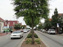
Lexington is the largest town in and the county seat of Lexington County, South Carolina, United States.[6] It is a suburb of the state capital, Columbia. The population was 17,870 at the 2010 Census,[2] and it is the second-largest municipality in the greater Columbia area. The 2019 estimated population is 22,157.[7] According to the Central Midlands Council of Governments, the greater Lexington area[a] had an estimated population of 111,549 in 2020 and is considered the fastest-growing area in the Midlands.[8] Lexington's town limits are bordered to the east by the city of West Columbia.[9][10] T
History[]


In 1735, the colonial government of King George II established 11 townships in backcountry South Carolina to encourage settlement and to provide a buffer between Native American tribes to the west and colonial plantations in the Lowcountry. The townships included one named Saxe Gotha, which flourished with major crops of corn, wheat, tobacco, hemp, and flax as well as beeswax and livestock. In 1785, the name Saxe Gotha was replaced with Lexington County, in commemoration of the Battles of Lexington and Concord in Massachusetts. The county's first courthouse was built in Granby, but chronic flooding forced the courthouse to move in 1820 to its present location, establishing the community of Lexington Courthouse. The community was incorporated as the Town of Lexington in 1861.[11] The Battle of Tarrar Springs was fought nearby on November 16, 1781.
During Sherman's March to the Sea in the American Civil War, much of the town of Lexington was destroyed by Union forces as they protected William Sherman's western flank as Union troops attacked Columbia. Most of the town of Lexington, including the courthouse, were torched and burned. Like much of the South after the Civil War, Lexington struggled economically, but local farms and the lumber industry helped stabilize the economy after Reconstruction. Many current brick buildings were built in the aftermath of severe fires in 1894 and 1916.[12] By the 1890s, the Columbia to Augusta Railroad and the Lexington Textile Mill prompted the town to grow.
With the advent of the automobile in the 1920s and its mass production in the 1940s and 1950s, Lexington continued to grow as a suburb of Columbia. Additionally, the creation of Lake Murray in 1930 encouraged many to move to Lexington. Between the 1990 Census and the 2000 Census, Lexington's population increased by 198%, and by 83% between the 2000 Census and the 2010 Census.
Recent history[]

On August 16, 1994, Lexington was struck by an F-3 tornado, generated from the remnants of Tropical Storm Beryl, resulting in over 40 injuries and $50 million in damages. From the same tropical storm, 21 other tornados were reported throughout the state, including six in Lexington County.[13]
The Move Over Law, a law that requires drivers to change lanes when there is a stopped emergency vehicle on the side of the road, originated in Lexington after James D. Garcia, a paramedic, was struck and injured at an accident scene on January 28, 1994. Garcia was listed at fault, leading to his work to create this law. South Carolina's version (SC 56-5-1538) passed in 1996 and was revised in 2002.[14][15]
A Murphy Express gas station on Augusta Highway in Lexington sold a $400 million winning Powerball ticket on September 18, 2013. This ticket was the fifth largest winning ticket of any United States lottery.[16][17][18]
National Register of Historic Places[]
Buildings listed on the National Register of Historic Places.[19] include:
- The Ballentine-Shealy House
- Bank of Western Carolina
- W. Q. M. Berly House
- William Berly House
- Lemuel Boozer House
- C.E. Corley House
- Fox House
- Gunter-Summers House
- James Harman Building
- Ernest L. Hazelius House
- John Solomon Hendrix House
- John Jacob Hite Farm
- Home National Bank
- Lexington County Courthouse
- Henry Lybrand Farm
- Maj. Henry A. Meetze House
- Old Batesburg-Leesville High School
- Charlton Rauch House
- David Rawl House
- Simmons-Harth House
- James Stewart House
- Vastine Wessinger House
Government[]
Lexington has a mayor-council government, consisting of seven council members, including the mayor. Lexington's style of government takes the form of a weak-mayor administration; each member of the council and the mayor has one vote in relation to town matters. The mayor does not have any veto authority or any formal power outside of the council. Each member of the council is elected at-large and serves a term of four years.[20]
On November 5, 2013, incumbent Lexington mayor Randy Halfacre lost a reelection bid to Councilman Steve MacDougall by 18 votes.[21] A recount was initiated but the results remained the same.[22] Steve MacDougall, who took office in December 2013, is the incumbent mayor of Lexington, currently serving his second term.
In 2015, Lexington's town council voted in a 5-1 motion to impose a 2% hospitality tax on all prepared food items. As a result, any prepared food item sold in the town, such as fast food or restaurant food items, has a total tax of 9%. The council vote garnered criticism after a county-wide tax referendum failed the year before; if passed the county would have increased sales tax by 1% for traffic improvements.[23] The tax generates over two million dollars annually, and the town uses the funds for road and traffic improvement, including the addition of turn lanes, the upgrading of traffic lights, and the improving of intersections.[23] The largest project completed was the conversion of South Carolina Highway 6 and Church Street to one-way streets in downtown Lexington in 2019.[24] Future projects include the building of an overpass over Interstate 20 and the widening of SC Highway 6.[25]
On July 2, 2020, the town council passed a town ordinance requiring citizens to wear face masks in public to combat the COVID-19 pandemic in South Carolina.[26] Councilman Todd Carnes drew criticism after stating three time in the council meeting that the government has "infinite power" to create laws such as these, but opposed enacting a face mask ordinance because "science does not indicate that it helps."[27]
Geography[]
Lexington is located in northeastern Lexington County at 33°58′52″N 81°13′51″W / 33.98111°N 81.23083°W (33.980975, -81.230839).[28]
According to the United States Census Bureau, the town has a total area of 12.0 square miles (31.0 km2), of which 11.9 square miles (30.7 km2) are land and 0.2 square miles (0.4 km2), or 1.21%, are water.[1] The town is drained on the north by Fourteenmile Creek and on the south by Twelvemile Creek, both northeast-flowing tributaries of the Saluda River.
Lexington is 12 miles (19 km) west of Columbia, South Carolina's state capital and second-largest city.[29]
Climate[]
The lowest recorded temperature in Lexington was −2 °F (−19 °C) in February 1899. The warmest recorded temperature was 111 °F (44 °C) in June 2012.[30] July averages the most yearly precipitation.[31] Lexington averages 48 in (1.2 m) of rain per year; Lexington averages 1.6 in (4.1 cm) of snow per year.[32]
| hideClimate data for Columbia, South Carolina (Columbia Airport), 1981–2010 normals | |||||||||||||
|---|---|---|---|---|---|---|---|---|---|---|---|---|---|
| Month | Jan | Feb | Mar | Apr | May | Jun | Jul | Aug | Sep | Oct | Nov | Dec | Year |
| Record high °F (°C) | 84 (29) |
84 (29) |
93 (34) |
96 (36) |
101 (38) |
107 (42) |
109 (43) |
107 (42) |
106 (41) |
101 (38) |
90 (32) |
83 (28) |
109 (43) |
| Average high °F (°C) | 56.0 (13.3) |
61 (16) |
68 (20) |
76 (24) |
84 (29) |
90 (32) |
93 (34) |
91 (33) |
85 (29) |
76 (24) |
67 (19) |
58 (14) |
75 (24) |
| Average low °F (°C) | 30 (−1) |
33 (1) |
41 (5) |
50 (10) |
60 (16) |
68 (20) |
72 (22) |
71 (22) |
64 (18) |
52 (11) |
42 (6) |
32 (0) |
51 (11) |
| Record low °F (°C) | −1 (−18) |
−4 (−20) |
4 (−16) |
26 (−3) |
34 (1) |
44 (7) |
54 (12) |
53 (12) |
40 (4) |
23 (−5) |
12 (−11) |
4 (−16) |
−4 (−20) |
| Average precipitation inches (mm) | 3.58 (91) |
3.74 (95) |
3.73 (95) |
2.62 (67) |
2.97 (75) |
4.69 (119) |
5.46 (139) |
5.26 (134) |
3.54 (90) |
3.17 (81) |
2.74 (70) |
3.22 (82) |
44.56 (1,132) |
| Average snowfall inches (cm) | 0.1 (0.25) |
0.8 (2.0) |
0.1 (0.25) |
0 (0) |
0 (0) |
0 (0) |
0 (0) |
0 (0) |
0 (0) |
0 (0) |
0 (0) |
0.1 (0.25) |
1.6 (4.1) |
| Average precipitation days (≥ 0.01 in) | 9.9 | 9.1 | 8.6 | 8.0 | 7.7 | 10.5 | 11.8 | 10.5 | 7.3 | 7.0 | 7.3 | 9.0 | 106.8 |
| Average snowy days (≥ 0.1 in) | 0.5 | 0.3 | 0.1 | 0 | 0 | 0 | 0 | 0 | 0 | 0 | 0 | 0.1 | 1.0 |
| Mean monthly sunshine hours | 173.6 | 183.6 | 238.7 | 270.0 | 291.4 | 279.0 | 285.2 | 263.5 | 240.0 | 235.6 | 195.0 | 173.6 | 2,829.2 |
| Source: NOAA (extremes 1887–present),[33] | |||||||||||||
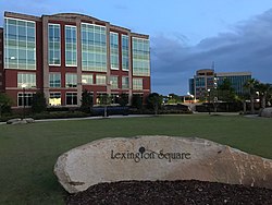
Economy[]
In 2019, the unemployment rate was 1.7%, and the per capita personal income was $31,900. According to the Town's 2020 Comprehensive Annual Financial Report,[34] the top employers in the city are:
| # | Employer | # of Employees |
|---|---|---|
| 1 | Lexington School District 1 | 1,083 |
| 2 | Lexington County | 905 |
| 3 | Walmart | 367 |
| 4 | Town of Lexington | 180 |
| 5 | Publix | 160 |
| 6 | Lowe's | 150 |
| 7 | Home Depot | 150 |
| 8 | Avtec | 135 |
| 9 | Target | 120 |
| 10 | Kohl's | 107 |
Transportation[]
Public transportation[]
Public transportation in Lexington is provided by the COMET, or officially the Central Midlands Regional Transit Authority (CMRTA). The bus system is the main public transit system for the greater Columbia area.[35]
Roads and highways[]
Interstate highways[]
 I-20 – Interstate 20 travels from west to east and connects Columbia to Atlanta and Augusta in the west and Florence in the east. It serves the nearby towns and suburbs of West Columbia, Oak Grove, and Red Bank.
U.S. routes[]
S.C. highways[]
Tourism[]
- Slightly north of the town of Lexington rests one of South Carolina's major lakes, Lake Murray. The lake is held by a 1.7-mile-long (2.7 km) dam 5 miles (8 km) north of town, on which people are free to drive, bike, run, or walk. The Saluda Dam, or Lake Murray Dam, provides electricity for the surrounding region. A public swimming area is open during the summer months on the Lexington side of the dam.[36]
- Lexington County Blowfish Baseball Stadium
- Lexington Community Band[37]
- Icehouse Amphitheater-hosted Florida's Sister Hazel in 2018, and Greenville's Edwin McCain in 2017
- Three public parks: Virginia Hilton Park, Gibson Pond Park, and Corely Street Water Park
- Lexington County Museum
- Fourteen-Mile Creek Trail


Demographics[]
| Historical population | |||
|---|---|---|---|
| Census | Pop. | %± | |
| 1880 | 262 | — | |
| 1890 | 342 | 30.5% | |
| 1900 | 806 | 135.7% | |
| 1910 | 709 | −12.0% | |
| 1920 | 894 | 26.1% | |
| 1930 | 1,152 | 28.9% | |
| 1940 | 1,033 | −10.3% | |
| 1950 | 1,081 | 4.6% | |
| 1960 | 1,127 | 4.3% | |
| 1970 | 969 | −14.0% | |
| 1980 | 2,131 | 119.9% | |
| 1990 | 3,289 | 54.3% | |
| 2000 | 9,793 | 197.8% | |
| 2010 | 17,870 | 82.5% | |
| 2019 (est.) | 22,157 | [5] | 24.0% |
| U.S. Decennial Census[38] | |||
As of the census of 2010, there were 17,870 people, 8,101 households, and 2,558 families residing in the town. The population density was 1,724.4 inhabitants per square mile (665.8/km2). There were 4,025 housing units at an average density of 708.7/sq mi (273.6/km2). Since 2000, the town population grew from nearly 10,000 inhabitants to 25,000, a 166% increase. Since 2005, 3,200 new homes have been built within the town limits, as well as 130 new businesses.[39]
In the 2010 census, the racial makeup of the town was 83.88% White, 12.48% Black or African American, 0.18% Native American, 2.05% Asian, 0.03% Pacific Islander, 0.67% from other races, and 0.70% from two or more races. Hispanic or Latino of any race were 1.91% of the population.
There were 3,644 households, out of which 40.5% had children under the age of 18 living with them, 55.9% were married couples living together, 12.3% had a female householder with no husband present, and 29.8% were non-families. 24.9% of all households were made up of individuals, and 7.5% had someone living alone who was 65 years of age or older. The average household size was 2.51 and the average family size was 3.03.
In the town, the population was spread out, with 27.1% under the age of 18, 7.5% from 18 to 24, 39.6% from 25 to 44, 18.3% from 45 to 64, and 7.5% who were 65 years of age or older. The median age was 33 years. For every 100 females, there were 97.6 males. For every 100 females age 18 and over, there were 96.3 males.
The median income for a household in the town was $53,865, and the median income for a family was $65,694. Males had a median income of $44,883 versus $29,020 for females. The per capita income for the town was $23,416. About 5.2% of families and 7.2% of the population were below the poverty line, including 7.3% of those under age 18 and 14.5% of those age 65 or over.
Education[]
Public education in Lexington is administered by Lexington County School District One, which has an enrollment of over 27,000 students and employees 3,900 faculty and staff.[40]
| Elementary schools | Enrollment | Within town limits? |
|---|---|---|
| Pleasant Hill Elementary School | 948 | No |
| Midway Elementary School | 947 | No |
| Meadow Glen Elementary School | 908 | Yes |
| Carolina Springs Elementary School | 800 | No |
| Lake Murray Elementary School | 759 | No |
| Saxe Gotha Elementary School | 752 | No |
| Rocky Creek Elementary | 730 | No |
| Deerfield Elementary School | 723 | No |
| Oak Grove Elementary School | 715 | No |
| White Knoll Elementary | 711 | No |
| New Providence Elementary School | 672 | Yes |
| Lexington Elementary School | 644 | Yes |
| Red Bank Elementary School | 579 | No |
| Middle schools | Enrollment | Within town limits? |
| Pleasant Hill Middle School | 1,208 | No |
| Meadow Glen Middle School | 1,029 | Yes |
| Lexington Middle School | 992 | Yes |
| Carolina Springs Middle | 930 | No |
| Beechwood Middle School | 850 | No |
| White Knoll Middle School | 787 | No |
| High schools | Enrollment | Within town limits? |
| Lexington High School | 2,105 | No |
| River Bluff High School | 2,047 | Yes |
| White Knoll High School | 1,955 | No |
| Lexington Technology Center | [c] | No |
| Adult education | Enrollment | Within town limits? |
| Rosenwald Community Learning Center | 100 | Yes |
Library[]
Lexington has a branch of the Lexington County Library.[41]
Neighboring towns and cities[]
Municipalities within 15 miles (24 km) of the center of Lexington, listed clockwise:
- Cayce (east 9.5 miles)
- Springdale (east 7.5 miles)
- Pine Ridge (southeast 9 miles)
- South Congaree (southeast 7.5 miles)
- Gilbert (west-southwest 10 miles)
- Summit (west-southwest 11.5 miles)
- Chapin (northwest 14.5 miles)
- Irmo (north-northeast 8 miles)
- Columbia (east-northeast 11.5 miles)
- West Columbia (east-northeast 9.5 miles)
Notable people[]
- Nick Ciuffo, 2013 first-round pick by the Tampa Bay Rays
- Manuel S. Corley, congressman (1868-1869)
- Nikki Haley, former United States Ambassador to the United Nations and 116th governor of South Carolina[note 1]
- Lacie Lybrand, Miss South Carolina USA 2006
- Bob Peeler, former lieutenant governor (1995–2003), trustee of Clemson University
- Shaq Roland, former South Carolina Gamecocks and West Georgia Wolves wide receiver, and former member of the Chicago Bears practice squad
- Floyd Spence, congressman from 1970 to 2001 and resident of Lexington while in office[42]
- Demetris Summers, former Canadian football running back for the Calgary Stampeders
- Harold E. Wilson, Marine in Korean War; awarded Congressional Medal of Honor[43]
Notes[]
- ^ Haley served as the representative from Lexington's 87th District in the South Carolina House of Representatives from 2005-2011.
References[]
- ^ Jump up to: a b "2019 U.S. Gazetteer Files". United States Census Bureau. Retrieved July 29, 2020.
- ^ Jump up to: a b "Total Population: 2010 Census DEC Summary File 1 (P1), Lexington town, South Carolina". data.census.gov. U.S. Census Bureau. Retrieved December 23, 2020.
- ^ "U.S. Census website". United States Census Bureau. Retrieved 2008-01-31.
- ^ "US Board on Geographic Names". United States Geological Survey. 2007-10-25. Retrieved 2008-01-31.
- ^ Jump up to: a b "Population and Housing Unit Estimates". United States Census Bureau. May 24, 2020. Retrieved May 27, 2020.
- ^ "Find a County". National Association of Counties. Archived from the original on May 31, 2011. Retrieved 2011-06-07.
- ^ "Population and Housing Unit Estimates". Retrieved May 21, 2020.
- ^ "Central Midlands Region Population Projection Report" (PDF). Central Midlands Council of Governments. March 2018. Retrieved 25 June 2020.
- ^ "West Columbia Zoning". Lexington County GIS. Retrieved 29 June 2020.
- ^ "Lexington, SC Annexation". Lexington County GIS. Retrieved 29 June 2020.
- ^ "A History of Lexington".
- ^ "Archived copy". Archived from the original on 2014-12-07. Retrieved 2015-01-01.CS1 maint: archived copy as title (link)
- ^ "South Carolina State Climatology Office". SC.gov. 17 July 2018.
- ^ "South Carolina Code > Title 56 > Chapter 5 - Uniform Act Regulating Traffic On Highways - LawServer". LawServer.
- ^ "Highway Patrol: People 'just not aware' of Move Over law". Aiken Standard.
- ^ Saeed Ahmed and Chuck Johnston, CNN (19 September 2013). "$400 million Powerball lottery ticket sold in South Carolina - CNN.com". CNN.
- ^ "Winner of $400M Powerball may remain anonymous". USA TODAY. 19 September 2013.
- ^ Casey Vaughn (19 September 2013). "Winner of $399M Powerball ticket sold in Lexington unknown".
- ^ "National Register Information System". National Register of Historic Places. National Park Service. July 9, 2010.
- ^ "Mayor & Council".
- ^ "Archived copy". Archived from the original on 2013-11-09. Retrieved 2013-11-09.CS1 maint: archived copy as title (link)
- ^ "Archived copy". Archived from the original on 2013-12-11. Retrieved 2013-12-10.CS1 maint: archived copy as title (link)
- ^ Jump up to: a b Stevens, Matthew (7 September 2015). "Lexington officials pass 2% hospitality tax". WatchFox57. Retrieved 29 June 2020.
- ^ "Downtown Improvements". Town of Lexington. Retrieved 29 June 2020.
- ^ "Traffic and Tourism Projects". Town of Lexington. Retrieved 29 June 2020.
- ^ Mallory, Laurel (2 July 2020). "Town of Lexington announces face masks are now required in all retail businesses". WISTV. Retrieved 14 July 2020.
- ^ "Town Council July Meeting, 2020". Town of Lexington. 6 July 2020. Retrieved 14 July 2020.
- ^ "US Gazetteer files: 2010, 2000, and 1990". United States Census Bureau. 2011-02-12. Retrieved 2011-04-23.
- ^ "Distance between Lexington, SC and Columbia, SC".
- ^ "Lexington, SC (29072) 10-Day Weather Forecast - The Weather Channel". Weather.com. Retrieved 2 January 2018.
- ^ "Archived copy". Archived from the original on March 6, 2014. Retrieved August 15, 2013.CS1 maint: archived copy as title (link)
- ^ "Lexington County, South Carolina Climate". Bestplaces.net. Retrieved 2 January 2018.
- ^ "The Weather Channel". The Weather Channel. Archived from the original on March 6, 2014. Retrieved 2013-08-15.
- ^ "Town of Lexington 2020 Comprehensive Report". Retrieved 2020-03-24.
- ^ "97 Batesburg-Leesville Rural ReFlex" (PDF). Catch the Comet.
- ^ "Lake Murray, South Carolina". Sciway.net. Retrieved 2 January 2017.
- ^ "Our next performance... Tuesday, December 12, 2017, 7:30 p.m., Lexington One Performing Arts Center at Lexington HS". Lexingtoncommunityband.org. Retrieved 2 January 2018.
- ^ United States Census Bureau. "Census of Population and Housing". Retrieved August 14, 2013.
- ^ "The 15 fastest-growing cities in the US". Business Insider. Retrieved 2 January 2018.
- ^ "Lexington One Schools". Lexington School District One. Retrieved 24 March 2020.
- ^ "Locations & Hours". Greenville County Library System. Retrieved 13 June 2019.
- ^ Barone, Michael; Ujifusa, Grant (1987). The Almanac of American Politics 1988. National Journal. p. 1084.
- ^ Lexington Chronicle and Dispatch News, 28 May 2020, vol 149, 32nd edition, page A1
External links[]
| show Municipalities and communities of Lexington County, South Carolina, United States |
|---|


| show Authority control |
|---|
- Towns in Lexington County, South Carolina
- Populated places established in 1820
- Towns in South Carolina
- County seats in South Carolina
- Columbia metropolitan area (South Carolina)