Liginiac
Liginiac | |
|---|---|
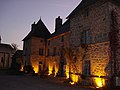
 The church in Liginiac | |
 Coat of arms | |
show Location of Liginiac | |
 Liginiac | |
| Coordinates: 45°24′59″N 2°20′03″E / 45.4164°N 2.3342°ECoordinates: 45°24′59″N 2°20′03″E / 45.4164°N 2.3342°E | |
| Country | France |
| Region | Nouvelle-Aquitaine |
| Department | Corrèze |
| Arrondissement | Ussel |
| Canton | Haute-Dordogne |
| Intercommunality | Haute-Corrèze Communauté |
| Government | |
| • Mayor (2020–2026) | Frédéric Bivert |
| Area 1 | 28.53 km2 (11.02 sq mi) |
| Population (Jan. 2018)[1] | 625 |
| • Density | 22/km2 (57/sq mi) |
| Demonym(s) | Liginiacois, Liginiacoises |
| Time zone | UTC+01:00 (CET) |
| • Summer (DST) | UTC+02:00 (CEST) |
| INSEE/Postal code | 19113 /19160 |
| Elevation | 351–692 m (1,152–2,270 ft) |
| 1 French Land Register data, which excludes lakes, ponds, glaciers > 1 km2 (0.386 sq mi or 247 acres) and river estuaries. | |


show This article may be expanded with text translated from the corresponding article in French. (January 2009) Click [show] for important translation instructions. |
Liginiac (French pronunciation: [liʒinjak]; Occitan: Liginhac) is a commune in the Corrèze department in central France.
Geography[]
The Triouzoune forms most of the commune's western boundary.
Population[]
| Year | Pop. | ±% |
|---|---|---|
| 2004 | 611 | — |
| 2006 | 607 | −0.7% |
| 2007 | 617 | +1.6% |
| 2008 | 629 | +1.9% |
| 2009 | 641 | +1.9% |
| 2010 | 641 | +0.0% |
| 2011 | 642 | +0.2% |
| 2012 | 618 | −3.7% |
| 2013 | 596 | −3.6% |
| 2014 | 574 | −3.7% |
| 2015 | 583 | +1.6% |
| 2016 | 583 | +0.0% |
| 2017 | 606 | +3.9% |
Politics[]
Presidential Elections Second Round:[2]
| Election | Winning Candidate | Party | % | |
|---|---|---|---|---|
| 2017 | Emmanuel Macron | EM | 69.36 | |
| 2012 | François Hollande | PS | 59.45 | |
| 2007 | Nicolas Sarkozy | UMP | 50.57 | |
| 2002 | Jacques Chirac | RPR | 90.12 | |
See also[]
References[]
- ^ "Populations légales 2018". INSEE. 28 December 2020.
- ^ http://www.lemonde.fr/data/france/presidentielle-2017/
La Mairie

L'Église


| Wikimedia Commons has media related to Liginiac. |
| show Authority control |
|---|
This Corrèze geographical article is a stub. You can help Wikipedia by . |
Categories:
- Communes of Corrèze
- Corrèze geography stubs