Line 1 (Sound Transit)
| Line 1 | ||
|---|---|---|
 A two-car train on an elevated section of Line 1 in Tukwila | ||
| Overview | ||
| Other name(s) | Central Link Red Line | |
| Status | Operational | |
| Owner | Sound Transit | |
| Locale | Seattle, Washington, U.S. | |
| Termini | University of Washington (north) Angle Lake (south) | |
| Stations | 16 | |
| Website | soundtransit.org | |
| Service | ||
| Type | Light rail | |
| System | Link light rail | |
| Operator(s) | King County Metro | |
| Rolling stock | 62 Kinkisharyo-Mitsui LRVs 122 Siemens S700s | |
| Daily ridership | 79,674 (2019, weekdays)[1] | |
| History | ||
| Opened | July 18, 2009 | |
| Technical | ||
| Line length | 20.35 mi (32.75 km) | |
| Number of tracks | 2 | |
| Character | At grade, elevated, and underground | |
| Track gauge | 4 ft 8+1⁄2 in (1,435 mm) standard gauge | |
| Electrification | 1,500 V DC, overhead catenary | |
| Operating speed | 55 miles per hour (89 km/h) | |
| ||
Line 1, formerly Central Link, is a light rail line in Seattle, Washington, United States, and part of Sound Transit's Link light rail system. It serves 16 stations in the cities of Seattle, SeaTac, and Tukwila, traveling 20 miles (32 km) between University of Washington and Angle Lake stations. The line connects the University District, Downtown Seattle, the Rainier Valley, and Seattle–Tacoma International Airport. Line 1 carried over 25 million total passengers in 2019, with an average of nearly 80,000 daily passengers on weekdays. It runs for 20 hours per day on weekdays and Saturdays, with headways of up to six minutes during peak hours, and reduced 18-hour service on Sundays and holidays.
Trains are composed of two or more cars that each can carry 194 passengers, including 74 in seats, along with wheelchairs and bicycles. Fares are calculated based on distance traveled and are paid through the regional ORCA card, paper tickets, or a mobile app. Sound Transit uses proof-of-payment to verify passenger fares, employing fare inspectors and transit police to conduct random inspections. All stations have ticket vending machines, public art, bicycle parking, and bus connections, while several also have park-and-ride lots.
Voters approved Central Link in a 1996 ballot measure and construction began in 2003, after the project was reorganized under a new budget and truncated route in response to higher than expected costs. The light rail line, which followed decades of failed transit plans for the Seattle region, opened on July 18, 2009, terminating at Westlake in the Downtown Seattle Transit Tunnel and Tukwila International Boulevard near Sea–Tac Airport. It was extended south to SeaTac/Airport in December 2009, north to the University of Washington in March 2016, and south to Angle Lake in September 2016. The line was temporarily renamed the Red Line until its designation was changed to Line 1 in 2020. It is scheduled to be extended north to Northgate in 2021.
Further extensions to Lynnwood and Federal Way are planned to open in 2024. Line 2 will open in 2023, connecting Seattle to the Eastside suburbs and forming a multi-line network via its connection with Line 1. Further expansion under Sound Transit 3 will divide the current corridor between two lines, Line 1 from Ballard to Tacoma and Line 3 from Everett to West Seattle.
History[]
Background and early transit proposals[]
Public transit service within Seattle began in 1884, with the introduction of the city's first horse-drawn streetcar line. The system had been replaced with a network of electric streetcars and cable cars by the end of the decade, which spurred the development of new streetcar suburbs across modern-day Seattle.[2][3] Interurban railways to Everett, Tacoma, and the Rainier Valley were established after the turn of the century, giving the region an intercity passenger rail system to feed the streetcar lines.[4] The interurban system failed to compete with the increasing popularity of automobile travel, capped by the completion of U.S. Route 99 in the late 1920s, and was shut down.[5] By 1941, the streetcars had also been acquired by the municipal government and replaced with a trolleybus network.[3][6]
Various proposals for a rapid transit system in Seattle, to replace the streetcar—and later bus—networks, were presented in the 20th century and rejected by city officials or voters due to their cost or other factors. In 1911, urban planner Virgil Bogue proposed a 41-mile (66 km) system of subway tunnels and elevated railways as the centerpiece to a comprehensive plan for the city, which was rejected by voters.[7] The Seattle Center Monorail, originally built for the 1962 World's Fair, has been the subject of several unsuccessful expansion proposals backed by Governor Albert Rosellini in the 1960s and Seattle voters in the early 2000s.[8] The Forward Thrust Committee of the late 1960s proposed a 47-mile (76 km) rapid transit system, to connect Downtown Seattle to Ballard, the University District, Lake City, Capitol Hill, Bellevue, and Renton. The federal government offered to fund two-thirds of the rail system's capital costs, approximately $770 million (equivalent to $4.41 billion in 2019 dollars),[9] if $385 million (equivalent to $2.2 billion in 2019 dollars)[9] in local property taxes were approved by voters.[10] The rapid transit initiative was placed on the ballot in February 1968, but failed to receive the necessary supermajority to pass. A second attempt in May 1970, with $440 million (equivalent to $2.28 billion in 2019 dollars)[9] in local funding and $870 million (equivalent to $4.51 billion in 2019 dollars)[9] in federal funding,[11] failed amid a local economic downturn caused by layoffs at Boeing.[12] The federal funding earmarked towards the rapid transit system was granted to Atlanta, Georgia, forming the initial funding for the Metropolitan Atlanta Rapid Transit Authority's rail system.[13]
Light rail planning[]
Following the failed Forward Thrust initiatives, Metro Transit was created in 1972 to oversee a countywide bus network, and plan for a future rail system.[14] In the early 1980s, Metro Transit and the Puget Sound Council of Governments (PSCOG) explored light rail and busway concepts to serve the region,[15] ultimately choosing to build a downtown transit tunnel that would be convertible from buses to light rail at a later date.[16] The PSCOG formally endorsed a light rail plan in 1986, recommending a system be built by 2020, and include a line between Seattle and Sea-Tac Airport,[17] with routing alternatives that served the Rainier Valley.[18][19] A 1988 advisory measure on light rail planning was passed in King County, encouraging Metro Transit to accelerate the plan's timeline to open by 2000.[20] In 1990, the state legislature endorsed the creation of a regional transit board composed of politicians from King, Pierce, and Snohomish counties, with the goal of implementing the regional transit plan.[21] Several members of the Seattle City Council endorsed the rail plan on the condition that it pass through the Rainier Valley, by then an economically disadvantaged and majority-minority neighborhood.[22]
The Central Puget Sound Regional Transit Authority, later renamed Sound Transit, was created in 1993 to write and present a regional transit plan for voter approval.[23] The agency proposed a 70-mile (110 km) light rail network as the centerpiece of a $6.7 billion transit ballot measure, with a surface line through the Rainier Valley and tunnels between Downtown Seattle, Capitol Hill, and the University District.[24][25] The ballot measure failed to pass on March 14, 1995,[26] and the light rail line was shortened to 25 miles (40 km), between the University District and Sea-Tac Airport.[27] Voters approved the $3.9 billion package on November 5, 1996, along with increases to sales taxes and motor vehicle excise taxes across the regional transit district.[27][28] Sound Transit considered several routing options during a series of public hearings and studies early into the project's environmental impact study,[29] which adopted the name "Central Link".[30] In 1999, Sound Transit selected the alignment for the light rail project, consisting of a line between the University District and Sea-Tac Airport, with surface segments passing through Tukwila, the Rainier Valley, and SoDo, and tunnels under Beacon Hill, First Hill, Capitol Hill, and Portage Bay.[31]
Budget issues and delays[]
The Central Link project was originally planned to open in 2006 and projected to cost $1.9 billion (equivalent to $2.92 billion in 2019 dollars),[9] but the estimates were found to be unrealistic by auditors in November 2000.[32] New executives, hired by Sound Transit to replace previous program directors, presented a revised plan with an opening date pushed back three years to 2009, costing $3.8 billion (equivalent to $5.47 billion in 2019 dollars).[9][33] Planning of the Portage Bay tunnel between Capitol Hill and the University District was suspended due to higher than expected contractor bids, attributed to difficult soil conditions.[34] Sound Transit adopted the revised budget and schedule in January 2001, including provisions to re-study routing options between Downtown Seattle and the University District, along with a $500 million federal grant agreement to fund the construction of an "initial segment" for the project.[35][36] The initial segment identified and approved by Sound Transit later that year shortened the line to 14 miles (23 km), between Downtown Seattle and a southern Tukwila station near Sea-Tac Airport. The remaining routes to the airport and University District were sent back to the planning stage, and re-organized into separate light rail projects.[37][38]
In November 2001, Sound Transit approved construction of the shortened Central Link light rail project, calling for a summer 2002 groundbreaking.[39] Property acquisition in the Rainier Valley began in March 2002,[40] but two legal battles delayed the start of construction. In November 2002, the King County Superior Court ruled in favor of Sound Transit in a lawsuit filed by light rail opponents, alleging that it lacked the authority to shorten a voter-approved line.[41] The approval of Tim Eyman's Initiative 776 threatened to repeal motor vehicle excise taxes needed to fund Sound Transit's budget, but was declared unconstitutional in February 2003.[42] Another routing change requested by the City of Tukwila, placing light rail tracks along freeways in lieu of International Boulevard, was approved by Sound Transit and the Federal Transit Administration in 2002, moving the project closer to construction.[43]
Construction and testing[]
Sound Transit received its $500 million federal grant agreement in October 2003,[44] and a groundbreaking ceremony was held in SoDo on November 8, 2003.[45] Construction contracts for various segments were awarded in 2004 and 2005, coming six percent under Sound Transit's estimates,[46] and work began along all parts of the system.[47][48] The first rails were installed on August 18, 2005, in the SoDo area;[46] a month later, the downtown transit tunnel closed for a two-year renovation to accommodate light rail service.[49] Excavation of the Beacon Hill tunnel and station began in 2005, and two tunnel boring machines were launched in early 2006 to bore the twin tunnels between SoDo and the Rainier Valley.[50]
The SODO and Stadium stations were completed in May 2006,[51] and light rail testing in the SoDo area began the following March.[52] Testing was extended to the re-opened downtown transit tunnel in September 2007, initially limited to weekends without bus service,[53] and further to the Rainier Valley after the completion of the Beacon Hill tunnel in 2008.[54][55] The elevated guideway in Tukwila, including crossings over major freeways and the Duwamish River, was completed in 2007 after the installation of 2,457 precast concrete segments and balanced cantilever bridges.[56] During construction in the Rainier Valley, Sound Transit and the City of Seattle offered $50 million in mitigation funds and development opportunities to affected businesses.[57] Construction of light rail along Martin Luther King Jr. Way South also resulted in utility lines being moved underground, improved sidewalks, street crossings, and landscaping.[58]
Opening and later extensions[]

Central Link was opened on July 18, 2009, with a community celebration that attracted more than 92,000 riders over the first weekend of free service.[59] Trains began operating on the 13.9-mile (22.4 km) segment between Westlake and Tukwila International Boulevard stations,[60] along with a bus shuttle to serve Sea-Tac Airport from Tukwila.[61] The 1.7-mile (2.7 km) extension to SeaTac/Airport station opened on December 19, 2009, replacing the shuttle and other bus services to the airport.[62] Sound Transit added lubrication equipment and rubber mats to segments in Tukwila and the Rainier Valley in 2010 to reduce noise levels that had reached up to 83 decibels, surpassing federal safety standards and triggering noise complaints from nearby residents.[63] A contract dispute with the Rainier Valley construction contractor was settled in 2011, bringing the project's total price to $117 million below the $2.44 billion budget.[64] The opening of light rail service to the Rainier Valley spurred new transit-oriented development, which had initially stalled during the Great Recession but recovered in the mid-2010s.[65][66]
Central Link train service was increased to a frequency of 6 minutes during peak hours, from 7.5 minutes, in 2015 to prepare for the opening of the University Link extension.[67] The line was extended north to University of Washington station, via Capitol Hill station, on March 19, 2016, via a $1.8 billion, 3.15-mile (5.07 km) tunnel.[68] The extension opened six months ahead of its scheduled date, and the opening celebrations drew 67,000 people during the first day of service. Sound Transit deployed additional three-car light rail trains to cope with higher ridership after the extension opened.[69] The line was extended 1.6 miles (2.6 km) south from Sea-Tac Airport to Angle Lake station on September 24, 2016, including the opening of a 1,120-stall park and ride.[70]
The escalators at Capitol Hill and University of Washington stations experienced several major failures and shutdowns in the two years since the University Link extension was opened. These failures were attributed to the installation of standard commercial escalators instead of stronger escalators designed for transit stations and are planned to be replaced by 2022 with new escalators and alternate stairways.[71] The Tukwila section of the line was shut down over one weekend in October 2018 for major repairs after cracks were discovered in the rails on the 1,200-foot (370 m) bridge crossing Interstate 5.[72] In September 2019, Central Link was renamed to the "Red Line" as part of a systemwide rebranding by Sound Transit to prepare for the arrival of East Link (the Blue Line).[73] Two months later, the agency announced that it would consider a new name after complaints due to the similarity of the "Red Line" with redlining, which historically affected residents of the Rainier Valley.[74] A new designation, Line 1 (colored green), was announced in April 2020.[75]
In January 2020, Sound Transit began a ten-week construction project called "Connect 2020" that required trains to single-track in the Downtown Seattle Transit Tunnel. The closure of tracks for work on the East Link Extension where it meets the existing tracks at International District/Chinatown necessitated the construction of a temporary center platform at Pioneer Square for use by through-riding passengers. Sound Transit deployed four-car trains running every 13–15 minutes and implemented restrictions on carrying bicyclists on trains through downtown.[76][77] The project was completed in late March after a week-long delay in testing, but the frequency restrictions remained due to the coronavirus pandemic and local shutdowns.[78][79] Service was reduced to every 30 minutes in April and partially restored in September to every 8 minutes during peak hours and 15 minutes during most other hours.[80][81] The first of the new "Series 2" light rail vehicles, based on the Siemens S700, entered service in May 2021.[82]
Route[]

The northern terminus of Line 1 is University of Washington station, located near Husky Stadium and the campus of the University of Washington in northeastern Seattle. The line heads south in the University Link tunnel, crossing under the Montlake Cut of the Lake Washington Ship Canal and State Route 520 before taking a turn to the southwest. The tunnel climbs Capitol Hill and passes under Interlaken Park and Volunteer Park before turning due south to enter Capitol Hill station on the east side of Broadway.[83] The tunnel makes a gradual turn to the west, dipping as far south as East Union Street, and crosses under Interstate 5 at Pine Street.[84][85] It merges into the Downtown Seattle Transit Tunnel within the Pine Street Stub Tunnel, where it formerly merged with buses from Convention Place station.[86][87]
The downtown transit tunnel, formerly shared between light rail trains and buses,[88] travels west under Pine Street through Westlake station and south on 3rd Avenue through University Street and Pioneer Square stations in Downtown Seattle.[87] The tunnel ends at International District/Chinatown station, adjacent to King Street Station (served by Amtrak and Sounder commuter rail),[89] and Line 1 travels south through SoDo along the east side of the SODO Busway. The SoDo section has two stations, Stadium and SODO, and includes several gated crossings.[52] From SODO station, the track ascends to an elevated guideway traveling east along South Forest Street,[84][90] passing the line's railyard and maintenance facility.[91] The elevated trackway passes over Airport Way and comes to rest on an embankment under Interstate 5, entering the Beacon Hill tunnel.[92][93]
The Beacon Hill tunnel travels approximately one mile (1.6 km) under Beacon Hill, serving a station at Beacon Avenue South.[94] Trains exit the tunnel on the east side of the hill, turning southeast and approaching the elevated Mount Baker station at the intersection of Rainier Avenue South and Martin Luther King Jr. Way South.[95] Light rail trains descend from Mount Baker station onto the median of Martin Luther King Jr. Way South, running at-grade with signal priority at 28 street crossings.[96][97] Line 1 passes through the Rainier Valley and serves three at-grade stations, Columbia City, Othello, and Rainier Beach, before leaving Seattle.[84][98]
The line enters Tukwila and crosses west over Interstate 5 and a mainline railroad at Boeing Access Road, near Boeing Field, before making a southward turn over East Marginal Way South. Line 1 continues south over the Duwamish River, traveling non-stop through Tukwila on a 4.7-mile (7.6 km) elevated guideway.[99] The guideway runs along the west sides of State Route 599 and Interstate 5 towards Southcenter Mall, where it turns west along State Route 518. The line passes through Tukwila International Boulevard station, home to a 600-stall park and ride facility, and turns south into the median of the Airport Expressway towards SeaTac. Light rail trains continue along the east side of Seattle–Tacoma International Airport, stopping at SeaTac/Airport station near the airport's terminals, before reaching Angle Lake station, where it terminates.[84][90]
Line 1, while officially a "light rail" line, has also been described as a "light metro" hybrid by transit experts due to its grade separated sections and use of larger trainsets than typical American light rail systems.[96] Approximately 6.4 miles (10.3 km) of the 20.35-mile (32.75 km) line is at-grade, including segments along freeways that are separated from intersecting roads.[100][101]:6–7
Stations[]
Stations on Line 1 are spaced approximately one mile (1.6 km) apart in most areas and are built with 380-foot-long (120 m) platforms to accommodate four-car train sets.[101]:6[102] Some stations are grade separated, with underground or elevated platforms connected to surface entrances by stairs, escalators, and elevators, while others were built at street level.[101]:6 The line's sixteen stations include bus connections,[103]:16 ticket vending machines, real-time arrivals information signs, public art, and bicycle parking.[104][105] Stations are also designed with clear sight lines on platforms, emergency phones and lights, and are monitored with surveillance cameras.[106]
As of 2016, there are only two stations with park and ride facilities (Angle Lake and Tukwila International Boulevard); for other stations, Sound Transit and local governments are encouraging alternative means of transportation to and from stations, including bus riding, walking, or bicycling.[107][108] Since 2019, a set of five stations in the Rainier Valley and Tukwila have had on-demand ride-hail shuttle service that accepts Metro fares and is operated by private contractor Via with subsidies from the city government.[109]
| Station | Image | Opened | Connections and notes[103][104] |
|---|---|---|---|
| University of Washington |  |
March 19, 2016 | |
| Capitol Hill | 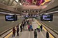 |
March 19, 2016 | Connects with First Hill Streetcar |
| Westlake | 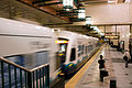 |
July 18, 2009[n 1] | Connects with Seattle Center Monorail and South Lake Union Streetcar |
| University Street |  |
July 18, 2009[n 1] | |
| Pioneer Square |  |
July 18, 2009[n 1] | Connects with Washington State Ferries, King County Water Taxi, and Kitsap Fast Ferries |
| International District/Chinatown |  |
July 18, 2009[n 1] | Connects with Amtrak, Sounder commuter rail, and First Hill Streetcar |
| Stadium |  |
July 18, 2009 | Connects with Greyhound |
| SODO |  |
July 18, 2009 | |
| Beacon Hill | July 18, 2009 | ||
| Mount Baker |  |
July 18, 2009 | |
| Columbia City |  |
July 18, 2009 | |
| Othello |  |
July 18, 2009 | |
| Rainier Beach |  |
July 18, 2009 | |
| Tukwila International Boulevard |  |
July 18, 2009 | Park and ride: 662 stalls |
| SeaTac/Airport |  |
December 19, 2009 | |
| Angle Lake |  |
September 24, 2016 | Park and ride: 1,120 stalls |
Notes[]
- ^ Jump up to: a b c d Stations in the Downtown Seattle Transit Tunnel originally opened as bus-only facilities on September 15, 1990, with light rail service commencing on July 18, 2009.[110]
Service[]
Line 1 trains run 20 hours per day from Monday to Saturday, from 5:00 am to 1:00 am, and 18 hours on Sundays and federal holidays, from 6:00 am to midnight.[111][112] Trains operate most frequently during weekday peak periods, running every six minutes from 6:00 am to 9:30 am and from 3:00 pm to 6:30 pm. Trains run every 10 minutes during midday and evening hours on weekdays and all day on weekends. Train frequency is reduced to every 15 minutes during the early morning and late night hours of all days.[111]
End-to-end travel from University of Washington to Angle Lake stations takes 48 minutes,[113] while trips between SeaTac/Airport station and Downtown Seattle take 38 minutes.[111] The SeaTac–Westlake corridor was formerly served by King County Metro bus route 194, which took 32 minutes to travel between the two areas, and used bus stops that were closer to the terminal. The bus route ran at less frequent intervals, was subject to traffic delays, and had shorter hours of operation.[114][115]
Ridership[]
Line 1 trains carried over 25 million total passengers in 2019, averaging 79,674 riders on weekdays.[1] Ridership is measured by on-board infrared passenger counters that automatically record the number of people entering and leaving the train.[59][116]
Ridership on Line 1 has risen significantly from the beginning of service in 2009, when it averaged 15,500 per weekday.[117] In 2010, ridership fell below projected levels due to the ongoing economic downturn, with only 21,611 daily riders on the line.[118] Ridership increased significantly in the following years, surpassing 25,000 daily riders in 2012,[119] 30,000 in 2014,[120] and 35,000 in 2015.[121]
The opening of the University Link extension in March 2016 increased daily ridership by 66 percent in its first month of operation,[122] and averaged 66,203 daily riders during the last quarter of the year.[123] A single-day ridership record of 82,361 estimated boardings was set on April 8, 2016,[124] credited to a Seattle Mariners home opener and the Emerald City Comic Con.[122] The record was surpassed five months later on September 30, estimated at 101,000 riders, due in part to home games for the Washington Huskies football team and Seattle Mariners.[125] Ridership fell to 9.7 million total passengers in 2020, a decline of 61 percent from 2019, due to the COVID-19 pandemic and other service reductions.[126]
| Year | Ridership | %± |
|---|---|---|
| 2009 | 2,501,211 | — |
| 2010 | 6,989,504 | 179.4% |
| 2011 | 7,812,433 | 11.8% |
| 2012 | 8,699,821 | 11.4% |
| 2013 | 9,681,432 | 11.3% |
| 2014 | 10,937,883 | 13% |
| 2015 | 11,530,411 | 5.4% |
| 2016 | 19,121,621 | 65.8% |
| 2017 | 23,186,633 | 21.3% |
| 2018 | 24,416,411 | 5.3% |
| 2019 | 25,075,922 | 2.7% |
| 2020 | 9,660,736 | -61.5% |
| Source: Sound Transit[127] | ||
Fares[]
Line 1 uses a proof-of-payment system, requiring valid payment before boarding and lacking a turnstile barrier at stations. Fares can be purchased as paper tickets at ticket vending machines at stations,[128] credit or passes loaded on an ORCA card, or through a mobile ticketing app.[129] Fare inspectors and transit police officers check for valid fares while aboard trains or in the fare-paid zone of stations;[103]:14[130] warnings and a $124 citation are issued to passengers who do not present a valid ticket or a validated ORCA card.[131][132]
Fares are calculated based on distance traveled, ranging from $2.25 to $3.25 for adults.[103]:14 ORCA card users are required to tap a reader before and after riding a train to calculate the fare.[133] Reduced fares are available to elderly passengers, persons with disabilities, persons under the age of 18, and low-income passengers enrolled in ORCA Lift.[134][135] Transfers from other modes, including buses, water taxis, and streetcars, are only accepted using ORCA cards.[136]
Rolling stock and equipment[]


The original "Series 1" fleet used on Line 1 consisted of 62 low-floor light rail vehicles manufactured in Japan by Kinkisharyo.[103]:8 The Kinkisharyo vehicles, built through a joint venture with Mitsui & Co.,[137] have 74 seats and can carry 194 seated and standing passengers at standard capacity; a maximum "crush load" of 252 passengers per car can be carried by Link trains for short distances.[138] Individual railcars are 95 feet (28.96 m) long and 8.7 feet (2,652 mm) wide, sporting dual cabs that allow cars to travel in either direction.[139] The interior is 70 percent low-floor, while the remaining 30 percent is raised above the floor and accessed via stairs. Railcars include four doors on each side, fold-up seating areas for wheelchairs, and two bicycle hooks above luggage storage areas.[140][141] Line 1 trains are typically arranged into two-car and three-car sets, but station platforms are built to accommodate four-car trains.[138][142] The trains have a top speed of 58 miles per hour (93 km/h), but typically operate at 35 miles per hour (56 km/h) on surface sections and 55 miles per hour (89 km/h) on elevated and tunneled sections.[139][143] Link uses a form of positive train control to prevent trains from exceeding the set speed limit for a given area.[144]
Trains are supplied electricity through an overhead catenary that is energized at 1,500 volts direct current and converted to three-phase alternating current through on-board inverters.[140] While other North American light rail systems use 750 V technology, Sound Transit chose to use 1,500 V to reduce the number of electrical substations, which are spaced approximately one mile (1.6 km) apart.[140][145] Sound Transit placed its initial order of 31 light rail vehicles in 2003, and added four more vehicles in 2005 for the extension to SeaTac/Airport station.[137][146] The cars were assembled in Everett, to comply with Buy America requirements,[147] and delivered from 2006 to 2008.[148][149] Another 27 vehicles were ordered for the University Link extension in 2009 and were delivered from 2010 to 2011.[148] The Line 1 fleet is stored and maintained at a 26-acre (10.5 ha) operating base in SoDo, between SODO and Beacon Hill stations. It opened in 2007, at a cost of $74 million to construct, and has a capacity of 105 light rail vehicles, including nine bays inside the 162,000-square-foot (15,100 m2) maintenance building that can hold 16 vehicles.[150][151][152] Line 1 trains are operated and maintained by King County Metro under contract with Sound Transit.[153]
In September 2016, Sound Transit approved a $554 million order to Siemens Mobility for 122 S700[a] "Series 2" light rail vehicles that will serve planned extensions to Northgate, Lynnwood, the Eastside, and Federal Way.[155] Another 30 vehicles were added to the order in April 2017, bringing the total to 152 vehicles.[156] The first Series 2 car arrived at Sound Transit's maintenance facility in June 2019, featuring the same seating capacity but a wider central walkway and other new features.[157][158] The first Siemens cars entered service on May 14, 2021.[82] A satellite maintenance facility, with a capacity of 96 vehicles, is planned to be constructed in Bellevue to accommodate part of the new fleet.[159]
Future plans[]
Sound Transit's expansion ballot measures, passed as Sound Transit 2 in 2008 and Sound Transit 3 in 2016, enabled the planning of future Link light rail extensions, scheduled to open in stages between 2021 and 2040. The Northgate Link extension is scheduled to open on October 2, 2021, extending service north to Northgate Transit Center,[160] followed by the East Link Extension in 2023, creating a new line to Bellevue and Redmond.[161][162] During construction related to East Link in early 2020, trains within the downtown transit tunnel were temporarily limited to single-track operations and divided into two lines at Pioneer Square station.[163]
Line 1 will be extended south and north to the suburbs of Federal Way and Lynnwood, respectively, in 2024 as part of the Sound Transit 2 program.[162][164] In 2030, a branch of Line 1 to West Seattle will begin service, temporarily operating between Alaska Junction and SODO station.[165] The opening of an extension to Ballard in 2039, traveling via a new tunnel through Downtown Seattle,[162][166] will split the corridor between two lines: Line 1, operating from Ballard to Tacoma via the Rainier Valley and Sea-Tac Airport; and Line 3, operating from Lynnwood (and later Everett) to West Seattle.[164][167] Two infill stations along the current route of Line 1 are planned to open in 2031 at South Graham Street in the Rainier Valley and Boeing Access Road in northern Tukwila.[168]
Notes[]
- ^ Jump up to: a b At the time of purchase in 2016, the second generation of light rail vehicles were to be based on the Siemens S70 model, which were retroactively rebranded as the S700 by Siemens in 2020.[154]
References[]
- ^ Jump up to: a b "Q4 2019 Service Delivery Quarterly Performance Report" (PDF). Sound Transit. February 27, 2020. Retrieved July 30, 2020.
- ^ "A look into rail's past". The Seattle Times. February 1, 1987. p. B3.
- ^ Jump up to: a b Crowley, Walt (October 2, 2000). "Street Railways in Seattle". HistoryLink. Archived from the original on September 18, 2017. Retrieved September 17, 2017.
- ^ Dorpat, Paul (November 6, 1983). "Plush as a Parlor: Some Interurban commuters paid more for a cushy ride". The Seattle Times. p. 6.
- ^ Crowley, Walt (September 19, 2000). "Interurban Rail Transit in King County and the Puget Sound Region". HistoryLink. Retrieved March 24, 2018.
- ^ "Seattle's streetcar history". The Seattle Times. December 10, 2007. p. A6. Archived from the original on September 18, 2017. Retrieved September 17, 2017.
- ^ Sipe, Tyler (March 5, 2017). "Off track: Seattle rejects first mass transit ballot measure on March 5, 1912". The Seattle Times. Archived from the original on September 18, 2017. Retrieved September 17, 2017.
- ^ Lindblom, Mike (July 30, 2002). "Another '60s revival: running a monorail along Interstate 5". The Seattle Times. p. A1. Retrieved September 17, 2017.
- ^ Jump up to: a b c d e f Thomas, Ryland; Williamson, Samuel H. (2020). "What Was the U.S. GDP Then?". MeasuringWorth. Retrieved September 22, 2020. United States Gross Domestic Product deflator figures follow the Measuring Worth series.
- ^ Coffman, Larry (February 4, 1968). "Rapid Transit: Everyone Agrees It's Needed, but What Kind?". The Seattle Times. p. 5.
- ^ "Tuesday Is 'Thrust' Day; The Biggest Issue: Rapid Transit". The Seattle Times. May 17, 1970. p. B1.
- ^ "Seattle Mass Transit Proposal Pleases Everybody but Voters". The New York Times. June 14, 1970. p. 16. Archived from the original on February 13, 2018. Retrieved February 12, 2018.
- ^ Cohen, Josh (October 14, 2016). "How Seattle blew its chance at a subway system". Crosscut.com. Archived from the original on September 17, 2017. Retrieved September 17, 2017.
- ^ Lane, Bob (March 20, 1975). "Metro program looks to future". The Seattle Times. p. H7.
- ^ Lane, Bob (March 22, 1981). "'Light rail' system might solve transit problems, says study". The Seattle Times. p. A16.
- ^ Lane, Bob (April 22, 1988). "Metro makes tracks for tracks for future". The Seattle Times. p. B1.
- ^ Matassa Flores, Michele; Parrish, W.Y.; Shatzkin, Kate (September 13, 1989). "Cities' influence takes off: Expanded roles with more clout for Sea-Tac and Federal Way". The Seattle Times. p. F1.
- ^ Bergsman, Jerry (July 9, 1986). "Panel's advice: Plan now for rail". The Seattle Times. p. H1.
- ^ "Appendix G: Environmental Justice Technical Report". Central Link Light Rail Transit Project Final Environmental Impact Statement. Sound Transit. October 22, 1999. p. G-36. OCLC 42730086. Archived from the original on January 19, 2018. Retrieved January 3, 2018 – via Google Books.
- ^ Lane, Bob (November 9, 1988). "Ballot Issues: On track, voters say 'hop to' on rail transit". The Seattle Times. p. E9.
- ^ Bergsman, Jerry (August 21, 1990). "Everett's OK may speed regional transit". The Seattle Times. p. C2.
- ^ Kelleher, Susan (July 16, 2001). "Distorted facts led to Rainier rail route". The Seattle Times. Retrieved November 22, 2018.
- ^ Sachefer, David (July 7, 1993). "Regional transit unit gets go-ahead". The Seattle Times. p. B3.
- ^ Lilly, Dick (April 5, 1994). "Light-rail option would traverse Rainier Valley". The Seattle Times. p. B3.
- ^ Schaefer, David (February 12, 1995). "On the right track? Questions, answers to the $6.7 billion proposal". The Seattle Times. p. A1.
- ^ Schaefer, David; Murakami, Kery (March 15, 1995). "Transit plan derailed: Pierce, Snohomish county voters say no to $6.7 billion proposal". The Seattle Times. p. A1. Archived from the original on January 19, 2018. Retrieved January 18, 2018.
- ^ Jump up to: a b Schaefer, David (October 6, 1996). "Looking at the new transit proposal". The Seattle Times. p. A1. Archived from the original on September 18, 2017. Retrieved September 17, 2017.
- ^ Schaefer, David (November 6, 1996). "Voters back transit plan on fourth try". The Seattle Times. p. A1. Archived from the original on March 3, 2016. Retrieved September 17, 2017.
- ^ Schaefer, David (December 10, 1997). "Residents debate light-rail route: under or out of our neighborhood, some say". The Seattle Times. p. B1. Archived from the original on August 14, 2017. Retrieved September 17, 2017.
- ^ "Sound Transit Motion No. M98-40" (PDF). Sound Transit. May 14, 1998. Archived from the original (PDF) on September 13, 2017. Retrieved September 17, 2017.
- ^ "Sound Transit Board achieves historic milestone by selecting route for central Link light rail" (Press release). Seattle, Washington: Sound Transit. November 18, 1999. Archived from the original on March 3, 2016. Retrieved September 17, 2017.
- ^ "Light-rail costs soars $1 billion". The Seattle Times. December 13, 2000. p. A1. Archived from the original on January 14, 2016. Retrieved September 17, 2017.
- ^ Garber, Andrew (January 18, 2001). "Congressman wants to delay light-rail money". The Seattle Times. p. A1. Archived from the original on September 18, 2017. Retrieved September 17, 2017.
- ^ Dudley, Brier (November 18, 2000). "Price puts tunnel on hold". The Seattle Times. p. A1. Archived from the original on August 14, 2017. Retrieved September 17, 2017.
- ^ Garber, Andrew (January 20, 2001). "Half-billion allocated for Sound Transit". The Seattle Times. p. B1. Archived from the original on September 18, 2017. Retrieved September 17, 2017.
- ^ "Central Link Initial Segment and Airport Link Before and After Study – Final Report" (PDF). Sound Transit. February 2014. p. 1. Retrieved March 21, 2018 – via Washington State Department of Transportation.
- ^ Garber, Andrew (September 26, 2001). "Sound Transit says it can build 14-mile line; light rail stops short of airport". The Seattle Times. p. B1. Archived from the original on January 6, 2017. Retrieved September 17, 2017.
- ^ Garber, Andrew (September 28, 2001). "Shorter light-rail line OK'd". The Seattle Times. p. A1. Archived from the original on January 7, 2017. Retrieved September 17, 2017.
- ^ Pryne, Eric (November 30, 2001). "Sound Transit adopts 14-mile route; light-rail construction could start in summer". The Seattle Times. p. A1. Archived from the original on January 6, 2017. Retrieved September 17, 2017.
- ^ Pryne, Eric (March 15, 2002). "Sound Transit gets green light to buy land for light rail". The Seattle Times. p. B1. Archived from the original on January 7, 2017. Retrieved September 17, 2017.
- ^ Lindblom, Mike (November 2, 2002). "Sound Transit gets light-rail go-ahead". The Seattle Times. p. B1. Archived from the original on September 18, 2017. Retrieved September 17, 2017.
- ^ Gilmore, Susan (February 11, 2003). "Judge tosses out $30 tabs". The Seattle Times. p. A1. Archived from the original on September 18, 2017. Retrieved September 17, 2017.
- ^ Pryne, Eric (June 29, 2002). "Sound Transit's hopes revived; Tukwila's approval 'not required'". The Seattle Times. p. A1. Archived from the original on January 6, 2017. Retrieved September 17, 2017.
- ^ Lindblom, Mike (October 24, 2003). "Light-rail construction could begin in two weeks". The Seattle Times. p. A1. Archived from the original on September 18, 2017. Retrieved September 17, 2017.
- ^ Lindblom, Mike (November 8, 2003). "Groundbreaking today for light rail". The Seattle Times. p. B1. Archived from the original on October 12, 2014. Retrieved September 17, 2017.
- ^ Jump up to: a b "Sound Transit installs first rails for Central Link light rail line" (Press release). Sound Transit. August 18, 2005. Archived from the original on July 28, 2017. Retrieved September 17, 2017.
- ^ Robinson, Lauren (September 16, 2004). "Light-rail line hits fast forward". Seattle Daily Journal of Commerce. Archived from the original on September 18, 2017. Retrieved September 17, 2017.
- ^ "Sound Transit Board Meeting Summary Minutes" (PDF). Sound Transit. March 10, 2005. Archived from the original (PDF) on September 17, 2017. Retrieved September 17, 2017.
- ^ Gilmore, Susan (September 23, 2005). "Bus tunnel shuts down tonight for 2 years". The Seattle Times. p. A1. Archived from the original on February 2, 2017. Retrieved September 17, 2017.
- ^ Gildner, Joe; Sage, Dick (March 23, 2006). "Sound Transit digs a cutting-edge tunnel". Seattle Daily Journal of Commerce. Archived from the original on September 18, 2017. Retrieved September 17, 2017.
- ^ "Sound Transit completes first two Central Link light rail stations" (Press release). Sound Transit. May 30, 2006. Archived from the original on July 28, 2017. Retrieved September 17, 2017.
- ^ Jump up to: a b Lindblom, Mike (March 16, 2007). "Sound Transit begins light-rail train tests in Sodo". The Seattle Times. p. B2. Archived from the original on September 17, 2017. Retrieved September 17, 2017.
- ^ "Downtown Seattle Transit Tunnel to reopen Sept. 24" (PDF). Sound Transit. August 2007. Archived (PDF) from the original on December 24, 2016. Retrieved September 17, 2017.
- ^ "Tunnel boring machine completes second Beacon Hill light rail tunnel" (Press release). Sound Transit. March 4, 2008. Archived from the original on September 18, 2017. Retrieved September 17, 2017.
- ^ Lindblom, Mike (August 13, 2008). "Sound Transit to run test trains through Rainier Valley". The Seattle Times. p. B1. Archived from the original on January 5, 2017. Retrieved September 17, 2017.
- ^ "Sound Transit completes construction of elevated light rail trackway between Seattle and Tukwila" (Press release). Sound Transit. September 27, 2007. Archived from the original on September 18, 2017. Retrieved September 17, 2017.
- ^ Lindblom, Mike (March 30, 2006). "Rail work clogs the way on MLK". The Seattle Times. p. A1. Archived from the original on September 18, 2017. Retrieved September 17, 2017.
- ^ Earl, Joni (July 16, 2009). "6 years and $2.4B later, Central Link ready to roll". Seattle Daily Journal of Commerce. Archived from the original on September 18, 2017. Retrieved September 17, 2017.
- ^ Jump up to: a b Lindblom, Mike (July 30, 2009). "Light rail averaging 12,000 riders per weekday so far". The Seattle Times. Archived from the original on August 16, 2016. Retrieved August 25, 2016.
- ^ "Central Puget Sound Regional Transit Authority 2016 Financial Plan" (PDF). Sound Transit. June 2016. p. 16. Archived from the original (PDF) on September 18, 2017. Retrieved September 17, 2017.
- ^ Lindblom, Mike (July 20, 2009). "Light-rail trains run smoothly, if not to capacity, on first day". The Seattle Times. p. B1. Archived from the original on November 28, 2016. Retrieved September 17, 2017.
- ^ Lindblom, Mike (December 17, 2009). "Airport rail station opens Saturday". The Seattle Times. p. A1. Archived from the original on January 16, 2017. Retrieved September 17, 2017.
- ^ Lindblom, Mike (April 4, 2010). "Sound Transit installs lube machines to quiet noisy tracks". The Seattle Times. p. B1. Archived from the original on September 18, 2017. Retrieved September 17, 2017.
- ^ Lindblom, Mike (June 24, 2011). "Light-rail contract dispute is resolved". The Seattle Times. p. B1. Archived from the original on September 18, 2017. Retrieved September 17, 2017.
- ^ McNichols, Joshua (February 26, 2015). "South Seattle Development Is Slow, Despite Promise Of Light Rail". KUOW. Archived from the original on June 9, 2017. Retrieved September 17, 2017.
- ^ Pryne, Eric (April 6, 2009). "Recession stalls building boom along South Seattle light-rail tracks". The Seattle Times. p. A1. Archived from the original on May 10, 2017. Retrieved September 17, 2017.
- ^ Lindblom, Mike (September 17, 2015). "Light-rail trains to run every 6 minutes between Seattle and Sea-Tac". The Seattle Times. p. B1. Archived from the original on October 11, 2016. Retrieved September 17, 2017.
- ^ Beekman, Daniel (March 19, 2016). "Capitol Hill, UW light-rail stations open to big crowds". The Seattle Times. Archived from the original on January 1, 2017. Retrieved September 17, 2017.
- ^ Lindblom, Mike (March 24, 2016). "Sound Transit to add longer trains to meet unexpected light-rail demand". The Seattle Times. p. B1. Archived from the original on September 11, 2017. Retrieved September 17, 2017.
- ^ Lindblom, Mike (September 23, 2017). "Angle Lake light-rail station opens Saturday with party". The Seattle Times. p. B3. Archived from the original on September 26, 2016. Retrieved September 17, 2017.
- ^ Lindblom, Mike (October 25, 2018). "Sound Transit will add stairs and stronger escalators to fix UW Station breakdowns". The Seattle Times. Retrieved October 25, 2018.
- ^ Lindblom, Mike (October 2, 2018). "Cracks in light-rail tracks slow trains in South Seattle; expect closures for repairs over weekend". The Seattle Times. Retrieved October 25, 2018.
- ^ Netzler, Kat (September 18, 2019). "Link light rail debuts line colors". The Platform. Sound Transit. Retrieved September 18, 2019.
- ^ Martinez-Vasquez, Jackie (November 14, 2019). "Sound Transit will drop the "Red Line" name". The Platform. Sound Transit. Retrieved November 14, 2019.
- ^ Shaner, Zach (April 9, 2020). "New line names coming in 2021". The Platform. Sound Transit. Retrieved April 9, 2020.
- ^ Lindblom, Mike (January 2, 2020). "Light-rail riders can expect more crowded, less frequent trains as downtown track construction begins". The Seattle Times. p. A1. Retrieved January 8, 2020.
- ^ "Connect 2020 Link schedules adjusting to every 13-15 minutes". The Platform. Sound Transit. January 8, 2020. Retrieved January 8, 2020.
- ^ "Connect 2020 concludes, ending Link light rail transfers at Pioneer Square and bicycle restrictions" (Press release). Sound Transit. March 22, 2020. Retrieved March 24, 2020.
- ^ Groover, Heidi; Baruchman, Michelle (March 15, 2020). "Light rail service disruptions will continue after problems discovered during downtown track work". The Seattle Times. Retrieved March 24, 2020.
- ^ "ST to temporarily reduce service further on Link and some ST Express routes" (Press release). Sound Transit. April 16, 2020. Retrieved September 1, 2020.
- ^ "Sound Transit to increase service on Link light rail effective September 19" (Press release). Sound Transit. August 11, 2020. Retrieved September 1, 2020.
- ^ Jump up to: a b Luczak, Marybeth (May 17, 2021). "New Sound Transit LRVs Enter Service". Railway Age. Retrieved May 19, 2021.
- ^ Light-rail link to UW (PDF) (Map). The Seattle Times. May 2011. Archived (PDF) from the original on August 13, 2011. Retrieved September 17, 2017.
- ^ Jump up to: a b c d Link light rail (Map). Cartography by Bing Maps. Sound Transit. Archived from the original on September 18, 2017. Retrieved September 17, 2017.
- ^ University Link Light Rail (PDF) (Map). Sound Transit. January 2007. Archived from the original (PDF) on September 10, 2015. Retrieved September 17, 2017.
- ^ "Pine Street Stub Tunnel" (PDF). Sound Transit. November 30, 2012. Archived from the original (PDF) on September 9, 2015. Retrieved September 17, 2017.
- ^ Jump up to: a b Downtown Seattle Transit Tunnel (PDF) (Map). King County Metro. Archived (PDF) from the original on October 6, 2014. Retrieved September 17, 2017.
- ^ Lindblom, Mike (May 21, 2009). "Tunnel two-step: It may take buses longer to clear shared tunnel". The Seattle Times. p. A1. Archived from the original on September 5, 2017. Retrieved September 17, 2017.
- ^ Transit Tunnel: International District/Chinatown Station (PDF) (Map). King County Metro. October 2015. Archived (PDF) from the original on November 23, 2015. Retrieved September 17, 2017.
- ^ Jump up to: a b Nowlin, Mark (July 12, 2009). "Your guide to riding light rail" (Map). The Seattle Times. Archived from the original on July 15, 2009. Retrieved September 17, 2017.
- ^ "Link Light Rail Operations & Maintenance Facility" (PDF). Sound Transit. November 30, 2012. Archived from the original (PDF) on September 21, 2015. Retrieved September 17, 2017.
- ^ "Beacon Hill Tunnel & Station" (PDF). Sound Transit. November 30, 2012. Archived from the original (PDF) on September 9, 2015. Retrieved September 17, 2017.
- ^ Metro Transit System: Northwest Area (PDF) (Map). King County Metro. September 2016. Archived from the original (PDF) on January 2, 2018. Retrieved September 17, 2017.
- ^ Lindblom, Mike (June 15, 2009). "Beacon Hill's light-rail station filled with colorful art". The Seattle Times. p. A1. Archived from the original on October 11, 2016. Retrieved September 17, 2017.
- ^ Lindblom, Mike (June 22, 2009). "Revamped bus routes to carry commuters to Mount Baker light-rail station". The Seattle Times. p. B1. Archived from the original on September 18, 2017. Retrieved September 17, 2017.
- ^ Jump up to: a b Lindblom, Mike (July 12, 2009). "All aboard, Seattle: You're a light-rail town now". The Seattle Times. p. A1. Archived from the original on September 18, 2017. Retrieved September 17, 2017.
- ^ Brown, Charles E. (April 27, 2009). "Some drivers see red over light rail's impact on traffic lights". The Seattle Times. p. B1. Archived from the original on September 18, 2017. Retrieved September 17, 2017.
- ^ Rainier Valley Link Light Rail Route & Stations (PDF) (Map). Sound Transit. February 2, 2004. OCLC 49259323. Archived from the original (PDF) on February 8, 2006. Retrieved September 17, 2017.
- ^ Hubbard, Ian (July 16, 2009). "The long bridge to Tukwila". Seattle Daily Journal of Commerce. Archived from the original on August 14, 2017. Retrieved September 17, 2017.
- ^ Cowan, Nils (October 5, 2016). "Sound Transit 3: Proposition 1 Hopes to Create a Regional Rail Network". KCTS-TV. Archived from the original on September 18, 2017. Retrieved September 17, 2017.
- ^ Jump up to: a b c Central Link Initial Segment and Airport Link Before & After Study: Final Report (PDF) (Report). Sound Transit. February 2014. Archived (PDF) from the original on February 23, 2017. Retrieved September 17, 2017 – via Washington State Department of Transportation.
- ^ Scigliano, Eric (October 26, 2016). "The South Seattle Neighborhood That Sound Transit Forgot". Seattle Weekly. Archived from the original on September 18, 2017. Retrieved September 17, 2017.
- ^ Jump up to: a b c d e Transit Development Plan 2017–2022 and 2016 Annual Report (PDF) (Report). Sound Transit. August 2017. Archived from the original (PDF) on September 6, 2017. Retrieved September 17, 2017.
- ^ Jump up to: a b "Link light rail stations". Sound Transit. Archived from the original on September 18, 2017. Retrieved September 17, 2017.
- ^ Gallagher, John (June 24, 2019). "Real-time information upgrades coming to Link light rail stations". The Platform. Sound Transit. Retrieved June 27, 2019.
- ^ Green, Sara Jean (July 15, 2009). "Sound Transit pumps up light-rail security with lights, cameras, officers". The Seattle Times. p. A1. Archived from the original on March 5, 2018. Retrieved March 4, 2018.
- ^ Krishnan, Sonia (July 16, 2009). "Would-be light-rail riders bemoan lack of parking". The Seattle Times. p. A1. Archived from the original on September 18, 2017. Retrieved September 17, 2017.
- ^ Chen, Natasha (March 29, 2016). "Parking problems intensify around light rail stations as more riders hop on". KIRO 7 News. Archived from the original on September 18, 2017. Retrieved September 17, 2017.
- ^ "New on-demand shuttle service makes it more convenient than ever to take transit in southeast Seattle and Tukwila" (Press release). King County Metro. April 16, 2019. Retrieved April 21, 2019.
- ^ Viriyincy, Oran (2013). "Chapter 3: Seattle Bus Tunnel". Back To The Future: A History of Transit Planning in the Puget Sound Region. Seattle: University of Washington College of Built Environments. p. 48. ISBN 978-1304103390. OCLC 961186618. Archived from the original on January 19, 2018. Retrieved September 17, 2017 – via Google Books.
- ^ Jump up to: a b c "Link light rail schedule". Sound Transit. March 11, 2017. Archived from the original on September 4, 2017. Retrieved September 17, 2017.
- ^ "Chapter 4: Financial Analysis". Central Link Light Rail Transit Project: Initial Segment Environmental Assessment. Sound Transit. February 2002. p. 45. OCLC 48937173. Archived from the original on January 19, 2018. Retrieved September 17, 2017 – via Google Books.
- ^ Lindblom, Mike (September 23, 2016). "Angle Lake light-rail station opens Saturday with party". The Seattle Times. p. B3. Archived from the original on September 26, 2016. Retrieved September 17, 2017.
- ^ Lindblom, Mike (November 14, 2009). "Light rail to airport to begin Dec. 19". The Seattle Times. p. A1. Archived from the original on September 18, 2017. Retrieved September 17, 2017.
- ^ "Proposed Service Change: Downtown Seattle – Sea-Tac International Airport". King County Metro. January 10, 2009. Archived from the original on May 11, 2009. Retrieved September 17, 2017.
- ^ "Transit technology works for you". Sound Transit. February 10, 2015. Archived from the original on September 18, 2017. Retrieved September 17, 2017.
- ^ Transit Development Plan 2010–2015 and 2009 Annual Report (PDF) (Report). Sound Transit. March 18, 2010. p. 16. Archived from the original (PDF) on September 18, 2017. Retrieved September 17, 2017.
- ^ Lindblom, Mike (March 3, 2011). "Sound Transit ridership falls short of its goals". The Seattle Times. p. B1. Archived from the original on August 25, 2016. Retrieved August 25, 2016.
- ^ "Fourth Quarter 2012 Service Delivery Quarterly Performance Report" (PDF). Sound Transit. 2013. Archived (PDF) from the original on March 13, 2016. Retrieved September 17, 2017.
- ^ "Fourth Quarter 2014 Service Delivery Quarterly Performance Report" (PDF). Sound Transit. February 26, 2015. Archived (PDF) from the original on March 13, 2016. Retrieved September 17, 2017.
- ^ "Fourth Quarter 2015 Service Delivery Quarterly Performance Report" (PDF). Sound Transit. February 25, 2016. Archived (PDF) from the original on April 18, 2016. Retrieved September 17, 2017.
- ^ Jump up to: a b "University Link ridership sprints out of the starting gates". Sound Transit. April 20, 2016. Archived from the original on August 25, 2016. Retrieved August 25, 2016.
- ^ "Fourth Quarter 2016 Service Delivery Quarterly Performance Report" (PDF). Sound Transit. February 17, 2017. Archived from the original (PDF) on February 18, 2017. Retrieved September 17, 2017.
- ^ "New light rail riders drive record-breaking second quarter ridership" (Press release). Sound Transit. August 25, 2016. Archived from the original on August 25, 2016. Retrieved August 25, 2016.
- ^ Lindblom, Mike (October 7, 2016). "UW-Stanford game helps break light-rail record of more than 100,000 riders". The Seattle Times. p. B1. Archived from the original on October 7, 2016. Retrieved October 6, 2016.
- ^ "Q4 2020 Service Delivery Quarterly Performance Report" (PDF). Sound Transit. February 25, 2021. Retrieved March 4, 2021.
- ^ "Quarterly Ridership Report". Sound Transit. Archived from the original on March 18, 2017. Retrieved March 6, 2017.
- ^ "Ticket Vending Machines" (PDF). Sound Transit. June 23, 2017. Archived (PDF) from the original on July 6, 2017. Retrieved September 17, 2017.
- ^ "Transit GO Ticket". King County Metro. Archived from the original on September 18, 2017. Retrieved September 17, 2017.
- ^ Gray, Bruce (November 14, 2017). "Why doesn't Link light rail use turnstiles?". The Platform. Sound Transit. Archived from the original on February 22, 2018. Retrieved February 21, 2018.
- ^ Lindblom, Mike (July 8, 2014). "Shooting brings attention to light rail's fare inspection force". The Seattle Times. p. A1. Archived from the original on September 18, 2017. Retrieved September 17, 2017.
- ^ Lindblom, Mike (August 12, 2009). "Link's ticket system confounds light-rail riders". The Seattle Times. p. A1. Archived from the original on February 22, 2018. Retrieved February 21, 2018.
- ^ Johnson, Matthew (September 24, 2015). "Q: Why do I need to tap on and tap off my ORCA card?". Sound Transit. Archived from the original on September 18, 2017. Retrieved September 17, 2017.
- ^ "Link light rail fares". Sound Transit. Archived from the original on August 25, 2017. Retrieved September 17, 2017.
- ^ "ORCA Lift". King County Metro. Archived from the original on September 30, 2017. Retrieved September 17, 2017.
- ^ Lee, Jessica (May 22, 2017). "From ORCA cards to bus-driver behavior: questions and answers". The Seattle Times. p. B1. Archived from the original on September 18, 2017. Retrieved September 17, 2017.
- ^ Jump up to: a b Pryne, Eric (November 25, 2003). "Sound Transit picks Japanese firm to build train cars for light-rail line". The Seattle Times. p. B3. Archived from the original on September 18, 2017. Retrieved September 17, 2017.
- ^ Jump up to: a b Lindblom, Mike (August 8, 2016). "Sound Transit keeping close eye on crowded light-rail trains". The Seattle Times. p. A7. Archived from the original on September 18, 2017. Retrieved September 17, 2017.
- ^ Jump up to: a b "Technical Data: Seattle, WA – Sound Transit" (PDF). Kinkisharyo International. August 2015. Archived (PDF) from the original on September 6, 2017. Retrieved September 17, 2017.
- ^ Jump up to: a b c Central Link Operations Plan – Westlake to SeaTac/Airport (PDF) (Report). Sound Transit. July 29, 2008. pp. 18–21. Archived (PDF) from the original on September 24, 2015. Retrieved September 17, 2017.
- ^ "Bicycle Riders Guide" (PDF). Sound Transit. June 2017. Archived (PDF) from the original on September 18, 2017. Retrieved September 17, 2017.
- ^ "Four new light rail cars proposed for Sound Transit's Airport Link extension" (Press release). Sound Transit. October 20, 2005. Archived from the original on August 16, 2016. Retrieved August 9, 2016.
- ^ "The Light-Rail Train" (PDF). The Seattle Times. July 10, 2009. Archived (PDF) from the original on August 26, 2017. Retrieved September 17, 2017.
- ^ Lindblom, Mike (May 27, 2015). "State finally getting satellite-based train controls, 20 years after fatal crash". The Seattle Times. Retrieved January 30, 2019.
- ^ Middleton, William D. (April 1, 2006). "Sound Transit builds for LRT: Projected growth over the next 25 years is driving the Seattle region's rapid push to expand light rail". Railway Age. Chicago, Illinois: Simmons-Boardman Publishing: 43–45. ISSN 0033-8826. OCLC 1586268. Archived from the original on May 2, 2006. Retrieved September 17, 2017.
- ^ "Sound Transit Motion No. M2005-117" (PDF). Sound Transit. December 8, 2005. Archived from the original (PDF) on September 18, 2017. Retrieved September 17, 2017.
- ^ Velush, Lukas (May 22, 2007). "Rail cars finished in Everett". The Everett Herald. Archived from the original on May 24, 2007. Retrieved September 17, 2017.
- ^ Jump up to: a b "Sound Transit Motion No. M2014-105" (PDF). Sound Transit. December 18, 2014. Archived from the original (PDF) on September 18, 2017. Retrieved September 17, 2017.
- ^ "Sound Transit unveils first Central Link light rail vehicle" (Press release). Sound Transit. December 17, 2006. Archived from the original on September 18, 2017. Retrieved September 17, 2017.
- ^ Link Operations & Maintenance Satellite Facility: Core Light Rail System Plan Review (PDF) (Report). Sound Transit. September 2012. p. 1. Archived (PDF) from the original on September 10, 2015. Retrieved September 17, 2017.
- ^ "ST opens state-of-the-art Link light rail Operations & Maintenance Facility" (Press release). Sound Transit. March 4, 2007. Archived from the original on September 18, 2017. Retrieved September 17, 2017.
- ^ Cohen, Aubrey (June 16, 2009). "Here's where they fix the light rail trains". Seattle Post-Intelligencer. Retrieved February 28, 2020.
- ^ "2017 Proposed Budget" (PDF). Sound Transit. September 2016. p. 32. Archived from the original (PDF) on September 18, 2017. Retrieved September 17, 2017.
- ^ "Siemens rebadges North American low-floor cars". Tramways & Urban Transit (993). UK: Mainspring Enterprises Ltd. September 2020. p. 336. ISSN 1460-8324.
- ^ Demay, Daniel (September 22, 2016). "Sound Transit places $554M order for more light rail cars". Seattle Post-Intelligencer. Archived from the original on September 30, 2016. Retrieved September 29, 2016.
- ^ "Sound Transit to order 30 additional light rail vehicles" (Press release). Sound Transit. April 27, 2017. Archived from the original on July 16, 2017. Retrieved July 16, 2017.
- ^ Lindblom, Mike (June 19, 2019). "Sound Transit shows off its new, roomier light-rail cars. They'll go into service next year". The Seattle Times. Retrieved June 19, 2019.
- ^ "Testing of Link's new light rail vehicles during service hours starts Dec. 19" (Press release). Sound Transit. December 18, 2020. Retrieved February 2, 2021.
- ^ "Operations & Maintenance Facility: East Fact Sheet" (PDF). Sound Transit. June 2017. Archived (PDF) from the original on September 18, 2017. Retrieved September 17, 2017.
- ^ "Northgate Link light rail extension will open October 2" (Press release). Sound Transit. April 9, 2021. Retrieved April 9, 2021.
- ^ "Draft 2018 Service Implementation Plan" (PDF). Sound Transit. October 2017. pp. 54–55. Archived (PDF) from the original on January 19, 2018. Retrieved October 28, 2017.
- ^ Jump up to: a b c "Sound Transit takes its game to the next level with kickoff of massive infrastructure investments" (Press release). Sound Transit. April 27, 2017. Archived from the original on September 18, 2017. Retrieved September 17, 2017.
- ^ Lindblom, Mike (February 7, 2019). "Sound Transit prepares for its own construction squeeze in 2020". The Seattle Times. Retrieved February 7, 2019.
- ^ Jump up to: a b Sound Transit Future Service (PDF) (Map). Sound Transit. March 2017. Archived from the original (PDF) on January 5, 2018. Retrieved September 17, 2017.
- ^ "West Seattle and Ballard Link Extensions: Project Overview" (PDF). Sound Transit. September 2017. Archived from the original (PDF) on September 17, 2017. Retrieved September 17, 2017.
- ^ Lindblom, Mike (August 5, 2021). "Two light-rail stations in Seattle escape ST3 budget chopping, most other projects delayed". The Seattle Times. Retrieved August 13, 2021.
- ^ "LRT System Operations and OMF Assumptions" (PDF). Sound Transit. April 7, 2016. Archived (PDF) from the original on February 11, 2017. Retrieved September 17, 2017 – via Washington State Department of Transportation.
- ^ Lindblom, Mike (November 14, 2016). "Where Sound Transit 3 projects could speed up or slow down". The Seattle Times. p. B1. Archived from the original on August 28, 2017. Retrieved September 17, 2017.
External links[]
Route map:

| ( • help)
|
 Media related to Central Link at Wikimedia Commons
- Official Sound Transit website
| show Mass transit in the Puget Sound region |
|---|
- Link Light Rail
- Railway lines opened in 2009
- Transportation in Seattle
- Transportation in King County, Washington
- Airport rail links in the United States
- 2009 establishments in Washington (state)
- 1500 V DC railway electrification