Liucheng County
show This article may be expanded with text translated from the corresponding article in Chinese. (October 2015) Click [show] for important translation instructions. |
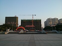
Liucheng County
柳城县 · Liujcwngz Yen | |
|---|---|
 | |
 Liucheng Location in Guangxi | |
| Coordinates: 24°39′11″N 109°14′42″E / 24.653°N 109.245°ECoordinates: 24°39′11″N 109°14′42″E / 24.653°N 109.245°E[1] | |
| Country | People's Republic of China |
| Autonomous region | Guangxi |
| Prefecture-level city | Liuzhou |
| Subdivisions | 9 towns 2 townships 1 ethnic township |
| Seat | (大埔镇) |
| Area | |
| • Total | 2,109.78 km2 (814.59 sq mi) |
| Elevation | 107 m (351 ft) |
| Population (2010)[3] | |
| • Total | 353,796 |
| • Density | 170/km2 (430/sq mi) |
| Time zone | UTC+8 (China Standard) |
| Postal code | 5452XX |

Liucheng County (simplified Chinese: 柳城县; traditional Chinese: 柳城縣; pinyin: Liǔchéng Xiàn; Standard Zhuang: Liujcwngz Yen) is under the administration of Liuzhou, Guangxi Zhuang Autonomous Region, China. It covers a land area of 2,109.78 square kilometres (814.59 sq mi) and had a permanent population of 353,796 as of 2010. Located north of Liuzhou's city proper, it borders the prefecture-level city of Hechi to the west.
Administrative divisions[]
Liucheng consists of 9 towns, 2 townships and 1 ethnic township:[4]
Towns:
- (大埔镇), (龙头镇), (太平镇), (沙埔镇), (东泉镇), (凤山镇), (六塘镇), (冲脉镇), (寨隆镇)
Townships:
- (马山乡), (社冲乡), (古砦仫佬族乡)
Climate[]
| showClimate data for Liucheng (1981−2010) |
|---|
References[]
- ^ Google (2014-07-02). "Liucheng" (Map). Google Maps. Google. Retrieved 2014-07-02.
- ^ Liuzhou City Land Use Plan (2006–20)/《柳州市土地利用总体规划(2006-2020年)》.(in Chinese) Accessed 8 July 2014.
- ^ 《中国2010年人口普查分县资料》 (in Chinese). 中国统计出版社. December 2012. ISBN 978-7-5037-6659-6.
- ^ 2011年统计用区划代码和城乡划分代码:柳城县 (in Chinese). National Bureau of Statistics of the People's Republic of China. Retrieved 2013-01-04.
External links[]
- (in Chinese) Official website of Liucheng County
Categories:
- County-level divisions of Guangxi
- Liuzhou