Beihai
Beihai
北海市 • Bwzhaij Si Pakhoi | |
|---|---|
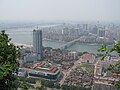
 Beihai Silver Beach | |
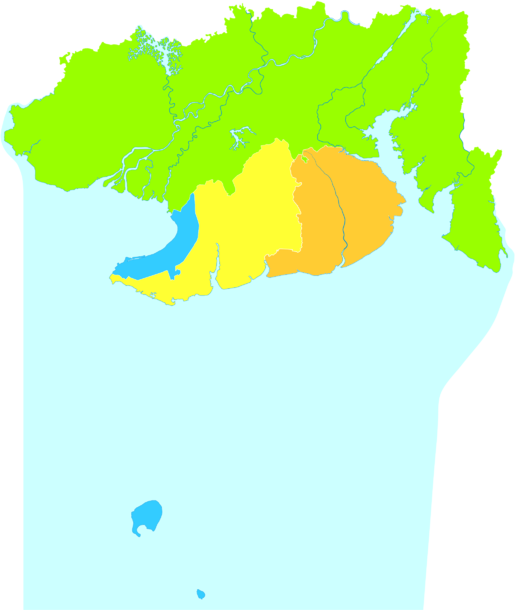
 Location of Beihai in Guangxi | |
| Coordinates (Beihai government): 21°28′52″N 109°07′12″E / 21.481°N 109.120°ECoordinates: 21°28′52″N 109°07′12″E / 21.481°N 109.120°E | |
| Country | People's Republic of China |
| Region | Guangxi |
| Municipal seat | Haicheng District |
| Area | |
| • Prefecture-level city | 3,337 km2 (1,288 sq mi) |
| Elevation | 21 m (69 ft) |
| Population (2010 census) | |
| • Prefecture-level city | 1,539,300 |
| • Density | 460/km2 (1,200/sq mi) |
| • Urban | 572,000 |
| • Metro | 405,600 |
| Time zone | UTC+8 (China Standard) |
| Postal code | 536000 |
| Area code(s) | 779 |
| ISO 3166 code | CN-GX-05 |
| Vehicle registration | 桂E |
| Website | beihai |

| Beihai | |||
|---|---|---|---|
 "Beihai", as written in Chinese | |||
| Chinese name | |||
| Chinese | 北海 | ||
| Postal | Pakhoi | ||
| Literal meaning | north of the sea | ||
| |||
| Zhuang name | |||
| Zhuang | Bwzhaij | ||
| 1957 orthography | Bɯƨhaiз | ||
Beihai (Chinese: 北海; pinyin: Běihǎi) is a prefecture-level city in the south of Guangxi, People's Republic of China. Its status as a seaport on the north shore of the Gulf of Tonkin has granted it historical importance as a port of international trade for Guangxi, Hunan, Hubei, Sichuan, Guizhou, and Yunnan.[1] Between the years 2006 and 2020, Beihai is predicted to be the world's fastest growing city.[2] Beihai has a large shipyard, but most of the money generated in the city is derived from trade.
In addition, it governs the small islands of Weizhou and Xieyang, and is directly west of Leizhou Peninsula.
Subdivisions[]
Beihai contains three districts and one county, which are subdivided into five urban sub-districts, 23 towns, 3 townships, 87 neighborhood committees, 343 village committees. (see also Administrative divisions of the People's Republic of China#Levels)
- Haicheng District (海城区)
- Yinhai District (银海区)
- Tieshangang District (铁山港区)
- Hepu County (合浦县)
| Map |
|---|
History[]
After the 1876 Sino-British Treaty of Yantai, eight Western nations (the UK, US, Germany, Austria-Hungary, France, Italy, Portugal, and Belgium) set up consulates, hospitals, churches, schools, and maritime customs. Today, 15 of these western buildings remain in Beihai. It officially became an international tourist spot (旅游对外开放城市) in 1982.
City timeline[]
- December 4, 1949: Beihai became a town of Hepu County under the Communist Party of China .
- January 1951: a province-administered city of Guangdong
- May 1951: entrusted to Guangxi
- March 1952: officially administered by Guangxi
- May 1955: Administered by Guangdong again
- 1956: reduced to a county-level city
- 1958: reduced to Beihai People's Commune of Hepu County
- 1959: county-class town
- 1964: restored to county-class city
- June 1965: Administered by Guangxi again
- October 1983: restored to prefecture-level city
Climate[]
Beihai has a monsoon-influenced humid subtropical climate (Köppen Cwa), with mild to warm winters and long, hot (but not especially) summers, and very humid conditions year-round. The monthly 24-hour average temperature ranges from 14.6 °C (58.3 °F) in January to 29.0 °C (84.2 °F) in July, while extremes have ranged from 2.6 to 37.1 °C (37 to 99 °F). Rain is both the heaviest and most frequent from June to September, when 70% of the annual rainfall also occurs. This is in contrast to the autumn and winter months, where only 20 to 40 millimetres (0.79 to 1.57 in) of rain falls per month. The area receives about 2,000 hours of sunshine annually.[1]
| showClimate data for Beihai (1981−2010) |
|---|
Language[]
Vernacular languages of Beihai include Qin-Lian Yue, Hakka and Min. Mandarin is of increasing prevalence as a result of the Chinese government's general promotion of it.
Transportation[]
Air Transportation[]
Beihai is served by Beihai Fucheng Airport (BHY). It serves domestic destinations and also Hong Kong.
Rail[]
Beihai is served by a railway branch from Nanning. There are passenger trains to Nanning and Guilin.[3] At the end of 2013, the introduction of high-speed (D-series) train service to Beihai was announced as well.[4]
Road[]
References[]
- ^ Jump up to: a b c 北海城市介绍 (in Chinese). Weather China. Retrieved 2012-02-25.
- ^ City Mayors: World's fastest growing urban areas
- ^ Beihai train schedule (in Chinese)
- ^ 广西再开通运营9对动车组 陈武宣布高铁开通. huochepiao.com. 2013-12-31. Archived from the original on 2014-11-29. Retrieved 2014-01-02. (Guangxi opens new CRH service, with 9 pairs of train a day. Chen Wu announces the opening of high-speed service), 2013-12-31
External links[]
| Wikivoyage has a travel guide for Beihai. |

| Authority control |
|---|
- Beihai
- Cities in Guangxi