Mayo River State Park (North Carolina)
| Mayo River State Park | |
|---|---|
 U.S. 220 access to Mayo River State Park | |
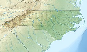 Location of Mayo River State Park in North Carolina | |
| Location | Rockingham, North Carolina, United States |
| Coordinates | 36°26′20″N 79°56′17″W / 36.438800°N 79.938171°WCoordinates: 36°26′20″N 79°56′17″W / 36.438800°N 79.938171°W |
| Area | 2,778 acres (11.24 km2)[1] |
| Established | May 31, 2003[2] |
| Named for | Mayo River |
| Governing body | North Carolina Division of Parks and Recreation |
| Website | Mayo River State Park |


Mayo River State Park is a North Carolina state park in Rockingham County, North Carolina in the United States. It covers 2,778-acre (11.24 km2)[1] along the Mayo River, and it adjoins a Virginia State Park of the same name. North Carolina's park is near Mayodan, North Carolina. The park is one of the newest in the North Carolina system, having been authorized by the General Assembly in May 2003.[3][2]
History[]

In May 2003, the North Carolina General Assembly authorized a state park along the Mayo River, from the Virginia-North Carolina state line, to the river's confluence with the Dan River.[2][4]
The Mayo Mountain Access was opened to the public on April 1, 2010, as an interim facility.[5][4]
For the first decade of its existence, the park struggled to obtain land with access to the river's edge.[6] Most of the state's initial park properties were above the river, where it may be seen, but not reached.
In 2016, Piedmont Land Conservancy (PLC) acquired a 354-acre (143 ha) tract from Mayo Properties LLC, which ran along both sides the Mayo River for 3 miles (4.8 km). The tract was originally assembled by investors in the 1950's, with plans to dam the Mayo as a water reservoir for the City of Greensboro. The plans never came into fruition, as Greensboro aided the development of the Randleman Reservoir on the Deep River instead. Duke Energy aided PLC, with a $1.1 million grant for the purchase of the property, as part of their restoration activity for the 2014 Dan River coal ash spill.[7][8]
In 2019, PLC acquired another 64-acre (26 ha) tract, which included Mayo Beach and the Boiling Hole.[9][10] A former property of Washington Mills Company, the linear track consists of 1.2 miles (1.9 km) of the river's right and left banks, and it tied several existing park parcels together. Duke Energy provided a $363,000 grant for the acquisition.[9][10]
Recreation[]
Mayo River State Park consists of multiple, disconnected access areas spread along the river.
Mayo Mountain access[]

The park's principle public access area is the Mayo Mountain Access, near Mayodan.
The access was once a corporate facility, formally known as Mayo Park, which was opened by the Washington Mills Company in 1948. Architect Antonin Raymond designed the original Mayo Park, which included a picnic shelter, a fishing pond, a swimming pond with a beach and a bathhouse. The state renovated and restored some of the existing structures from the former park, while trying to maintain a style compatible with Raymond's design. By the time North Carolina State Parks obtained the property, Raymond's bathhouse had degraded beyond repair. A restroom building resembling the former bathhouse's design was constructed in its place, and materials salvaged from the bathhouse were incorporated into it. The diving platform and other swimming facilities were removed from the swimming pond.[4]
The core of the access area consists of a visitor contact station, two picnic shelters, a small picnic area, two catch and release fishing ponds, a restroom building and a trailhead.[4] The 1.8 miles (2.9 km) Mayo Mountain Loop Trail starts at the picnic area, and it leads hikers along the ridge of Mayo Mountain. The trail does not reach the summit, which is private property. The 0.5-mile (0.80 km) Inner Loop Trail is formed by a shortcut of the Mayo Mountain loop, which avoids ascending the mountain. The access area also has a 40-person group campground set away from the rest of the park facilities.
Deshazo Mill access[]

The park's Deshazo Mill access is its northernmost and second-developed area. The access has a small parking and picnic area, which serve as the trailhead for the Mayo River Trail.[4] The trail takes hikers past Fall Creek Falls, before reaching the Mayo River.[4] The trail then turns north and passes by the confluence of the North and South Forks of the Mayo, and it formally ends at Bryd's Ledge. Named for Mr Bryd, the rock formation in the North Mayo River was a landmark when the North Carolina–Virgina state line was surveyed.[4] An informal trail continues on into Virginia's Mayo River State Park.
Anglin Mill access[]
The Anglin Mill access, also known as Mayo Beach,[4] is along a naturally sandy bank of the river. The beach is a popular local swimming area,[4][6] and upstream of the beach is a Class III rapid, called the Boiling Hole.[4] This stretch of the river is commonly used for playboating, due to its ease of access.
Hickory Creek access[]
The Hickory Creek access provides hikers an informal trailhead near Hickory Creek and a 0.75-mile (1.21 km) trail which leads to the river.[4]
Mayodan access[]
Close to downtown Mayodan, the Mayodan access provides a primitive put-in for kayaks and canoes.[4]
Virginia's Mayo River State Park[]
After North Carolina began development of its state park, the State of Virginia studied the creation of its own adjoining state park in 2007.[11] The Virginia Department of Conservation and Recreation concluded the park was feasible,[11] and in 2009 it acquired an initial 332-acre (134 ha) tract adjoining North Carolina's park.[12] Virginia proposed merging the two parks together into an 'interstate park'; however, North Carolina declined, preferring a separate but cooperative approach to park management.[11] Some of the properties North Carolina acquired for its park, extended into Virginia. To aid with the growth of Virginia's park, North Carolina kept its out-of-state landholdings until Virginia could purchase them in 2013. In October 2021, Virginia broke ground on visitor facilities for its park, with plans to open the park in Spring 2022.[13]
Nearby state parks[]
The following state parks are within 30 miles (48 km) of Mayo River State Park:
References[]
- ^ a b "Size of the North Carolina State Parks System" (XLS). North Carolina Division of Parks and Recreation. July 1, 2020. Archived from the original on August 17, 2020. Retrieved August 17, 2020.
- ^ a b c "Session Law 2003-106". Raleigh, North Carolina: General Assembly of North Carolina. May 31, 2003. Retrieved January 22, 2022.
- ^ "New Parks for a New Century: Mayo River". NC Division of Parks and Recreation.
- ^ a b c d e f g h i j k l Timmons Group (August 2021). "Mayo River State Park Master Plan: A Guide to Future Improvements" (PDF). North Carolina Department of Parks and Recreation. Archived (PDF) from the original on 2022-01-19. Retrieved 2022-01-18.
- ^ "New Mayo River State Park Will Open to the Public April 1". NC Division of Parks and Recreation.
- ^ a b "Mayo River State Park has no access to the water". Winston-Salem Journal. 2014-08-24. Archived from the original on 2022-01-23. Retrieved 2022-01-20.
- ^ Wireback, Taft (2016-07-06). "Conservancy protects 3 miles of Mayo River land". Greensboro News & Record. Archived from the original on 2022-01-23. Retrieved 2022-01-20.
- ^ "Piedmont Land Conservancy acquires major parcel along Mayo River". Stokes News. 2016-07-20. Archived from the original on 2016-07-28. Retrieved 2022-01-20.
- ^ a b "Another 64 acres to be donated to Mayo River State Park in Rockingham County". Winston-Salem Journal. 2019-07-11. Archived from the original on 2022-01-23. Retrieved 2022-01-20.
- ^ a b Brown, Keri (2019-07-12). "Land Acquisition Will Open Up Mayo River Access Points For Public". WFDD. Archived from the original on 2021-07-14. Retrieved 2022-01-20.
- ^ a b c "Feasibility Study for a State Park On the Mayo Rivers in Henry County and Mayo Scenic Rivers Study" (PDF). Virginia Department of Conservation and Recreation. 2007. Archived (PDF) from the original on 2021-12-27. Retrieved 2022-01-18.
- ^ "Land Conservation Five-Year Funding Considerations" (PDF). Virginia Department of Conservation and Recreation. April 2019. p. 6. Archived (PDF) from the original on 2022-01-04. Retrieved 2022-01-18.
- ^ Wyatt, Bill (2021-10-27). "WATCH NOW: Ground has broken on a new state park in Henry County". Martinsville Bulletin. Archived from the original on 2022-01-07. Retrieved 2022-01-18.
External links[]
- Official website
- Session Law 2003-106 established Mayo River State Park
| Location |
|  |
|---|---|---|
| Cities |
| |
| Counties |
| |
| Newspapers | ||
| Higher education |
| |
| Protected areas |
| |
| Transportation | ||
- IUCN Category III
- State parks of North Carolina
- Protected areas of Rockingham County, North Carolina
- Protected areas established in 2003
- 2003 establishments in North Carolina