Miandoab County
Miandoab County
شهرستان میاندوآب | |
|---|---|
 Counties of West Azerbaijan Province | |
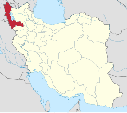 Location of West Azerbaijan Province in Iran | |
| Coordinates: 36°57′N 46°00′E / 36.950°N 46.000°ECoordinates: 36°57′N 46°00′E / 36.950°N 46.000°E | |
| Country | |
| Province | West Azerbaijan |
| Capital | Miandoab |
| Bakhsh (Districts) | Central District, Marhemetabad District, Baruq District |
| Population (2006) | |
| • Total | 245,153 |
| Time zone | UTC+3:30 (IRST) |
| • Summer (DST) | UTC+4:30 (IRDT) |
| Miandoab County can be found at GEOnet Names Server, at this link, by opening the Advanced Search box, entering "9205915" in the "Unique Feature Id" form, and clicking on "Search Database". | |

Miandoab County (Persian: شهرستان میاندوآب) is a county in West Azerbaijan Province in Iran. The capital of the county is Miandoab. This city is located in the south of Urmia Lake and between the two rivers Zarrineh river and Simineh river.
The name of this city is due to the location of this city between the two rivers Zarrineh river and Simineh river. According to the condition of rivers and geographical location of the region, the communication route of the provinces of West Azerbaijan, East Azerbaijan, Kurdistan and Zanjan is through this city.[1]
The city is famous for the hospitality of the people and its favorable temperate climate and the beautiful appearance that the Zarrinehrood and Siminehrood rivers have given it.
Country divisions[]
The country divisions of this city, according to the results of the 2006 census of the whole country, are as district, city, Dehestan and village are as follows:[2][3]
Districts[]
the Central District, Marhemetabad District, Baruq District and Baktash District.
Cities[]
The county has three cities: Miandoab, Chahar Borj, and Baruq.
Dehestans[]
Dehestans of Central District are: Zarrineh Rud-e Jonubi Rural District, Zarrineh Rud-e Shomali Rural District, Zarrineh Rud Rural District and Mokriyan-e Shomali Rural District
Dehestans of Marhemetabad District are: Marhemetabad Rural District, Marhemetabad-e Shomali Rural District, Marhemetabad-e Miani and Marhemetabad-e Jonubi Rural District
Dehestans of Baruq District are: Baruq Rural District, Ajorluy-ye Gharbi Rural District, Ajorluy-ye Sharqi Rural District and Heydar Baghi District
Agriculture[]
The very favorable geographical location has led to very good agricultural growth and as a result, the industrial development of Miandoab region. Miandoab sugar factory was built in the early twentieth century with the cooperation of Belgian engineers. The construction of the Nowruzlu diversion dam in the 1971 made this area prone to development and industrialization.
History[]
The discovery of several ancient monuments around Miandoab indicates the very old settlement of the region in the unrecorded periods of history. Archaeological excavations and artifacts such as the Qara Quzulu hill date back to 800 to 4100 BC.[4] Menorsky, a contemporary Russian orientalist, believes that there are territories south of Lake Urmia. It is non-Indian and European, such as Al-Abrian, Kharkhar and Alpi, and in the southwest it refers to a country called "Parswa" in 844 BC, and in the southeast "Parsava" from 836 BC to "Matai". And then after 714 BC named the "Manna" who around 830 to 858 BC as a neighbor attached to the "Parsva" which according to historians rule This Manna tribe was in the village of "Dash Tappeh" in Miandoab and an inscription in this field has been obtained from there. "[5]
The migration of the Qara Papaqs and in the early reign of Agham Mohammad Khan Qajar, following the forced migration of a population from the Kerman region, were added to the inhabitants of the city and the Kermanis were mixed with the natives of Miandoab for two generations. Indicates this population movement.[1]
During the turbulent years of World War I, Miandoab, like many people in the region, tasted the bitter taste of famine and instability in Iran. The Iranian government was in a state of chaos and political turmoil. At the end of World War II, the Soviet Army took control of the region following the deportation of Reza Shah.[6]
Language[]
The language used by the majority of the people in this city is Azerbaijani Turkish, but around the city of Miandoab, towards the city of Mahabad, the people of several villages speak Sorani Kurdish.[7]
Ancient relics[]
There are traces of Medes as well as Urartians in the village of Dash tappeh.
Other ancient relics of this city are as follows:
Fortress of Husseinabad[]
Hosseinabad mud and clay fort is located 15 km from Miandoab. Since this fort was the summer fortress of the Hulagu Khan, it is also known as Hulagu khan's Fortress.
Parts of the fortress wall and the indoor space, the foundations of one of the watchtowers, and ... now are visible.
Mirza Rasool or Tatao bridge[]
On the Simineh river, a Qajar bridge named can be seen. This bridge, with 80 meters length and 6.4 meters wide, has five spans with gabled arches, which can be seen on the road from Miandoab to Mahabad. This historical bridge was registered on July 20, 1998, with the registration number 2068 as one of the national monuments of Iran and hosts a significant number of tourists on different occasions of the year, especially during Nowruz. The foundations of this bridge are made of cut stone made of travertine and below it, a piers is used to prevent shocks and water intensity, and the arches of the bridge are in the form of two folds and arches. Some believe that this bridge was built during the Qajar period with seven spans and 200 years old, but after research it was found that this bridge dates back to the Safavid period and 'Mirza Rasool' only repaired this bridge during the Qajar period.[4]
Kouseh-lar bridge[]
The second historical bridge in Miandoab is a bridge called "Kouseh-lar" and it is located in a village of the same name.
This historical monument, which is registered as one of the national monuments of Iran with the registration number 6402, was built on the road from Miandoab to the city of Chahar Borj in the village of Kouseh Lar on a duct called Aji Gobi, which is a tributary of the Zarrineh River.
Kouseh-lar Bridge dates back to the late Qajar period and has two piers, which are based on stone carcasses and lime mortar on not so strong foundations and are built for communication between the two sides of the duct.
The foundations of this historic bridge are 1.6 meters wide and 4.5 meters length, and in the opposite direction of the water flow, it has triangular pier. The arches are 1.5 meters.
The bridge has three openings with 2 meters length and 3.2 meters height from the floor of the bridge and is made of brick and lime mortar.[5]
Archaeological Museum[]
The Miandoab Museum was opened in 1968 with its prehistoric pottery, bronze relic from Lorestan and the post-Islamic period, decorative and national arts, various coins, anthropology, and so on. This museum is located in Moallem Park and next to the city public library hall.
Other historical monuments of this city include the churches of Hazrat Maryam, Georg and Hohans holly, the Qajar mosque arch and the ancient hill of Gug Tappeh.
Hundreds of hills have a historical site in their heart that is spread all over this region, relics that each have thousands of unspoken words hidden in their hearts, but unfortunately, except for a few cases, no research has been done about them and they are anonymous.
Ancient hills[]
These historical hills include the following:
Qara Gozlu hill, Shineabad hill, remnants of Yarjan Olya hill, Javad Tappeh Si, Kohneh Kand hill, Qoruqchi Tappeh Si, Chal Khomaz hill, It Ullen hill (dead dog), Sichan Tappeh Si, Daghi Oghun hill, Ghol Anjir Daghi hill, Gorabad hill (Bazaar hill), Khalifa red hill, Shurjeh Barouq hill, Yaghlan hill, Noroozlu dam hill, Gardeh Shin hill, Rash, Hamin Barik hill, Gerd hill, Abbas Bolaghi hill, Shaitan Takhti hill, Cheraghvah hill, Malekabad hill, Pareh hill, Fasnduz hill, Dolatabad hill, Holako castle hill, Madi hill, Qabchaq hill, Ozon Gheshlagh hill, Uch Tappeh town, Shah Tappeh (Islam Tappeh), Mirza Ali Asgar hill, Haj Tappeh hill Firoozabad, Mirza Nezam Tappeh Si, Ilan Tappeh Si, Nasiban Tappeh Si, Kol Yeri Varzan Hill, Dushan Tappeh, Saremi Hill, Yaqin Ali Tappeh Hills, Dam Dam Tappeh, Och Tappeh Gerd Hill, Shitanabad Bazaar Hill, Dash Tappeh Hill Chogan Lu, Gardmalahsan, Sugli Tappeh Hill, Qara Tappeh Hill, Gouliish Goli Lands, Armenian Hill, Shortpeh, Nasir Kennedy Hills, Qaryaghdi Hill and Cemetery, Shurijeh Hill, Mullah Shahabuddin Hill, No. 1, De Tappeh Chahar Hill[5]
Other places of interest and tourism[]
Other places of interest in this city include the following:[8][1]
Forests and nature of Badamlu village[]
Badamlu village is the most beautiful rural point in Miandoab, which is located 130 km from this city in the Ajorluy-ye Sharqi Rural District. Badamlu forests are one of the main forest areas of Miandoab, and this beautiful and eye-catching forest nature has attracted the attention of every viewer.
Nowruzlu Dam Road[]
Another place that can be mentioned as a place to spend nature day is the beautiful and eye-catching nature on the road of Nowruzlu Miandoab dam.
Jabaklu Cave[]
It is located in Jabaklu village, 25 km away from Miandoab city, which is one of the natural and tourist attractions.
Ozan Waterfall[]
This waterfall is located in Ozan village, 70 km away from Miandoab city.
Historical hill of Islam Tappeh
Historical hill of Islam Tappeh located in the village of Islam Tappeh with rock architecture is one of the ancient monuments dating back to the first thousand BC and the Urartus.
Mountains of Jan Agha[]
Jan Agha is a village in the Baruq District of Miandoab city in the West Azarbaijan province of Iran. Next to this village is mountains of Jan Agha and on top of this mountain, there are very strong armored houses. These houses are made of large and small stones, the heaviest of which weighs about 22 tons. Next to these houses, ways have been built with the floors which are paved, and the sides of which, like the wall, are made of tall, thin stones that act as tables. Ajorloo Lake still passes through this village.
Heidar baghi village[]
Haidar Baghi village is on Baroog district of Miandoab and has a beautiful and unique nature.
The village of Qatar (Means train) is on Baroog district and is located 30 km from Miandoab and is divided into two sections: Chay Qatar (Means river train ) and Dash Qatar (meanse stone train). In this village, there are natural landscapes such as train-like chain stones in the hills foot of the surrounding mountains and a river that passes through the village.
The religion of the people[]
Most of the residents of Miandoab are Shia And a significant minority of Sunni and a small minority of Yarsani live in the area.[9]
References[]
- ^ a b c "میاندوآب". www.ataland.com/. Retrieved 20 March 2021.
{{cite web}}: CS1 maint: url-status (link) - ^ "سیمای کلی شهرستان میاندوآب". www.miandoab-ag.ir. Retrieved 21 March 2021.
{{cite web}}: CS1 maint: url-status (link) - ^ "خانوارهاي معمولي ساكن و گروهي در واحد مسكوني معمولي بر حسب نحوه تصرف محل سکونت (استان، شهرستان، بخش، دهستان، شهر)". www.amar.org.ir. Retrieved 21 March 2021.
{{cite web}}: CS1 maint: url-status (link) - ^ a b "تاتاوي، پلي به تاريخ كهن مياندوآب". /www.irna.ir. 28 September 2016.
{{cite web}}: CS1 maint: url-status (link) - ^ a b c "گذشته پررمز و راز میاندوآب و فریادی که شنیده نمی شود/ اینجا، تاریخ ایستاده می میرد!". www.dana.ir. 28 September 2016.
{{cite web}}: CS1 maint: url-status (link) - ^ "اشغال ایران در جنگ جهاني دوم ؛ آلمان ها یا منافع نفتی؟". www.petromuseum.ir. Retrieved 20 March 2021.
{{cite web}}: CS1 maint: url-status (link) - ^ "تاریخچه شهرستان میاندوآب". www.miandoabma.ir (in Persian). 2018-08-21. Retrieved 2021-03-21.
{{cite web}}: CS1 maint: url-status (link) - ^ "میاندوآب، سرزمینی با طبیعت ناشناخته/ به دیدار طبیعت زیبای میاندوآب برویم". www.myandoab.ir. Retrieved 21 March 2021.
{{cite web}}: CS1 maint: url-status (link) - ^ "درباره میاندوآب". www.miandoabpress.ir. Retrieved 21 March 2021.
{{cite web}}: CS1 maint: url-status (link)

- Miandoab County
- Counties of West Azerbaijan Province