Naillat
Naillat | |
|---|---|
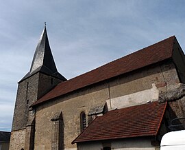 The church of Saint-Médard, in Naillat | |
show Location of Naillat | |
 Naillat | |
| Coordinates: 46°15′55″N 1°38′18″E / 46.2653°N 1.6383°ECoordinates: 46°15′55″N 1°38′18″E / 46.2653°N 1.6383°E | |
| Country | France |
| Region | Nouvelle-Aquitaine |
| Department | Creuse |
| Arrondissement | Guéret |
| Canton | Dun-le-Palestel |
| Intercommunality | CC Pays Dunois |
| Government | |
| • Mayor (2020–2026) | Laurent Tardy[1] |
| Area 1 | 36.23 km2 (13.99 sq mi) |
| Population (Jan. 2018)[2] | 634 |
| • Density | 17/km2 (45/sq mi) |
| Time zone | UTC+01:00 (CET) |
| • Summer (DST) | UTC+02:00 (CEST) |
| INSEE/Postal code | 23141 /23800 |
| Elevation | 316–530 m (1,037–1,739 ft) (avg. 360 m or 1,180 ft) |
| 1 French Land Register data, which excludes lakes, ponds, glaciers > 1 km2 (0.386 sq mi or 247 acres) and river estuaries. | |


Naillat (French pronunciation: [naja]; Occitan: Nalhac) is a commune in the Creuse department in the Nouvelle-Aquitaine region in central France.
Geography[]
A farming area comprising the village and several hamlets situated some 14 miles (23 km) northwest of Guéret at the junction of the D5, D14 and the D44 roads. A small tributary of the Creuse, the river Brézentine flows through the middle of the village.
Population[]
| Year | Pop. | ±% |
|---|---|---|
| 2006 | 653 | — |
| 2007 | 655 | +0.3% |
| 2008 | 657 | +0.3% |
| 2009 | 669 | +1.8% |
| 2010 | 670 | +0.1% |
| 2011 | 673 | +0.4% |
| 2012 | 675 | +0.3% |
| 2013 | 680 | +0.7% |
| 2014 | 682 | +0.3% |
| 2015 | 668 | −2.1% |
| 2016 | 653 | −2.2% |
Sights[]
- The twelfth-century church, with a twisted spire.
- A feudal motte.
- Two menhirs.
- The château de La Vergne.
See also[]
References[]
- ^ "Répertoire national des élus: les maires". data.gouv.fr, Plateforme ouverte des données publiques françaises (in French). 2 December 2020.
- ^ "Populations légales 2018". INSEE. 28 December 2020.
| Wikimedia Commons has media related to Naillat. |
This Creuse geographical article is a stub. You can help Wikipedia by . |
Categories:
- Communes of Creuse
- Creuse geography stubs