Saint-Agnant-de-Versillat
Saint-Agnant-de-Versillat | |
|---|---|
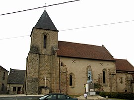 The church and the war memorial in Saint-Agnant-de-Versillat | |
show Location of Saint-Agnant-de-Versillat | |
 Saint-Agnant-de-Versillat | |
| Coordinates: 46°16′47″N 1°30′43″E / 46.2797°N 1.5119°ECoordinates: 46°16′47″N 1°30′43″E / 46.2797°N 1.5119°E | |
| Country | France |
| Region | Nouvelle-Aquitaine |
| Department | Creuse |
| Arrondissement | Guéret |
| Canton | La Souterraine |
| Intercommunality | CC Pays Sostranien |
| Government | |
| • Mayor (2020–2026) | Pierre Decoursier |
| Area 1 | 50.46 km2 (19.48 sq mi) |
| Population (Jan. 2018)[1] | 1,089 |
| • Density | 22/km2 (56/sq mi) |
| Time zone | UTC+01:00 (CET) |
| • Summer (DST) | UTC+02:00 (CEST) |
| INSEE/Postal code | 23177 /23300 |
| Elevation | 279–449 m (915–1,473 ft) (avg. 302 m or 991 ft) |
| 1 French Land Register data, which excludes lakes, ponds, glaciers > 1 km2 (0.386 sq mi or 247 acres) and river estuaries. | |


Saint-Agnant-de-Versillat (French pronunciation: [sɛ̃.t‿aɲɑ̃ də vɛʁsija]; Occitan: Sent Anhan) is a commune in the Creuse department in central France.
Population[]
| Year | Pop. | ±% |
|---|---|---|
| 1962 | 1,173 | — |
| 1968 | 1,253 | +6.8% |
| 1975 | 1,168 | −6.8% |
| 1982 | 1,067 | −8.6% |
| 1990 | 1,115 | +4.5% |
| 1999 | 1,101 | −1.3% |
| 2006 | 1,121 | +1.8% |
| 2008 | 1,348 | +20.2% |
See also[]
References[]
- ^ "Populations légales 2018". INSEE. 28 December 2020.
| Wikimedia Commons has media related to Saint-Agnant-de-Versillat. |
This Creuse geographical article is a stub. You can help Wikipedia by . |
Categories:
- Communes of Creuse
- Creuse geography stubs