From Wikipedia, the free encyclopedia
Location of Crawford County in Kansas
This is a list of the National Register of Historic Places listings in Crawford County, Kansas .
This is intended to be a complete list of the properties and districts on the National Register of Historic Places in Crawford County , Kansas , United States . The locations of National Register properties and districts for which the latitude and longitude coordinates are included below, may be seen in a map.[1]
There are 22 properties and districts listed on the National Register in the county.
This National Park Service list is complete through NPS recent listings posted February 11, 2022. [2]
Current listings [ ]
[3] Name on the Register[4]
Image
Date listed[5]
Location
City or town
Description
1
April 16, 2008 (#08000300 ) 121 E. 4th St. 37°31′14″N 94°50′36″W / 37.520556°N 94.843333°W / 37.520556; -94.843333 (Besse Hotel ) Pittsburg
2
Upload image September 6, 2006 (#06000771 ) Junction of 200th St. and 720th Ave. 37°40′01″N 94°44′30″W / 37.666861°N 94.741528°W / 37.666861; -94.741528 (Cato District No. 4 School ) Cato
3
April 16, 2008 (#08000301 ) 409 N. Broadway 37°24′40″N 94°42′17″W / 37.411111°N 94.704722°W / 37.411111; -94.704722 (Colonial Fox Theatre ) Pittsburg
4
Crawford County Courthouse
April 22, 2009 (#09000225 ) 111 E. Forest, Courthouse Square 37°30′39″N 94°50′36″W / 37.510839°N 94.843219°W / 37.510839; -94.843219 (Crawford County Courthouse ) Girard
5
First Presbyterian Church
July 8, 2009 (#09000496 ) 202 N. Summit 37°30′39″N 94°50′36″W / 37.510878°N 94.843383°W / 37.510878; -94.843383 (First Presbyterian Church ) Girard
6
Upload image October 11, 2016 (#16000703 ) 401-424 N. Broadway, 105 and 121 E. 4th Sts. 37°24′41″N 94°42′17″W / 37.411262°N 94.704792°W / 37.411262; -94.704792 (Fourth and Broadway Historic District ) Pittsburg
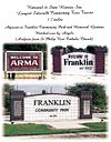
7
March 16, 2007 (#07000143 ) Parallel to Business Route 69 between Franklin and Arma 37°32′00″N 94°42′17″W / 37.533333°N 94.704750°W / 37.533333; -94.704750 (Franklin Sidewalk ) Franklin
8
Upload image July 10, 2017 (#100001286 ) 210 E. 4th St. 37°24′40″N 94°42′09″W / 37.411063°N 94.702590°W / 37.411063; -94.702590 (Frisco Freight Depot ) Pittsburg
9
Girard Carnegie Library
June 25, 1987 (#87000952 ) 128 W. Prairie 37°30′37″N 94°50′42″W / 37.510278°N 94.845°W / 37.510278; -94.845 (Girard Carnegie Library ) Girard
10
April 30, 1980 (#80001464 ) 707 Broadway 37°24′51″N 94°42′19″W / 37.414167°N 94.705278°W / 37.414167; -94.705278 (Hotel Stilwell ) Pittsburg
11
Upload image July 2, 1985 (#85001433 ) 10 miles south and 3.2 miles west of Girard 37°22′08″N 94°53′56″W / 37.368889°N 94.898889°W / 37.368889; -94.898889 (Hudgeon Bridge ) Girard
12
January 11, 2017 (#100000505 ) 211 N. Summit St. 37°30′44″N 94°50′37″W / 37.512351°N 94.843499°W / 37.512351; -94.843499 (J.T and Anna Leonard House ) Girard
13
Upload image January 4, 1990 (#89002174 ) Over Little Walnut Creek, northeast of Walnut 37°38′43″N 95°02′45″W / 37.645278°N 95.045833°W / 37.645278; -95.045833 (Little Walnut Creek Bowstring ) Walnut
14
Upload image January 6, 2022 (#100007281 ) 104 North Locust St. 37°24′32″N 94°42′12″W / 37.4088°N 94.7033°W / 37.4088; -94.7033 (Pittsburg Foundry & Machine Company ) Pittsburg
15
Pittsburg Public Library
November 9, 1977 (#77000577 ) 4th and Walnut Sts. 37°24′40″N 94°42′26″W / 37.411111°N 94.707222°W / 37.411111; -94.707222 (Pittsburg Public Library ) Pittsburg
16
Upload image April 3, 2007 (#07000255 ) 301 Osage St. 37°30′28″N 94°50′43″W / 37.507778°N 94.845278°W / 37.507778; -94.845278 (J. E. Raymond House ) Girard
17
May 21, 2009 (#09000348 ) 215 E. Prairie Ave. 37°30′34″N 94°50′29″W / 37.50951°N 94.84145°W / 37.50951; -94.84145 (S-W Supply Company ) Girard
18
St. John's Episcopal Church
April 22, 2009 (#09000226 ) Southeastern corner of Buffalo and Summit 37°30′29″N 94°50′35″W / 37.507975°N 94.842986°W / 37.507975; -94.842986 (St. John's Episcopal Church ) Girard
19
State Bank of Girard
August 7, 2009 (#09000349 ) 105 E. Prairie 37°30′34″N 94°50′36″W / 37.509553°N 94.843308°W / 37.509553; -94.843308 (State Bank of Girard ) Girard
20
Upload image April 16, 2008 (#08000302 ) 209 S. Locust St. 37°24′26″N 94°42′12″W / 37.407222°N 94.703333°W / 37.407222; -94.703333 (Washington Grade School ) Pittsburg
21
Julius A. Wayland House
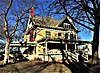
November 21, 1976 (#76000819 ) 721 N. Summit 37°31′14″N 94°50′36″W / 37.520556°N 94.843333°W / 37.520556; -94.843333 (Julius A. Wayland House ) Girard
22
March 20, 2002 (#02000204 ) 116 E. Lindburg and 120 E. Lindburg 37°23′31″N 94°42′15″W / 37.391944°N 94.704167°W / 37.391944; -94.704167 (Whitesitt-Shirk Historic District ) Pittsburg
See also [ ] References [ ]
^ The latitude and longitude information provided in this table was derived originally from the National Register Information System, which has been found to be fairly accurate for about 99% of listings. Some locations in this table may have been corrected to current GPS standards.
^ National Park Service, United States Department of the Interior , "National Register of Historic Places: Weekly List Actions" , retrieved February 11, 2022.
^ Numbers represent an alphabetical ordering by significant words. Various colorings, defined here , differentiate National Historic Landmarks and historic districts from other NRHP buildings, structures, sites or objects.
^ "National Register Information System" . National Register of Historic Places National Park Service . March 13, 2009.^ The eight-digit number below each date is the number assigned to each location in the National Register Information System database, which can be viewed by clicking the number.
Categories :
National Register of Historic Places in Crawford County, Kansas Lists of National Register of Historic Places in Kansas by county Buildings and structures in Crawford County, Kansas Hidden categories:
Articles using NRISref without a reference number Lists of coordinates Geographic coordinate lists Articles with Geo Commons category link is on Wikidata