National Register of Historic Places listings in Durham County, North Carolina

This list includes properties and districts listed on the National Register of Historic Places in Durham County, North Carolina. Click the "Map of all coordinates" link to the right to view an online map of all properties and districts with latitude and longitude coordinates in the table below.[1]
Current listings[]
- This National Park Service list is complete through NPS recent listings posted February 11, 2022.[2]
| [3] | Name on the Register[4] | Image | Date listed[5] | Location | City or town | Description |
|---|---|---|---|---|---|---|
| 1 | American Tobacco Company Manufacturing Plant |  |
September 29, 2000 (#00001163) |
Roughly bounded by W. Pettigrew St., Blackwell St., Willard St. and Carr St. 35°59′43″N 78°54′17″W / 35.995278°N 78.904722°W | Durham | |
| 2 | Bassett House |  |
November 29, 1979 (#79003330) |
1017 W. Trinity Ave. 36°00′20″N 78°54′38″W / 36.005556°N 78.910556°W | Durham | |
| 3 | Bennett Place State Historic Site |  |
February 26, 1970 (#70000452) |
4409 Bennett Memorial Rd. 36°01′45″N 78°58′32″W / 36.029167°N 78.975556°W | Durham | Site of the largest surrender of Confederate troops during the Civil War, April 26, 1865[6] |
| 4 | Mary Duke Biddle Estate |  |
January 9, 2013 (#12001157) |
1044 and 1050 W. Forest Hills Boulevard 35°58′59″N 78°55′08″W / 35.98292°N 78.918854°W | Durham | |
| 5 | Richard D. Blacknall House |  |
March 1, 1990 (#90000350) |
300 Alexander Ave. 36°00′13″N 78°55′38″W / 36.003611°N 78.927222°W | Durham | |
| 6 | Bright Leaf Historic District |  |
December 30, 1999 (#99001619) |
Roughly bounded by W. Peabody St., Duke St., Minerva Ave., N&W RR, Corporation St., Ligget St., Morris St. and W. Loop 36°00′06″N 78°54′21″W / 36.001667°N 78.905833°W | Durham | |
| 7 | Bull Durham Tobacco Factory |  |
September 10, 1974 (#74001346) |
201 W. Pettigrew St. 35°59′38″N 78°54′16″W / 35.993889°N 78.904444°W | Durham | Also known as W. T. Blackwell and Company Tobacco Factory |
| 8 | Bullington Warehouse |  |
August 30, 1982 (#82003448) |
500 N. Duke St. 36°00′10″N 78°54′22″W / 36.002778°N 78.906111°W | Durham | |
| 9 | Burch Avenue Historic District |  |
September 3, 2010 (#10000631) |
Roughly bounded by S. Buchanan Blvd., W. Chapel Hill St., Duke University Rd., Burch Ave., and Rome Ave. 35°59′53″N 78°55′03″W / 35.998056°N 78.9175°W | Durham | |
| 10 | John C. and Binford Carr House | 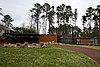 |
August 5, 2011 (#11000508) |
3400 Westover Rd. 35°56′48″N 78°57′22″W / 35.946667°N 78.956111°W | Durham | |
| 11 | City Garage Yard and Fire Drill Tower |  |
May 3, 2000 (#00000394) |
501 Washington St. 36°00′10″N 78°54′14″W / 36.002778°N 78.903889°W | Durham | |
| 12 | Clark and Sorrell Garage | 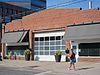 |
August 16, 2000 (#00000991) |
323 Foster St. 35°59′57″N 78°54′33″W / 35.999167°N 78.909144°W | Durham | |
| 13 | Cleveland Street District |  |
September 20, 1985 (#85002438) |
Roughly Cleveland St. between Seminary & Gray Aves. & Mallard St. 35°59′59″N 78°53′42″W / 35.999722°N 78.895°W | Durham | |
| 14 | College Heights Historic District | January 28, 2019 (#100003295) |
Roughly bounded by Masondale & Formosa Aves., Fayetteville, Cecil & Nelson Sts. 35°58′22″N 78°54′15″W / 35.9728°N 78.9042°W | Durham | ||
| 15 | Cranford-Wannamaker House | 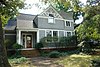 |
November 29, 1979 (#79003331) |
1019 W. Trinity Ave. 36°00′22″N 78°54′38″W / 36.006111°N 78.910556°W | Durham | |
| 16 | Crowell House |  |
November 29, 1979 (#79003332) |
504 Watts St. 36°00′22″N 78°54′41″W / 36.006111°N 78.911389°W | Durham | |
| 17 | Dillard-Gamble Houses |  |
January 19, 1979 (#79003333) |
1311 and 1307 N. Mangum St. 36°00′32″N 78°53′38″W / 36.008889°N 78.893889°W | Durham | |
| 18 | Downtown Durham Historic District | 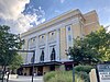 |
November 1, 1977 (#77000998) |
Roughly bounded by Peabody, Morgan, Seminary, Cleveland, Parrish, and Queen Sts. 35°59′42″N 78°54′01″W / 35.995°N 78.900278°W | Durham | |
| 19 | Duke Homestead and Tobacco Factory |  |
November 13, 1966 (#66000590) |
0.5 miles (0.80 km) north of Durham on Guess Rd., east of SR 1025 36°02′06″N 78°55′16″W / 36.035°N 78.921111°W | Durham | |
| 20 | Duke Memorial United Methodist Church | 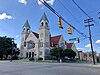 |
August 11, 1985 (#85001781) |
504 W. Chapel Hill St. 35°59′51″N 78°54′34″W / 35.9975°N 78.909444°W | Durham | |
| 21 | Durham Cotton Mills Village Historic District |  |
August 9, 1985 (#85001793) |
Roughly bounded by Byrd and Middle Sts., E. Frontage Rd., and Reservoir St. 35°58′36″N 78°52′56″W / 35.976667°N 78.882222°W | Durham | |
| 22 | Durham Hosiery Mill |  |
November 14, 1978 (#78001944) |
Angier Ave. 35°59′19″N 78°53′34″W / 35.988611°N 78.892778°W | Durham | |
| 23 | Durham Hosiery Mills Dye House |  |
January 22, 2014 (#13001115) |
708-710 Gilbert St. 35°59′44″N 78°53′23″W / 35.995421°N 78.889659°W | Durham | |
| 24 | Durham Hosiery Mills No. 2-Service Printing Company Building | 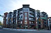 |
November 27, 1985 (#85003055) |
504 E. Pettigrew St. 35°59′23″N 78°53′52″W / 35.989722°N 78.897778°W | Durham | Burned 1985/Deteriorated[7] |
| 25 | East Durham Historic District | December 23, 2004 (#04001393) |
Roughly bounded by Southern Railway right-of-way, N. Guthrie Ave. Holloway St., Hyde Park Ave, S. Plum St. and Vale St. 35°59′39″N 78°52′31″W / 35.994178°N 78.875378°W | Durham | ||
| 26 | Emmanuel AME Church |  |
August 9, 1985 (#85001775) |
710 Kent St. 35°59′40″N 78°55′08″W / 35.994444°N 78.918889°W | Durham | |
| 27 | Ephphatha Church |  |
August 9, 1985 (#85001778) |
220 W. Geer St. 36°00′20″N 78°53′53″W / 36.005556°N 78.898056°W | Durham | |
| 28 | Erwin Cotton Mills Company Mill No. 1 Headquarters Building |  |
November 20, 1984 (#84002724) |
W. Main and 9th Sts. 36°00′27″N 78°55′24″W / 36.0075°N 78.923333°W | Durham | |
| 29 | Fairntosh Plantation | April 3, 1973 (#73001337) |
Near junction of SR 1004 and 1632 36°05′56″N 78°49′42″W / 36.098889°N 78.828333°W | Durham | ||
| 30 | Wiley and Elizabeth Forbus House |  |
April 28, 2005 (#05000348) |
3307 Devon Rd. 35°57′07″N 78°57′11″W / 35.951875°N 78.952969°W | Durham | |
| 31 | Forest Hills Historic District |  |
December 28, 2005 (#05001476) |
Roughly bounded by Kent St., Bivins St., Wells St., American Tobacco Trail, Forestwood Dr., and Beverly Dr. 35°58′55″N 78°54′53″W / 35.981944°N 78.914722°W | Durham | |
| 32 | Foster and West Geer Streets Historic District | 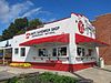 |
April 23, 2013 (#13000204) |
Bounded by W. Corporation, Madison, and Washington Sts., Rigsbee Ave., the railroad tracks, and 724 and 733 Foster St. 36°00′14″N 78°54′05″W / 36.0037727°N 78.9014059°W | Durham | |
| 33 | Golden Belt Historic District |  |
August 9, 1985 (#85001791) |
Roughly bounded by the railroad tracks, Taylor and Holman Sts., Morning Glory Ave., and Main St.; also 1000-1004 E. Main St. 35°59′26″N 78°53′20″W / 35.990556°N 78.888889°W | Durham | Second set of addresses represents a boundary increase of July 30, 1996 |
| 34 | Greystone | 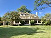 |
June 1, 1982 (#82003449) |
618 Morehead Ave. 35°59′32″N 78°54′32″W / 35.992222°N 78.908889°W | Durham | |
| 35 | Hampton-Ellis Farm | December 22, 2011 (#11000955) |
3305 Pat Tilley Rd. 36°10′11″N 78°50′01″W / 36.169622°N 78.833533°W | Bahama | ||
| 36 | Hardscrabble | January 20, 1972 (#72000960) |
Northern side of SR 1002, 1.2 miles (1.9 km) west of its junction with SR 1003 36°08′01″N 78°57′36″W / 36.133611°N 78.96°W | Bahama | ||
| 37 | John Sprunt Hill House | 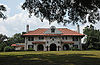 |
January 30, 1978 (#78001945) |
900 S. Duke St. 35°59′18″N 78°54′36″W / 35.988333°N 78.91°W | Durham | |
| 38 | Hillside Park High School | 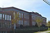 |
December 30, 2013 (#13001026) |
200 E. Ulmstead St. 35°58′56″N 78°54′09″W / 35.982127°N 78.902595°W | Durham | |
| 39 | Holloway Street District | 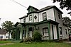 |
September 20, 1985 (#85002437) |
Roughly bounded by Holloway, Railroad, and Liberty Sts., Peachtree Pl., and Dillard St.; also roughly bounded by Holloway, Elizabeth, Primitive, and Queen Sts., and Mallard Ave. 35°59′43″N 78°53′30″W / 35.995278°N 78.891667°W | Durham | Second set of boundaries represents a boundary increase of April 30, 2009 |
| 40 | Kinchen Holloway House | August 29, 2008 (#08000814) |
4418 Guess Rd. 36°04′26″N 78°55′59″W / 36.073761°N 78.93315°W | Durham | ||
| 41 | Hope Valley Historic District | December 11, 2009 (#09001105) |
Avon Rd., Chelsea Circle, Cornwall Rd., Devon Rd. Exeter Way, Littlewoods Ln., Norwich Way, Stratford Rd. 35°56′56″N 78°56′52″W / 35.948767°N 78.947894°W | Durham | ||
| 42 | Horton Grove Complex |  |
March 17, 1978 (#78001946) |
North of Durham on SR 1626 36°07′35″N 78°50′22″W / 36.126389°N 78.839444°W | Durham | |
| 43 | Lakewood Park Historic District | 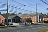 |
May 1, 2003 (#03000340) |
1601-1907 W. Lakewood Ave., 2001-2112 Chapel Hill Rd., 1406-1601 James St., and 1809-1819 Bivins St. 35°59′14″N 78°55′33″W / 35.987222°N 78.925833°W | Durham | |
| 44 | Leigh Farm | September 5, 1975 (#75001257) |
East of Chapel Hill off NC 54 35°55′19″N 78°58′58″W / 35.921944°N 78.982778°W | Chapel Hill | ||
| 45 | Liberty Warehouse Nos. 1 and 2 | 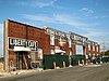 |
August 6, 2008 (#08000774) |
611-613 Rigsbee Ave. 36°00′05″N 78°54′00″W / 36.0013°N 78.899969°W | Durham | |
| 46 | January 11, 1985 (#85000118) |
Address Restricted | Chapel Hill | |||
| 47 | Little River High School |  |
April 17, 2017 (#100000896) |
8307 N. Roxboro Rd. 36°08′43″N 78°54′24″W / 36.145278°N 78.906667°W | Bahama | |
| 48 | Bartlett Mangum House |  |
May 25, 1989 (#89000446) |
2701 Chapel Hill Rd. 35°58′37″N 78°56′09″W / 35.976944°N 78.935833°W | Durham | |
| 49 | Meadowmont |  |
July 11, 1985 (#85001554) |
Off NC 54 35°54′40″N 79°00′19″W / 35.911111°N 79.005278°W | Chapel Hill | |
| 50 | Morehead Hill Historic District |  |
August 9, 1985 (#85001792) |
Roughly bounded by Jackson St., the East-West Expressway, S. Duke St., Lakewood Ave., Shephard St., and Arnette Ave.; also portions of Arnette, Vickers, Yancey, Parker, and Wells Sts. 35°59′23″N 78°54′46″W / 35.989722°N 78.912778°W | Durham | Second set of boundaries represents a boundary increase of June 2, 2004 |
| 51 | Pauli Murray Family Home |  |
December 23, 2016 (#100000866) |
906 Carroll St. 35°59′34″N 78°54′59″W / 35.992778°N 78.916389°W | Durham | Now the Pauli Murray Center. |
| 52 | North Carolina Central University |  |
March 28, 1986 (#86000676) |
Bounded by Lawson St., Alston Ave., Nelson, and Fayette Sts. 35°58′23″N 78°53′47″W / 35.972983°N 78.896289°W | Durham | |
| 53 | North Carolina Mutual Life Insurance Company Building |  |
May 15, 1975 (#75001258) |
114-116 W. Parrish St. 35°59′43″N 78°54′02″W / 35.995278°N 78.900556°W | Durham | |
| 54 | North Durham County Prison Camp (Former) |  |
December 31, 1998 (#98001573) |
2410 Broad St. 36°01′57″N 78°54′39″W / 36.032589°N 78.910831°W | Durham | |
| 55 | North Durham-Duke Park District | 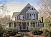 |
June 20, 1985 (#85001338) |
Roughly bounded by Glendale Ave., W. Knox St., Roxboro Rd., Trinity Ave., Magnum & Broadway Sts. 36°00′22″N 78°53′38″W / 36.006111°N 78.893889°W | Durham | |
| 56 | William Thomas O'Brien House | 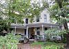 |
August 9, 1985 (#85001777) |
820 Wilkerson Ave. 36°00′06″N 78°54′55″W / 36.001667°N 78.915278°W | Durham | |
| 57 | Pearl Mill Village Historic District | 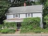 |
August 9, 1985 (#85001782) |
900 block of Washington and Orient Sts. between Trinity and Dacien Aves. 36°00′19″N 78°54′08″W / 36.005278°N 78.902222°W | Durham | |
| 58 | Pegram House |  |
November 29, 1979 (#79003334) |
1019 Minerva Ave. 36°00′15″N 78°54′37″W / 36.004167°N 78.910139°W | Durham | |
| 59 | George Poland House | December 4, 2004 (#04001287) |
502 John Jones Rd. 36°08′43″N 78°53′41″W / 36.145303°N 78.894694°W | Bahama | ||
| 60 | Powe House | 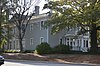 |
August 9, 1985 (#85001780) |
1503 W. Pettigrew St. 36°00′18″N 78°55′11″W / 36.005000°N 78.919722°W | Durham | |
| 61 | Russell School | 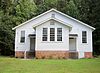 |
August 5, 2009 (#09000601) |
2001 St. Mary's Rd. (south side SR 1002 .1 miles (0.16 km) west of junction with SR 1003) 36°07′24″N 78°56′45″W / 36.123342°N 78.945797°W | Durham | |
| 62 | St. Joseph's African Methodist Episcopal Church |  |
August 11, 1976 (#76001319) |
Fayetteville St. and Durham Expwy. 35°59′11″N 78°53′53″W / 35.986389°N 78.898056°W | Durham | |
| 63 | Scarborough House | 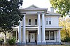 |
August 9, 1985 (#85001779) |
1406 Fayetteville St. 35°58′49″N 78°54′00″W / 35.980139°N 78.900000°W | Durham | |
| 64 | Scott and Roberts Dry Cleaning Plant, Office, and Store | 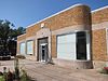 |
June 20, 2012 (#12000345) |
733 Foster St. 36°00′18″N 78°54′06″W / 36.004934°N 78.901718°W | Durham | |
| 65 | Smith Warehouse |  |
September 16, 1985 (#85002429) |
100 N. Buchanan Blvd. 36°00′05″N 78°54′57″W / 36.001389°N 78.915833°W | Durham | |
| 66 | Stagville |  |
May 25, 1973 (#73001338) |
5828 Old Oxford Highway 36°06′03″N 78°50′19″W / 36.100833°N 78.838611°W | Durham | |
| 67 | Stokesdale Historic District | December 28, 2010 (#10001093) |
Roughly bounded by Fayetteville St., Umstead St., Lawson St., Moline St., Concord St., and Dunstan St. 35°58′46″N 78°53′56″W / 35.979444°N 78.898889°W | Durham | ||
| 68 | Marcus Tilley House | January 14, 2000 (#99001684) |
7616 Jock Rd. 36°09′20″N 78°50′26″W / 36.155556°N 78.840556°W | Bahama | ||
| 69 | Trinity Historic District |  |
March 26, 1986 (#86000672) |
Roughly bounded by Green, Duke, Morgan, and W. Main Sts., Markham Ave., and Clarendon St.; also roughly bounded by the original Trinity Historic District, N. Buchanan Boulevard, W. Club Boulevard, Woodland Dr., and N. Duke St.; also 209-215 N. Gregson St. 36°00′22″N 78°54′43″W / 36.006111°N 78.911944°W | Durham | Second and third sets of boundaries represent boundary increases of June 4, 2004 and January 9, 2008 respectively |
| 70 | Adolphus W. Umstead House | September 14, 1989 (#89001418) |
NC 1607, 0.5 miles (0.80 km) north of NC 1611 36°11′07″N 78°51′16″W / 36.185278°N 78.854444°W | Bahama | ||
| 71 | December 2, 2014 (#14000983) |
3500 Hall Rd. 36°11′04″N 78°50′41″W / 36.1845°N 78.8446°W | Bahama | |||
| 72 | Venable Tobacco Company Prizery and Receiving Room |  |
August 21, 2003 (#03000804) |
302-304 East Pettigrew 35°59′29″N 78°53′57″W / 35.991389°N 78.899167°W | Durham | |
| 73 | Venable Tobacco Company Warehouse |  |
August 9, 1985 (#85001847) |
302-304 E. Pettigrew St. 35°59′32″N 78°53′57″W / 35.992222°N 78.899167°W | Durham | |
| 74 | Watts and Yuille Warehouses |  |
April 5, 1984 (#84002259) |
905 W. Main St. 36°00′01″N 78°54′37″W / 36.000278°N 78.910278°W | Durham | |
| 75 | Watts Hospital |  |
April 2, 1980 (#80002824) |
Broad St. and Club Blvd. 36°01′09″N 78°55′15″W / 36.019167°N 78.920833°W | Durham | |
| 76 | Watts-Hillandale Historic District | 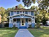 |
April 25, 2001 (#01000427) |
Roughly bounded by Durham Waterworks, Wilson St., Sprunt Ave., Broad St., Englewood Ave., and Hillsborough Rd. 36°01′14″N 78°55′45″W / 36.020556°N 78.929167°W | Durham | |
| 77 | West Durham Historic District |  |
March 26, 1986 (#86000680) |
Roughly bounded by Knox, Ninth, W. Main Sts., and Rutherford St. and Carolina Ave. 36°00′41″N 78°55′28″W / 36.011389°N 78.924444°W | Durham | |
| 78 | West Point on the Eno |  |
August 9, 1985 (#85001776) |
5101 N Roxboro St. 36°04′11″N 78°54′31″W / 36.069722°N 78.908611°W | Durham | |
| 79 | Wright's Automatic Machinery Company | 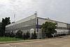 |
December 26, 2012 (#12001088) |
915 Holloway St. 35°59′42″N 78°53′04″W / 35.995134°N 78.884348°W | Durham |

See also[]
| Wikimedia Commons has media related to National Register of Historic Places in Durham County, North Carolina. |
- National Register of Historic Places listings in North Carolina
- List of National Historic Landmarks in North Carolina
References[]
- ^ The latitude and longitude information provided in this table was derived originally from the National Register Information System, which has been found to be fairly accurate for about 99% of listings. Some locations in this table may have been corrected to current GPS standards.
- ^ National Park Service, United States Department of the Interior, "National Register of Historic Places: Weekly List Actions", retrieved February 11, 2022.
- ^ Numbers represent an alphabetical ordering by significant words. Various colorings, defined here, differentiate National Historic Landmarks and historic districts from other NRHP buildings, structures, sites or objects.
- ^ "National Register Information System". National Register of Historic Places. National Park Service. April 24, 2008.
- ^ The eight-digit number below each date is the number assigned to each location in the National Register Information System database, which can be viewed by clicking the number.
- ^ "Bennett Place". North Carolina Department of Cultural Resources. March 10, 2009. Retrieved March 29, 2009.
- ^ "North Carolina Listings in the National Register of Historic Places by County". North Carolina State Historic Preservation Office. 22 October 2008. Archived from the original on 30 November 2012. Retrieved 14 July 2009.

U.S. National Register of Historic Places | |
|---|---|
| Topics |
|
| Lists by state |
|
| Lists by insular areas | |
| Lists by associated state | |
| Other areas |
|
| Related |
|
| |
Municipalities and communities of Durham County, North Carolina, United States | ||
|---|---|---|
County seat: Durham | ||
| Cities |
|  |
| Towns |
| |
| Townships | ||
| CDPs |
| |
| Unincorporated communities | ||
| Footnotes | ‡This populated place also has portions in an adjacent county or counties | |
| ||
Categories:
- Lists of National Register of Historic Places in North Carolina by county
- National Register of Historic Places in Durham County, North Carolina