Rural Municipality of Frenchman Butte No. 501
Frenchman Butte No. 501 | |
|---|---|
| Rural Municipality of Frenchman Butte No. 501 | |
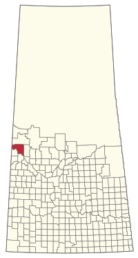 Location of the RM of Frenchman Butte No. 501 in Saskatchewan | |
| Coordinates: 53°35′06″N 109°38′49″W / 53.585°N 109.647°WCoordinates: 53°35′06″N 109°38′49″W / 53.585°N 109.647°W[1] | |
| Country | Canada |
| Province | Saskatchewan |
| Census division | 17 |
| SARM division | 6 |
| Formed[2] | January 1, 1954 |
| Government | |
| • Reeve | Barbara Bonnie Mills-Midgley |
| • Governing body | RM of Frenchman Butte No. 501 Council |
| • Administrator | Mae Rotsey |
| • Office location | Paradise Hill |
| Area (2016)[4] | |
| • Land | 1,927.39 km2 (744.17 sq mi) |
| Population (2016)[4] | |
| • Total | 1,494 |
| • Density | 0.8/km2 (2/sq mi) |
| Time zone | CST |
| • Summer (DST) | CST |
| Area code(s) | 306 and 639 |

The Rural Municipality of Frenchman Butte No. 501 (2016 population: 1,494) is a rural municipality (RM) in the Canadian province of Saskatchewan within Census Division No. 17 and SARM Division No. 6.
History[]
The RM of Frenchman Butte No. 501 incorporated as a rural municipality on January 1, 1954.[2] It was formed through the amalgamation of the RMs of Paradise Hill No. 501 and North Star No. 531 on December 31, 1953.[citation needed]
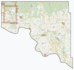
Geography[]
Communities and localities[]
The following urban municipalities are surrounded by the RM.
- Towns
- St. Walburg
- Villages
- Paradise Hill
The following unincorporated communities are within the RM.
- Organized hamlets[5]
- Localities
- Fort Pitt
- Onion Lake
The RM also surrounds Seekaskootch First Nation Indian Reserve No. 119 and borders Makaoo 120.[6]
Demographics[]
In the 2016 Census of Population conducted by Statistics Canada, the RM of Frenchman Butte No. 501 recorded a population of 1,494 living in 455 of its 544 total private dwellings, a 3.9% change from its 2011 population of 1,438. With a land area of 1,927.39 km2 (744.17 sq mi), it had a population density of 0.8/km2 (2.0/sq mi) in 2016.[4]
In the 2011 Census of Population, the RM of Frenchman Butte No. 501 recorded a population of 1,438, a 17.6% change from its 2006 population of 1,223. With a land area of 1,927.74 km2 (744.30 sq mi), it had a population density of 0.7/km2 (1.9/sq mi) in 2011.[9]
Government[]
The RM of Frenchman Butte No. 501 is governed by an elected municipal council and an appointed administrator that meets on the second Thursday of every month.[3] The reeve of the RM is Barbara Bonnie Mills-Midgley while its administrator is Mae Rotsey.[3] The RM's office is located in Paradise Hill.[3]
Transportation[]
- Rail[10]
- North Battleford - Turtleford Branch C.N.R—serves North Battleford, Hamlin, Prince, Meota, Vawn, Edam, Longstaff, Mervin, Turtleford, Cleeves, Spruce Lake, St. Walburg
- Roads[11]
- Highway 797—serves Fort Pitt and Onion Lake and Frenchman Butte
- Highway 21 --
- Highway 26—intersects Highway 3
- Highway 795 --
- Highway 3—serves Paradise Hill
See also[]
References[]
- ^ "Pre-packaged CSV files - CGN, Canada/Province/Territory (cgn_sk_csv_eng.zip)". Government of Canada. July 24, 2019. Retrieved May 23, 2020.
- ^ Jump up to: a b "Rural Municipality Incorporations (Alphabetical)". Saskatchewan Ministry of Municipal Affairs. Archived from the original on April 21, 2011. Retrieved May 9, 2020.
- ^ Jump up to: a b c d "Municipality Details: RM of Frenchman Butte No. 501". Government of Saskatchewan. Retrieved May 21, 2020.
- ^ Jump up to: a b c "Population and dwelling counts, for Canada, provinces and territories, and census subdivisions (municipalities), 2016 and 2011 censuses – 100% data (Saskatchewan)". Statistics Canada. February 8, 2017. Retrieved May 1, 2020.
- ^ "2019-2020 Rural Revenue Sharing Organized Hamlet Grant". Government of Saskatchewan. Retrieved May 4, 2020.
- ^ Municipal Relations Division - RM Boundary Changes Archived 2008-01-25 at the Wayback Machine
- ^ "Saskatchewan Census Population" (PDF). Saskatchewan Bureau of Statistics. Archived from the original (PDF) on September 24, 2015. Retrieved May 9, 2020.
- ^ "Saskatchewan Census Population". Saskatchewan Bureau of Statistics. Retrieved May 9, 2020.
- ^ "Population and dwelling counts, for Canada, provinces and territories, and census subdivisions (municipalities), 2011 and 2006 censuses (Saskatchewan)". Statistics Canada. June 3, 2019. Retrieved May 1, 2020.
- ^ Canadian Maps: January 1925 Waghorn's Guide. Post Offices in Man. Sask. Alta. and West Ontario.
- ^ Eversoft Streets and Trips
| show Places adjacent to Rural Municipality of Frenchman Butte No. 501 |
|---|
| show |
|---|
| show Division No. 17, Saskatchewan |
|---|

- Rural municipalities in Saskatchewan
- Frenchman Butte No. 501, Saskatchewan
- Division No. 17, Saskatchewan