Sør-Fron
Sør-Fron kommune | |
|---|---|
 | |
 Coat of arms  Innlandet within Norway | |
 Sør-Fron within Innlandet | |
| Coordinates: 61°34′8″N 9°55′24″E / 61.56889°N 9.92333°ECoordinates: 61°34′8″N 9°55′24″E / 61.56889°N 9.92333°E | |
| Country | Norway |
| County | Innlandet |
| District | Gudbrandsdal |
| Administrative centre | Hundorp |
| Government | |
| • Mayor (2011) | Ole Tvete Muriteigen (Sp) |
| Area | |
| • Total | 745 km2 (288 sq mi) |
| • Land | 714 km2 (276 sq mi) |
| Area rank | 147 in Norway |
| Population (2004) | |
| • Total | 3,292 |
| • Rank | 257 in Norway |
| • Density | 5/km2 (10/sq mi) |
| • Change (10 years) | −5.0% |
| Demonym(s) | Frøning[1] |
| Time zone | UTC+01:00 (CET) |
| • Summer (DST) | UTC+02:00 (CEST) |
| ISO 3166 code | NO-3438 |
| Official language form | Neutral[2] |
| Website | www |
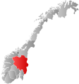
Sør-Fron is a municipality in Innlandet county, Norway. It is part of the traditional region of Gudbrandsdal. The administrative centre of the municipality is the village of Hundorp.
The old municipality of Fron was divided into Sør-Fron and Nord-Fron in 1851. In 1966, they were merged back together again, but that only lasted until 1977 when they separated once again.
General information[]
Name[]
The Old Norse form of the name was Frón. The meaning of the name is unknown (maybe "earth" or "land"). Therefore, the meaning of Sør-Fron is "(the) southern (part of) Fron", since the parish and municipality of Fron was divided in 1851. In the 19th century, it was called Søndre Fron (søndre also means 'south').[3]
Coat of arms[]
The coat of arms is from modern times (1988). The arms show the club that smashed to pieces the statue of the god Thor standing at Hundorp.
| Ancestry | Number |
|---|---|
| 85 | |
| 37 | |
| 32 | |
| 18 | |
| 16 |
Geography[]

On the north it is bordered by Nord-Fron municipality. On the west, it is bordered by Øystre Slidre. To the south it is bordered by Gausdal and Ringebu. To the east it is bordered by Folldal and Stor-Elvdal municipalities in Hedmark county.
Rondane National Park[]

Rondane National Park, which lies partially in Sør-Fron, was the first Norwegian National Park, established in 1962. In 2003, Rondane National Park was enlarged and smaller areas of nature protection were opened or enlarged adjacent to the park.
Villages include , Hundorp, Lia and Harpefoss.
Culture[]
The famous play Peer Gynt is staged annually at Lake Gålå in a mountainous region of Sør-Fron as part of a festival. The play itself is supposed to have been set in a Norwegian location such as Gålå.
Notable residents[]
- Dale-Gudbrand (1100s) an historical Norwegian Hersir, lived at a farm in Hundorp
- Ludvig Holberg, Baron of Holberg (1684–1754) a writer, philosopher, historian and playwright, brought up in Sør-Fron
- Andreas Brandrud (1868 in Sør-Fron – 1957) a Norwegian professor, theologian and church historian
- Oddvar Nygaard (1919 in Hundorp – 1985) a Norwegian accordionist and composer
References[]
- ^ "Navn på steder og personer: Innbyggjarnamn" (in Norwegian). Språkrådet.
- ^ "Forskrift om målvedtak i kommunar og fylkeskommunar" (in Norwegian). Lovdata.no.
- ^ Rygh, Oluf (1900). Norske gaardnavne: Kristians amt (in Norwegian) (4 ed.). Kristiania, Norge: W. C. Fabritius & sønners bogtrikkeri. p. 120.
- ^ "Immigrants and Norwegian-born to immigrant parents, by immigration category, country background and percentages of the population". ssb.no. Archived from the original on 15 July 2017. Retrieved 29 June 2015.
External links[]
 Media related to Sør-Fron at Wikimedia Commons
 The dictionary definition of Sør-Fron at Wiktionary
- Municipal fact sheet from Statistics Norway
 Oppland travel guide from Wikivoyage
 Gudbrandsdalen travel guide from Wikivoyage
- Sør-Fron
- Municipalities of Oppland


