San Juan Capistrano, California
San Juan Capistrano | |
|---|---|
City | |
| City of San Juan Capistrano | |
    Top and middle: Mission San Juan Capistrano; Bottom left: Mission Basilica of San Juan Capistrano; Bottom right: Old Town San Juan Capistrano | |
 Seal | |
| Motto(s): "Preserving The Past To Enhance The Future" | |
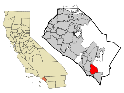 Location of San Juan Capistrano within Orange County, California. | |
 San Juan Capistrano Location in the United States | |
| Coordinates: 33°29′58″N 117°39′42″W / 33.49944°N 117.66167°WCoordinates: 33°29′58″N 117°39′42″W / 33.49944°N 117.66167°W | |
| Country | United States |
| State | California |
| County | Orange |
| Incorporated | April 19, 1961[1] |
| Named for | Giovanni da Capistrano |
| Government | |
| • Type | Council-Manager |
| • City council[2] | Mayor John Taylor, Mayor Pro Tem Derek Reeve, Sergio Farias, and Troy Bourne Howard Hart |
| • City manager[3] | Benjamin Siegel |
| Area | |
| • Total | 14.43 sq mi (37.37 km2) |
| • Land | 14.43 sq mi (37.37 km2) |
| • Water | 0.00 sq mi (0.00 km2) 1.26% |
| Elevation | 121 ft (37 m) |
| Population | |
| • Total | 34,593 |
| • Estimate (2019)[7] | 35,911 |
| • Density | 2,488.63/sq mi (960.84/km2) |
| Time zone | UTC-8 (Pacific) |
| • Summer (DST) | UTC-7 (PDT) |
| ZIP code | 92675 |
| Area code | 949 |
| FIPS code | 06-68028 |
| GNIS feature IDs | 1661383, 2411793 |
| Website | sanjuancapistrano.org |

San Juan Capistrano (/sæn ˌwɑːn kæpɪˈstrɑːnoʊ/; Spanish: [saŋ ˈxwaŋ kapisˈtɾano]; Spanish for '"Saint John of Capestrano"') is a city in Orange County, California, United States. The current Office of Management and Budget metropolitan designation for San Juan Capistrano and the Orange County area is Santa Ana–Anaheim–Irvine, CA. The population was 34,593 at the 2010 census, up from 33,826 at the 2000 census.
History[]

San Juan Capistrano is the site of a Catholic mission for which it is named, Mission San Juan Capistrano. At the time the Mission was founded in 1776, the region was populated by the Acjachemen band of Native Americans, called Juaneños by the Spanish. They had resided in the area for approximately 10,000 years. The mission was named after Giovanni da Capistrano (1386–1456), the Franciscan saint from Capestrano, in the Italian region of Abruzzo.
The city is the site of California's oldest post-colonial residential neighborhood, Los Rios. It is also the home of the oldest in-use building in California, the Serra Chapel in the Mission. The area was the site of both the first vineyard and first winery in California.
Demographics[]
| Historical population | |||
|---|---|---|---|
| Census | Pop. | %± | |
| 1880 | 376 | — | |
| 1960 | 1,120 | — | |
| 1970 | 3,781 | 237.6% | |
| 1980 | 18,959 | 401.4% | |
| 1990 | 26,183 | 38.1% | |
| 2000 | 33,826 | 29.2% | |
| 2010 | 34,593 | 2.3% | |
| 2019 (est.) | 35,911 | [7] | 3.8% |
| U.S. Decennial Census[8] | |||
2010[]
At the 2010 census San Juan Capistrano had a population of 34,593. The population density was 2,419.9 people per square mile (934.3/km2). The racial makeup of San Juan Capistrano was 26,664 (77.1%) White (55.8% Non-Hispanic White),[9] 193 (0.6%) African American, 286 (0.8%) Native American, 975 (2.8%) Asian, 33 (0.1%) Pacific Islander, 5,234 (15.1%) from other races, and 1,208 (3.5%) from two or more races. Hispanic or Latino of any race were 13,388 persons (38.7%).[10]
The census reported that 34,506 people (99.7% of the population) lived in households, and 87 (0.3%) lived in non-institutionalized group quarters.
There were 11,394 households, 4,030 (35.4%) had children under the age of 18 living in them, 6,706 (58.9%) were opposite-sex married couples living together, 1,089 (9.6%) had a female householder with no husband present, 526 (4.6%) had a male householder with no wife present. There were 456 (4.0%) unmarried opposite-sex partnerships, and 87 (0.8%) same-sex married couples or partnerships. 2,381 households (20.9%) were one person and 1,407 (12.3%) had someone living alone who was 65 or older. The average household size was 3.03. There were 8,321 families (73.0% of households); the average family size was 3.44.
The age distribution was 8,518 people (24.6%) under the age of 18, 3,066 people (8.9%) aged 18 to 24, 7,804 people (22.6%) aged 25 to 44, 9,792 people (28.3%) aged 45 to 64, and 5,413 people (15.6%) who were 65 or older. The median age was 40.2 years. For every 100 females, there were 98.3 males. For every 100 females age 18 and over, there were 96.7 males.
There were 11,940 housing units at an average density of 835.2 per square mile, of the occupied units 8,462 (74.3%) were owner-occupied and 2,932 (25.7%) were rented. The homeowner vacancy rate was 1.3%; the rental vacancy rate was 4.7%. 24,052 people (69.5% of the population) lived in owner-occupied housing units and 10,454 people (30.2%) lived in rental housing units.
According to the 2010 United States Census, San Juan Capistrano had a median household income of $75,356, with 12.7% of the population living below the federal poverty line.[9]
2000[]
As of the census of 2000, there were 33,826 people in 10,930 households, including 8,196 families, in the city. The population density was 2,381.2 inhabitants per square mile (919.1/km2). There were 11,320 housing units at an average density of 307.6 persons/km2 (796.9 persons/mi2). The racial makeup of the city was 78.47% White, 0.78% African American, 1.07% Native American, 1.92% Asian, 0.11% Pacific Islander, 14.21% from other races, and 3.43% from two or more races. 33.13% of the population were Hispanic or Latino of any race.
Of the 10,930 households, 39.9% had children under the age of 18 living with them, 62.7% were married couples living together, 8.5% had a female householder with no husband present, and 25.0% were non-families. 19.7% of households were one person and 10.3% were one person aged 65 or older. The average household size was 3.06 and the average family size was 3.45.
The age distribution was 28.1% under the age of 18, 7.8% from 18 to 24, 27.3% from 25 to 44, 23.7% from 45 to 64, and 13.1% 65 or older. The median age was 36 years. For every 100 females, there were 96.9 males. For every 100 females age 18 and over, there were 94.0 males.
The median household income was $62,392 and the median family income was $69,481. Males had a median income of $47,574 versus $34,821 for females. The per capita income for the city was $29,926. About 10.7% of the population and 6.6% of families were below the poverty line, including 14.8% of those under age 18 and 4.2% of those age 65 or over.[11][12]
Government[]
As of 2021, the City Council members are: John Taylor, (Mayor), Derek Reeve, (Mayor Pro Tem), Sergio Farias, Howard Hart, and Troy Bourne.[13] The current city manager is Benjamin Siegel.[3]
In the California State Legislature, San Juan Capistrano is in the 36th Senate District, represented by Republican Patricia Bates, and in the 73rd Assembly District, represented by Republican Laurie Davies.[14]
In the United States House of Representatives, San Juan Capistrano is in California's 49th congressional district, represented by Democrat Mike Levin.[15]
Geography and climate[]
San Juan Capistrano is located in south Orange County and is bisected by Interstate 5. 33°29′58″N 117°39′42″W / 33.49944°N 117.66167°W (33.499493, -117.661614).[16]
According to the United States Census Bureau, the city has a total area of 14.3 square miles (37 km2). 14.1 square miles (37 km2) of it is land and 0.1 square miles (0.26 km2) of it (1.26%) is water.
| hideClimate data for San Juan Capistrano, California | |||||||||||||
|---|---|---|---|---|---|---|---|---|---|---|---|---|---|
| Month | Jan | Feb | Mar | Apr | May | Jun | Jul | Aug | Sep | Oct | Nov | Dec | Year |
| Record high °F (°C) | 93 (34) |
94 (34) |
96 (36) |
101 (38) |
101 (38) |
107 (42) |
110 (43) |
104 (40) |
116 (47) |
108 (42) |
99 (37) |
93 (34) |
116 (47) |
| Average high °F (°C) | 69 (21) |
69 (21) |
72 (22) |
75 (24) |
79 (26) |
83 (28) |
88 (31) |
90 (32) |
88 (31) |
82 (28) |
74 (23) |
68 (20) |
78 (26) |
| Average low °F (°C) | 47 (8) |
47 (8) |
50 (10) |
53 (12) |
57 (14) |
61 (16) |
66 (19) |
67 (19) |
64 (18) |
58 (14) |
51 (11) |
46 (8) |
56 (13) |
| Record low °F (°C) | 25 (−4) |
30 (−1) |
32 (0) |
33 (1) |
39 (4) |
44 (7) |
48 (9) |
47 (8) |
45 (7) |
38 (3) |
35 (2) |
28 (−2) |
25 (−4) |
| Average precipitation inches (mm) | 3.05 (77) |
3.31 (84) |
1.83 (46) |
0.83 (21) |
0.37 (9.4) |
0.12 (3.0) |
0.12 (3.0) |
0.12 (3.0) |
0.24 (6.1) |
0.61 (15) |
0.83 (21) |
2.20 (56) |
13.63 (344.5) |
| Source: [17][18] | |||||||||||||
Economy[]


For detailed information on San Juan Capistrano's economy, see the city's 2018 Comprehensive Annual Financial Report.
San Juan Capistrano is home to over 1,700 businesses. The city's unemployment rate was at 3.7% as of December 2017.[19]
Top employers[]
According to the city's Comprehensive Annual Financial Report from June 30, 2020,[20] the largest employers in the city are:
| # | Employer | # of employees |
|---|---|---|
| 1 | Capistrano Unified School District | 3,841 |
| 2 | St. Margaret's Episcopal School | 429 |
| 3 | Costco | 337 |
| 4 | Ensign Services | 228 |
| 5 | Brookdale San Juan Capistrano | 169 |
| 6 | JSerra Catholic High School | 145 |
| 7 | Fluidmaster Inc. HQ | 130 |
| 8 | Marbella Country Club | 106 |
| 9 | Target | 100 |
| 10 | Capistrano Connections Academy | 100 |
The City of San Juan Capistrano employs approximately 93 people.[19]
The Cliff Swallows of Capistrano[]

San Juan Capistrano is also known for its cliff swallows. The protected birds return during migration, which originates in the town of Goya, Argentina, around St. Joseph's Day (March 19) each year. The day is celebrated by the city's annual Swallows' Day Parade and other festive events.[21] The swallows leave around October 23, the former feast day of St. John of Capistrano. The 1940 hit song "When the Swallows Come Back to Capistrano", written by Leon René, is a love song inspired by this annual event.
From 2009 to 2017, the famous swallows did not return to San Juan Capistrano.[22] They instead began migrating to and nesting in the Chino Hills of Southern California, north of San Juan Capistrano. They built their mud nests in the eaves of the Vellano Country Club, situated around a golf course in the Chino Hills just north of the Chino Hills State Park. Mission San Juan Capistrano officials stated that the swallows changed their route because the mission is no longer the tallest building in the area due to urban sprawl, and thus stopped attracting the swallows for nesting.[23]
Realizing the city's famous birds were no longer returning home, members of the Mission San Juan Capistrano enlisted the help of Dr. Charles R. Brown,[24] a cliff swallows specialist from the University of Tulsa. In 2012, the first phase of a two-step process began, where the sounds and calls of the cliff swallows were played throughout the mission to lure the birds back home. In 2015, the project continued with the second phase where a replica wall of man-made colonies was built to give the birds a nest to return to. The nests were built to be very similar to the original nests made in the mission, prior to the early 1900s re-stabilization. As of summer of 2017, the cliff swallows have returned home to Mission San Juan Capistrano and are still celebrated each year at the town's annual Swallows Day Parade and Mercado Street Fair.
In 2018, the town celebrated its 80th annual Swallows Day Parade and Mercado Street Fair put on by the San Juan Capistrano Fiesta Association.[25] The parade is the end celebration of a three-month Fiesta de las Golondrinas where the town puts on events to commemorate the migration home of the songbirds. The parade shuts down a portion of the downtown area to make way for floats, horses, and people walking in the parade. The event holds the title of being the longest-running and largest non-motorized parade west of the Mississippi.
In 2020, the Mission canceled its annual celebration due to the outbreak of COVID-19.[26]
Education[]

San Juan Capistrano is served by Capistrano Unified School District. In the 2007–08 academic year, San Juan Hills High School opened with about 600 freshman students. It is the city's only public high school, although a sizeable portion of San Juan Capistrano's residents attend high schools in neighboring cities since the schools in most of its neighboring cities are also under Capistrano Unified School District which is the second largest school district in Orange County.
San Juan has four public elementary schools (grades K–5): Del Obispo Elementary School, Harold Ambuehl Elementary School, Kinoshita Elementary School, and San Juan Elementary School. The local public middle school (grades 6–8) is Marco Forster Middle School. Capistrano Valley High School (grades 9–12) lies just outside of the city's borders, but serves many of the city's students.
A public continuation high school, Junipero Serra High School, also serves the area. Not to be confused with the Catholic school to the north, the Serra High School is a campus dedicated to helping adults finish their pre-collegiate educational goals.
San Juan also has six private, non-secular schools. (grades pre-K – 12), Saddleback Valley Christian School (grades pre-K – 12), St. Margaret's Episcopal School (grades pre-K – 12), and JSerra Catholic High School (grades 9–12). Mission Basilica School (grades K–8) is located on the historic Mission grounds, utilizes some of the historic buildings as classrooms, and is part of Mission Basilica San Juan Capistrano. The other is Rancho Capistrano Christian School (grades K–8), located off Interstate 5 on Saddleback Church's south campus.
San Juan also has a private, secular school, Fairmont School[27] (grade K - 12), located close to San Juan Capistrano Mission.
Transportation[]
Buses[]
The Orange County Transportation Authority (OCTA) operates bus routes within the city, connecting it to other parts of Orange County.
Rail[]
The San Juan Capistrano station is served by Amtrak and Metrolink. The station is located one block away from the historic San Juan Capistrano Mission next to Los Rios Street in downtown San Juan Capistrano. Its proximity to the city's tourist attractions makes it a popular stop during the summer months.
Highways[]
![]() Interstate 5 has three interchanges completely located in the city (at Camino Capistrano, SR 74/Ortega Highway, and Junipero Serra Road), two interchanges partially located within the city (at SR 1/Camino las Ramblas (which is partially within Dana Point) as well as SR 73 (which is partially within Mission Viejo)), and an additional northbound entrance ramp from Stonehill Drive and Camino Capistrano.
Interstate 5 has three interchanges completely located in the city (at Camino Capistrano, SR 74/Ortega Highway, and Junipero Serra Road), two interchanges partially located within the city (at SR 1/Camino las Ramblas (which is partially within Dana Point) as well as SR 73 (which is partially within Mission Viejo)), and an additional northbound entrance ramp from Stonehill Drive and Camino Capistrano.
![]() Pacific Coast Highway is one of the most notable state routes in California. It officially terminates at Interstate 5 near the border between San Juan Capistrano and Dana Point. There is an official SR 1 terminus sign on a traffic light pole along the southbound lanes on SR 1 shortly after crossing under Interstate 5. It is where the northbound exit from I-5 intersects Camino las Ramblas and is within San Juan Capistrano city limits.
Pacific Coast Highway is one of the most notable state routes in California. It officially terminates at Interstate 5 near the border between San Juan Capistrano and Dana Point. There is an official SR 1 terminus sign on a traffic light pole along the southbound lanes on SR 1 shortly after crossing under Interstate 5. It is where the northbound exit from I-5 intersects Camino las Ramblas and is within San Juan Capistrano city limits.
![]() California State Route 73 southbound terminates at I-5 in San Juan Capistrano, while the northbound direction begins at I-5. There are no exits along SR 73 in San Juan Capistrano other than its junction with Interstate 5.
California State Route 73 southbound terminates at I-5 in San Juan Capistrano, while the northbound direction begins at I-5. There are no exits along SR 73 in San Juan Capistrano other than its junction with Interstate 5.
![]() California State Route 74 has its official western terminus at Interstate 5 in San Juan Capistrano. The city-maintained road that continues west as Ortega Highway originally terminated at Camino Capistrano in front of Mission San Juan Capistrano; however, interchange reconstruction that was completed in 2015 brought Ortega Highway to continue onto Del Obispo Street towards Dana Point, with a right turn required to stay on the older portion of Ortega Highway.[28]
California State Route 74 has its official western terminus at Interstate 5 in San Juan Capistrano. The city-maintained road that continues west as Ortega Highway originally terminated at Camino Capistrano in front of Mission San Juan Capistrano; however, interchange reconstruction that was completed in 2015 brought Ortega Highway to continue onto Del Obispo Street towards Dana Point, with a right turn required to stay on the older portion of Ortega Highway.[28]
![]() California State Route 241, which originally terminated at Oso Parkway between Las Flores and Coto de Caza, was extended roughly 4 miles to Cow Camp Road in the community of Rancho Mission Viejo, which is located just east of the city limits.
California State Route 241, which originally terminated at Oso Parkway between Las Flores and Coto de Caza, was extended roughly 4 miles to Cow Camp Road in the community of Rancho Mission Viejo, which is located just east of the city limits.
![]() The original route of U.S. 101 ran through downtown San Juan Capistrano on what is now Camino Capistrano. It was decommissioned when Interstate 5 was completed in the 1950s.
The original route of U.S. 101 ran through downtown San Juan Capistrano on what is now Camino Capistrano. It was decommissioned when Interstate 5 was completed in the 1950s.
Points of interest[]

- Mission San Juan Capistrano
- Mission Basilica San Juan Capistrano
- Ortega's Capistrano Trading Post
- Richard Egan House
- San Juan Creek
- Trabuco Creek
- El Adobe de Capistrano
- The Depot
- Los Rios District
Sister cities[]
- Capestrano, Italy
- Goya, Argentina[29]
Notable people[]
- Austin Hedges, San Diego Padres
- Kyle Hendricks, Chicago Cubs
- Anthony Cumia, radio host and podcaster
- Norm Sherry (1931–2021), catcher, manager, and coach in Major League Baseball
Media[]
San Juan Capistrano is served by two newspapers, the Capistrano Valley News (owned by the Orange County Register) and The Capistrano Dispatch. The Capistrano Valley News runs once weekly on Thursdays and The Dispatch runs on the second and fourth Fridays of each month.
The San Juan Capistrano Patch, an online-only news website, also serves the city.
See also[]
- San Juan Capistrano (Amtrak station)
References[]
- ^ "California Cities by Incorporation Date". California Association of Local Agency Formation Commissions. Archived from the original (Word) on November 3, 2014. Retrieved August 25, 2014.
- ^ "Mayor and City Council". City of San Juan Capistrano. Retrieved May 10, 2018.
- ^ Jump up to: a b "City Manager". City of San Juan Capistrano. Retrieved January 12, 2021.
- ^ "2019 U.S. Gazetteer Files". United States Census Bureau. Retrieved July 1, 2020.
- ^ "San Juan Capistrano". Geographic Names Information System. United States Geological Survey. Retrieved October 23, 2014.
- ^ "San Juan Capistrano (city) QuickFacts". United States Census Bureau. Archived from the original on March 11, 2015. Retrieved February 26, 2015.
- ^ Jump up to: a b "Population and Housing Unit Estimates". United States Census Bureau. May 24, 2020. Retrieved May 27, 2020.
- ^ "Census of Population and Housing". Census.gov. Retrieved June 4, 2015.
- ^ Jump up to: a b "San Juan Capistrano (city), California". quickfacts.census.gov. July 8, 2014. Archived from the original on March 11, 2015. Retrieved September 30, 2014.
- ^ "2010 Census Interactive Population Search: CA - San Juan Capistrano city". U.S. Census Bureau. Archived from the original on July 15, 2014. Retrieved July 12, 2014.
- ^ "San Juan Capistrano city, California - Fact Sheet - American FactFinder". U.S. Census Bureau. Archived from the original on February 12, 2020. Retrieved June 27, 2010.
- ^ "California by Placae - GCT-PH1, Population, Housing Units, Area, and Density: 2000". U.S. Census Bureau. Archived from the original on February 12, 2020. Retrieved June 27, 2010.
- ^ "Mayor and City Council". City of San Juan Capistrano. Retrieved January 12, 2021.
- ^ "Statewide Database". UC Regents. Archived from the original on February 1, 2015. Retrieved November 23, 2014.
- ^ "California's 49th Congressional District - Representatives & District Map". Civic Impulse, LLC.
- ^ "US Gazetteer files: 2010, 2000, and 1990". United States Census Bureau. February 12, 2011. Retrieved April 23, 2011.
- ^ "Records and Averages for San Juan Capistrano, CA". Retrieved February 26, 2021.
- ^ "San Juan Capistrano, CA Historical Information". Retrieved February 26, 2021.
- ^ Jump up to: a b City of San Juan Capistrano CAFR
- ^ "Comprehensive Annual Financial Report for the Fiscal Year Ended June 30, 2020". City of San Juan Capistrano. Retrieved August 2, 2021.
- ^ "Swallows Parade". Archived from the original on October 15, 2007. Retrieved November 2, 2007.
- ^ Esquivel, Paloma (March 25, 2009). "Another year without swallows – Festival goes on without birds at historic mission". The Boston Globe. Boston. Retrieved September 30, 2014.
- ^ "Famed swallows of Capistrano nest in country club". The Associated Press (via Southern Carolina Public Radio). New York City. June 7, 2010. Retrieved September 30, 2014.
- ^ "Swallows Legend - Mission San Juan Capistrano". Mission San Juan Capistrano. Retrieved May 13, 2018.
- ^ "San Juan Capistrano Fiesta Association". San Juan Capistrano Fiesta Association. Retrieved May 13, 2018.
- ^ "Saint Joseph's Day and The Return of the Swallows Celebration". Mission San Juan Capistrano. Retrieved March 21, 2020.
- ^ "Private School In San Juan Capistrano, CA - Pre-K-12th | Fairmont Schools". Retrieved April 2, 2021.
- ^ https://www.thecapistranodispatch.com/ortega-highway-construction-nearing-end/
- ^ Capistrano: The swallows of Goya
- ^ Dean, William. "Before Ortega's Trading Post..." San Juan Capistrano Patch. Patch. Retrieved September 16, 2018.
External links[]
| show Places adjacent to San Juan Capistrano, California |
|---|
| show Municipalities and communities of Orange County, California, United States |
|---|

| show Greater Los Angeles Area |
|---|

| show Authority control |
|---|
- San Juan Capistrano, California
- 1961 establishments in California
- Cities in Orange County, California
- Incorporated cities and towns in California
- Populated places established in 1776
- Spanish mission settlements in North America