Ubon Ratchathani Province
This article needs additional citations for verification. (April 2013) |
Ubon Ratchathani
อุบลราชธานี | |
|---|---|
From left to right, top to bottom : Pha Taem National Park, Wat Phra That Nong Bua, Prasat Ban Ben, Sam Phan Bok, Ubon Ratchathani University, Thung Si Mueang | |
 Flag  Seal | |
| Nickname(s): Ubon | |
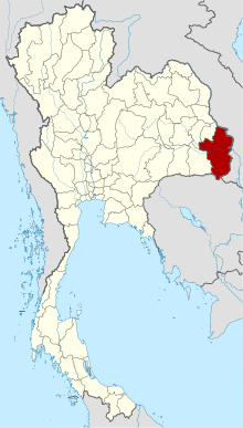 Map of Thailand highlighting Ubon Ratchathani Province | |
| Country | Thailand |
| Capital | Mueang Ubon Ratchathani |
| Government | |
| • Governor | Sarit Withun |
| Area | |
| • Total | 15,626 km2 (6,033 sq mi) |
| Area rank | Ranked 5th |
| Population (2019)[2] | |
| • Total | 1,878,146 |
| • Rank | Ranked 3rd |
| • Density | 120/km2 (300/sq mi) |
| • Density rank | Ranked 41st |
| Human Achievement Index | |
| • HAI (2017) | 0.5586 "low" Ranked 62nd |
| Time zone | UTC+7 (ICT) |
| Postal code | 34xxx |
| Calling code | 045 |
| ISO 3166 code | TH-34 |
| Website | www |


Ubon Ratchathani (Thai: อุบลราชธานี, pronounced [ʔù.bōn râːt.t͡ɕʰā.tʰāː.nīː]), often shortened to Ubon (อุบลฯ), is one of Thailand's seventy-six provinces lies in lower northeastern Thailand also called Isan. Ubon is about 630 km (390 mi) from Bangkok.[4] Neighboring Provinces are (from west clockwise) Sisaket, Yasothon, and Amnat Charoen. To the north and east it borders Salavan and Champasak of Laos, to the south Preah Vihear of Cambodia.
Geography[]

At Khong Chiam the Mun River, the biggest river of the Khorat Plateau, joins the Mekong, which forms the northeastern boundary of Thailand with Laos. It is called "Maenam Song Si" or the "Mun River alluvium" because the brown water from Mekong River mixes with the blue water of the Mun. It is about 84 km (52 mi) from Ubon Ratchathani city centre.[5]
The area in the Dângrêk Mountains where the borders of the three countries, Thailand, Laos, and Cambodia meet is promoted as the "Emerald Triangle", in contrast to the "Golden Triangle" in the north of Thailand. "Emerald" refers to the largely intact monsoon forests there. The total forest area is 2,808 km2 (1,084 sq mi) or 18 percent of provincial area.[1]
History[]
Ayutthaya and Thonburi periods[]
On the bank of the Mun River around 1767, Chao Phra Wo and Chao Phra Ta of Vientiane, had a conflict with Chao Siri Bun San, the ruler of Vientiane. And persuaded troops to evacuate across the Mekong and fled to settle in Nong Bua Lam Phu and named the city "Khuen Kan Kab Kaew Bua Ban". Chao Siri Bun San accused Chao Phra Wo and Chao Phra Ta think of rebellion and sent an army to subdue, but lost to the people of the Chao Phra Wo and Chao Phra Ta every time. The battle for up to 3 years, Chao Phra Wo and Chao Phra Ta saw that their army was not enough, therefore went to ask the Burma Army to help, but Burma returned to help Chao Siri Bun San and attacked the city of Khuen Kan Kab Kaew Bua Ban, causing Chao Phra Ta die, Chao Phra Wo and the rest of the people, they fled down to depend on Chao Nakhon Champasak. Later, migrated and moved back to the Don Mod Daeng on the banks of the Mun River, when Chao Siri Bun San found out about him, he attacked Don Mod Daeng, then surrounded Chao Phra Wo and Chao Phra Wo was executed.
Thao Kam son of Chao Phra Wo, Kham Pong and Thao Thidprom the son of Chao Phra Ta escaped. And informed to Nakhon Ratchasima to King Taksin to ask for help. King Taksin has raised the army to hit Champasak and Vientiane in 1778, Nakhon Champasak is therefore a royal country directly to Krung Thonburi since then. Later, when Somdej Phraya Maha Kasatsuek ascended the throne, Phra Pratum therefore asked the King to move his family to hometown at Ban Huai Chae Ramae. Later, King Rama I raised the status of Ban Huai Chae Ramae to be the city of "Ubon Ratchathani" in 1792.
Rattanakosin Period[]
After the founding of Ubon Ratchathani, there was an important city in the county of Ubon Ratchathani province, many more cities such as in 1814, set up Ban Khok Phaniang to be a city of Khemarat Thani.
In 1823, raised a village to create a city of Mekong Chiang (Khong Chiam), depending on the city of Champasak.
In 1845 in the reign of King Rama III, has raised Ban Chong Nang to be a city of Senangkhanikhom and raised a Ban Nam Dome Yai into Det Udom.
In 1847, set up a Dong Krua or Ban Rai became city of Bua Kan. Later, changed to Bua Buntharik city or the current Buntharik District.
In 1863 in the reign of King Rama IV, set up a Ban Kwang Lam Chado to became the city of Phibun Mangsahan and set up Ban Sapue to became the city of Trakan Phuet Phon.
In 1879 in the reign of King Rama V, set up Ban Tha Yak Ku as a city of Chanuman and set up Ban Phra Lao as a city of Phana Nikhom.
In 1880, set up Warin Chamrap.
In 1881, set up Muang Dome Pradit.
In 1882, set up Ban Kasem Sima, which later changed to Muang Sam Sip District.
In 1933, the entire county was abolished, Ubon Ratchathani then becomes the Ubon Ratchathani province until the present.
Ubon Ratchathani was the largest province of Thailand by area until 1972.
Yasothon was split off from Ubon Ratchathani in 1972, followed by Amnat Charoen in 1993.
Symbols[]
The provincial seal shows a Lotus flower in a pond. This alludes to the meaning of the name of the province, which translates to 'royal city of the lotus flower'. The provincial flower is the lotus (Nymphaea lotus). The provincial tree is the Yang-na (Dipterocarpus alatus).
Economy[]
Ubon Ratchathani is the nation's leading rice-producing province. It earns more than 10 billion baht a year from rice sales.[6]
National parks[]

Ubon Ratchathani boasts the following national parks:
- Phu Chong–Na Yoi National Park is in the mountainous southern region of the province.[7]
- Kaeng Tana National Park is in Khong Chiam District.[8]
- Pha Taem National Park covers an area of 140 km2 (54 sq mi). Plateaus and hills dominate the park landscape. The sheer cliffs here are a result of earthquakes. The interesting places in the national park are Pha Taem and Pha Kham. On the cliffs surfaces are numerous prehistoric cave paintings from 3,000 to 4,000 years ago. These paintings depict scenes of fishing, rice farming, figures of people, animals, hands and geometric designs that depict life during the pre-historic time and reflect the ancient lifestyle of the people who lived there.[9][10]
Health[]
The main hospital of Ubon Ratchathani Province is Sunpasitthiprasong Hospital.
Transportation[]
Air[]

Ubon Ratchathani is served by Ubon Ratchathani Airport.
Rail[]
Ubon Ratchathani Railway Station is the main railway station in Ubon Ratchathani.
Education[]
Ubon Ratchathani Province is the home of Ubon Ratchathani University.
Administrative divisions[]
Provincial government[]

The province is divided into 25 districts (amphoe). The districts are further divided into 219 subdistricts (tambons) and 2,469 villages (mubans).
|
|
Municipalities[]
| No. | City/Town | Thai | Urban Population[11] | Notes |
|---|---|---|---|---|
| 1. | Ubon Ratchathani | เทศบาลนครอุบลราชธานี | 79,023 | |
| 2. | เทศบาลเมืองแจระแม | 11,092 | ||
| 3. | เทศบาลตำบลขามใหญ่ | 34,538 | ||
| 4. | เทศบาลเมืองวารินชำราบ | 28,154 | ||
| 5. | เทศบาลตำบลแสนสุข | 24,720 | ||
| 6. | เทศบาลเมืองเดชอุดม | 14,264 | ||
| 7. | เทศบาลตำบลกุดประทาย | 13,382 | ||
| 8. | เทศบาลตำบลคอแลน | 12,703 | ||
| 9. | เทศบาลตำบลเทพวงศา | |||
| 10. | เทศบาลเมืองพิบูลมังสาหาร | 10,842 | ||
| 11. | เทศบาลตำบลปทุม | 10,505 | ||
| 12. | เทศบาลตำบลหนองผือ | 9,685 | ||
| 13. | เทศบาลตำบลตระการ | 9,082 | ||
| 14. | เทศบาลตำบลน้ำยืน | 9,542 | ||
| 15. | เทศบาลตำบลขามป้อม | 9,209 | ||
| 16. | เทศบาลตำบลนิมคมสร้างตนเองลำโดมน้อย | 7,538 | ||
| 17. | เทศบาลตำบลนาจะหลวย | 7,470 | ||
| 18. | เทศบาลตำบลบัวงาม | 7,086 | ||
| 19. | Na Yia | เทศบาลตำบลนาเยีย | 6,730 | |
| 20. | เทศบาลตำบลเขมราฐ | 6,288 | ||
| 21. | Ubon | เทศบาลตำบลอุบล | 6,101 | |
| 22. | เทศบาลตำบลเขื่องใน | 4,751 | ||
| 23. | เทศบาลตำบลบุณฑริก | 4,607 | ||
| 24. | เทศบาลตำบลศรีเมืองใหม่ | 4,284 | ||
| 25. | เทศบาลตำบลกุดข้าวปุ้น | 4,124 | ||
| 26. | เทศบาลตำบลช่องเม็ก | 3,628 | ||
| 27. | เทศบาลตำบลม่วงสามสิบ | 3,358 | ||
| 28. | เทศบาลตำบลห้วยขะยูง | 3,346 | ||
| 29. | เทศบาลตำบลอ่างศิลา | 3,304 | ||
| 30. | เทศบาลตำบลตาลสุม | 3,267 | ||
| 31. | เทศบาลตำบลนาส่วง | 3,215 | ||
| 32. | เทศบาลตำบลโพธิ์ไทร | 3,100 | ||
| 33. | เทศบาลตำบลบ้านด่านโขงเจียม | 2,741 | ||
| 34. | เทศบาลตำบลหัวนา | N/A | ||
| 35. | เทศบาลตำบลเมืองศรีไค | N/A | ||
| 36. | เทศบาลตำบลธาตุ | N/A |
Local government[]
As of 26 November 2019 there are:[12] one Ubon Ratchathani Provincial Administration Organisation (ongkan borihan suan changwat) and 60 municipal (thesaban) areas in the province. Ubon Ratchathani has city (thesaban nakhon) status. Chaeramae, Det Udom, Phibun Mangsahan and Warin Chamrap have town (thesaban mueang) status. Further 54 subdistrict municipalities (thesaban tambon). The non-municipal areas are administered by 179 Subdistrict Administrative Organisations - SAO (ongkan borihan suan tambon).[2]
Human achievement index 2017[]
| Health | Education | Employment | Income |
| 66 | 72 | 63 | 65 |
| Housing | Family | Transport | Participation |

|
 |

|
|
| 12 | 7 | 29 | 33 |
| Province Ubon Ratchathani, with an HAI 2017 value of 0.5586 is "low", occupies place 62 in the ranking. | |||
Since 2003, United Nations Development Programme (UNDP) in Thailand has tracked progress on human development at sub-national level using the (HAI), a composite index covering all the eight key areas of human development. National Economic and Social Development Board (NESDB) has taken over this task since 2017.[3]
| Rank | Classification |
| 1 - 15 | "high" |
| 16 - 30 | "somewhat high" |
| 31 - 45 | "average" |
| 45 - 60 | "somewhat low" |
| 61 - 77 | "low" |
| showMap with provinces and HAI 2017 rankings |

Gallery[]

Wat Tham Heo Sin Chai

Sao Chaliang or mushroom-like sandstone pillars, dated from the Cretaceous and Jurassic periods, Pha Taem National Park

Wat Sirindhorn Wararam Phu Phrao, Sirindhorn District


Sister cities[]
References[]
- ^ Jump up to: a b "ตารางที่ 2 พี้นที่ป่าไม้ แยกรายจังหวัด พ.ศ.2562" [Table 2 Forest area Separate province year 2019]. Royal Forest Department (in Thai). 2019. Retrieved 6 April 2021, information, Forest statistics Year 2019, Thailand boundary from Department of Provincial Administration in 2013CS1 maint: postscript (link)
- ^ Jump up to: a b รายงานสถิติจำนวนประชากรและบ้านประจำปี พ.ส.2562 [Statistics, population and house statistics for the year 2019]. Registration Office Department of the Interior, Ministry of the Interior. stat.bora.dopa.go.th (in Thai). 31 December 2019. Retrieved 26 February 2020.
- ^ Jump up to: a b Human achievement index 2017 by National Economic and Social Development Board (NESDB), pages 1-40, maps 1-9, retrieved 14 September 2019, ISBN 978-974-9769-33-1
- ^ "Ubon Ratchathani". Tourism Authority of Thailand (TAT). Retrieved 18 August 2018.
- ^ "Maenam Song Si". Tourist Authority of Thailand (TAT). Archived from the original on 2015-09-12. Retrieved 18 May 2015.
- ^ Wipatayotin, Apinya (18 August 2018). "How to pad farmers' pockets". Bangkok Post. Retrieved 18 August 2018.
- ^ "Phu Chong Na Yoi National Park". Tourist Authority of Thailand (TAT). Retrieved 18 August 2018.
- ^ "Kaeng Tana National Park". Tourist Authority of Thailand (TAT). Retrieved 18 August 2018.
- ^ "Pha Taem National Park". Tourist Authority of Thailand (TAT). Retrieved 18 August 2018.
- ^ Pawaputanon, Oopatham (May 2007). "An Introduction to the Mekong Fisheries of Thailand" (PDF). Mekong Development Series No. 5. Vientiane: Mekong River Commission. ISSN 1680-4023. Retrieved 18 May 2015.
- ^ Department of Provincial Administration (2014). "Official Statistics Registration System". Retrieved November 10, 2015.[failed verification]
- ^ "Number of local government organizations by province". dla.go.th. Department of Local Administration (DLA). 26 November 2019. Retrieved 10 December 2019.
75 Ubon Ratchathani: 1 PAO, 1 City mun., 4 Town mun., 54 Subdistrict mun., 179 SAO.
External links[]
 Ubon Ratchathani travel guide from Wikivoyage
| Wikimedia Commons has media related to Ubon Ratchathani Province. |
| show Places adjacent to Ubon Ratchathani Province |
|---|
Coordinates: 15°13′46″N 104°51′04″E / 15.22944°N 104.85111°E

| show Authority control |
|---|
- Ubon Ratchathani Province
- Provinces of Thailand