Wintersburg, Arizona
Wintersburg, Arizona | |
|---|---|
 Wintersburg Post Office-1931 | |
 Location of Wintersburg in Maricopa County, Arizona. | |
 Wintersburg, Arizona Location in the United States | |
| Coordinates: 33°25′28″N 112°52′05″W / 33.42444°N 112.86806°WCoordinates: 33°25′28″N 112°52′05″W / 33.42444°N 112.86806°W | |
| Country | United States |
| State | Arizona |
| County | Maricopa |
| Area | |
| • Total | 0.49 sq mi (1.28 km2) |
| • Land | 0.49 sq mi (1.28 km2) |
| • Water | 0.00 sq mi (0.00 km2) |
| Elevation | 1,008 ft (307 m) |
| Population (2010) | |
| • Total | 136 |
| • Estimate (2016)[2] | N/A |
| Time zone | UTC-7 (Mountain (MST)) |
| ZIP codes | 85354 |
| FIPS code | 04-84000 |

Wintersburg is a census-designated place in Maricopa County, Arizona, United States, located approximately 50 miles west of Phoenix, and 15 miles west of Buckeye along Interstate 10.
Wintersburg is home to the Palo Verde Nuclear Generating Station, the largest nuclear power plant in the United States.
Demographics[]
| Historical population | |||
|---|---|---|---|
| Census | Pop. | %± | |
| U.S. Decennial Census[3] | |||
As of the census[4] of 2010, there were 136 people living in the CDP. The population density was 274.5 people per square mile. The racial makeup of the CDP was 82% White, 2% Black or African American, 1% Native American, 2% Pacific Islander, and 12% from other races. 26% of the population were Hispanic or Latino of any race.
Images of Wintersburg[]
These are some images of Wintersburg
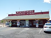
General Store
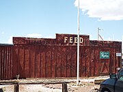
Feed Store
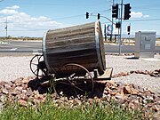
19th Century Water Barrel Cart


References[]
- ^ "2016 U.S. Gazetteer Files". United States Census Bureau. Retrieved July 18, 2017.
- ^ "Population and Housing Unit Estimates". Retrieved June 9, 2017.
- ^ "Census of Population and Housing". Census.gov. Retrieved June 4, 2016.
- ^ United States Census[dead link]
| show Municipalities and communities of Maricopa County, Arizona, United States |
|---|

| show Authority control |
|---|
This Maricopa County, Arizona location article is a stub. You can help Wikipedia by . |
- Census-designated places in Maricopa County, Arizona
- Maricopa County, Arizona geography stubs