El Mirage, Arizona
El Mirage | |
|---|---|
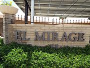
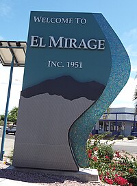 Entrance to the city of El Mirage | |
 Seal | |
 Location of El Mirage in Maricopa County, Arizona. | |
 El Mirage Location in the United States | |
| Coordinates: 33°36′32″N 112°19′29″W / 33.60889°N 112.32472°WCoordinates: 33°36′32″N 112°19′29″W / 33.60889°N 112.32472°W | |
| Country | United States |
| State | Arizona |
| County | Maricopa |
| Government | |
| • Council/Manager | Alexis Hermosillo |
| Area | |
| • Total | 9.95 sq mi (25.78 km2) |
| • Land | 9.90 sq mi (25.63 km2) |
| • Water | 0.06 sq mi (0.15 km2) |
| Elevation | 1,145 ft (349 m) |
| Population (2020) | |
| • Total | 35,805 |
| • Density | 3,617.40/sq mi (1,396.72/km2) |
| Time zone | UTC-7 (MST (no DST)) |
| ZIP code | 85335 |
| Area code(s) | 623 |
| FIPS code | 04-22220 |
| GNIS feature ID | 24845 |
| Website | cityofelmirage.org |

El Mirage is a city in Maricopa County, Arizona, United States. According to the U.S. Census estimates in 2019, the population of the city is 35,753.[2]
Geography[]
El Mirage is located along the Agua Fria River and US Route 60 within the northwestern part of the Phoenix Metropolitan area.[3]
According to the United States Census Bureau, the city has a total area of 9.7 square miles (25 km2), all land.
Demographics[]
| Historical population | |||
|---|---|---|---|
| Census | Pop. | %± | |
| 1960 | 1,723 | — | |
| 1970 | 3,258 | 89.1% | |
| 1980 | 4,307 | 32.2% | |
| 1990 | 5,001 | 16.1% | |
| 2000 | 7,609 | 52.1% | |
| 2010 | 31,797 | 317.9% | |
| 2020 | 35,805 | 12.6% | |
| U.S. Decennial Census[4] | |||
At the 2000 census, there were 7,609 people in 2,121 households, including 1,737 families, in the city. The population density was 786.8 people per square mile (303.8/km²). There were 3,162 housing units at an average density of 326.9 per square mile (126.3/km²). The racial makeup of the city was 66.3% White, 3.3% Black or African American, 0.9% Native American, 0.4% Asian, 0.1% Pacific Islander, 26.2% from other races, and 3.0% from two or more races. 66.8% of the population were Hispanic or Latino of any race.
Of the 2,121 households 48.8% had children under the age of 18 living with them, 55.3% were married couples living together, 17.7% had a female householder with no husband present, and 18.1% were non-families. 13.0% of households were one person and 3.7% were one person aged 65 or older. The average household size was 3.59 and the average family size was 3.87.
The age distribution was 36.8% under the age of 18, 14.1% from 18 to 24, 28.6% from 25 to 44, 13.8% from 45 to 64, and 6.6% 65 or older. The median age was 25 years. For every 100 females, there were 105.5 males. For every 100 females age 18 and over, there were 105.0 males.
The median household income was $33,813 and the median family income was $33,468. Males had a median income of $25,176 versus $19,192 for females. The per capita income for the city was $10,342. About 12.6% of families and 15.9% of the population were below the poverty line, including 14.2% of those under age 18 and 22.0% of those age 65 or over.
El Mirage is near Luke U.S. Air Force Base, the largest Fighter Pilot Training Base in the North Atlantic Treaty Organization (NATO), and can boast that it has the highest paid city manager per capita in the Phoenix, Arizona metropolitan area
Historic structures of El Mirage[]
Front of the former city hall building.

Historic El Mirage Agua Fria River Bridge built in 1895.

Former El Mirage City Hall located at 12145 NW Grand Ave.
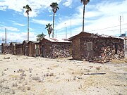
El Mirage Motel. These are the individual rooms of the motel which were used by motorist who traveled through Grand Ave.

El Mirage Motel was built out of fieldstone in 1937 and is located at 12229 NW Grand Ave. The property is in state of abandonment.


References[]
- ^ "2020 U.S. Gazetteer Files". United States Census Bureau. Retrieved October 29, 2021.
- ^ "U.S. Census website". United States Census Bureau. Retrieved January 31, 2019.
- ^ Arizona Atlas & Gazetteer, DeLorme, 4th ed., 2001, p. 57 ISBN 0899333257
- ^ "Census of Population and Housing". Census.gov. Retrieved June 4, 2016.
- https://web.archive.org/web/20100415023621/http://peopleofelmirage.com/wp-content/uploads/2010/04/City-Manager-Salary.pdf Surprise Time Newspaper-City Managers Salary
External links[]
Municipalities and communities of Maricopa County, Arizona, United States | ||
|---|---|---|
| Cities |  | |
| Towns | ||
| CDPs | ||
| Populated places |
| |
| Indian reservations | ||
| Ghost towns/ former populated places | ||
| Footnotes | ‡This populated place also has portions in an adjacent county or counties | |
| ||
- Cities in Arizona
- Cities in Maricopa County, Arizona
- Phoenix metropolitan area